Calora, Nebraska | |
|---|---|
 Calora, Nebraska  Calora, Nebraska | |
| Coordinates: 41°36′N101°24′W / 41.6°N 101.4°W | |
| Country | |
| State | |
| County | Arthur |
Calora is an unincorporated community in Arthur County, Nebraska, United States. [1]
Calora, Nebraska | |
|---|---|
| Calora, Nebraska Calora, Nebraska | |
| Coordinates: 41°36′N101°24′W / 41.6°N 101.4°W | |
| Country | |
| State | |
| County | Arthur |
Calora is an unincorporated community in Arthur County, Nebraska, United States. [1]
A post office was established at Calora in 1912, and remained in operation until it was discontinued in 1951. [2] The community's name is an amalgamation of Carl and Oura. [3]
Municipalities and communities of Arthur County, Nebraska, United States | ||
|---|---|---|
| Village | 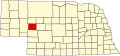 | |
| Unincorporated communities | ||
41°38′25″N101°26′52″W / 41.64028°N 101.44778°W
| | This Arthur County, Nebraska state location article is a stub. You can help Wikipedia by expanding it. |