
Omagh is the county town of County Tyrone, Northern Ireland. It is situated where the rivers Drumragh and Camowen meet to form the Strule. Northern Ireland's capital city, Belfast, is 68 miles (109.5 km) to the east of Omagh, and Derry is 34 miles (55 km) to the north.

Dromore is a town, townland and civil parish in County Tyrone, Northern Ireland. It is nine miles (14 km) south west of Omagh on the A32 and sixteen miles (26 km) from Enniskillen. The population of Dromore was 1,198 at the 2011 Census.

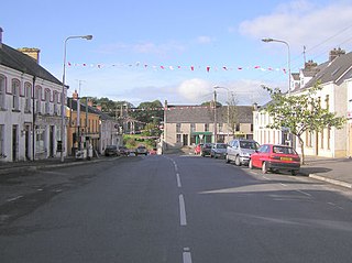
Fintona, is a village and townland in County Tyrone, Northern Ireland. Its population at the 2011 Census was 1,164.

Creggan is a townland in County Tyrone, Northern Ireland. It is situated in the historic barony of Omagh East and the civil parish of Termonmaguirk and covers an area of 4022 acres.

Beragh is a village and townland in County Tyrone, Northern Ireland. It is about 8 miles southeast of Omagh and is in the Fermanagh and Omagh District Council area. The 2001 Census recorded a population of 520.
Sixmilecross is a townland and small village in County Tyrone, Northern Ireland.
Edward Martin Hurson was an Irish Republican hunger striker and a Volunteer in the East Tyrone Brigade of the Provisional Irish Republican Army (IRA). He was the sixth Irish Republican to die from starvation during the 1981 Irish Hunger Strike.

Pomeroy is a small village and civil parish in County Tyrone, Northern Ireland. It is in the townland of Cavanakeeran, about 8.5 miles (14 km) from Cookstown, 9 miles (14 km) from Dungannon and 16 miles (26 km) from Omagh. The 2011 Census recorded a population of 788 people.

Dooish is a village and townland near Drumquin in County Tyrone, Northern Ireland. The townland is situated in the historic barony of Omagh West and the civil parish of Longfield West and covers an area of 845 acres. In the 2001 Census it had a population of 93 people. It lies within the Omagh District Council area.
Cappagh is a small village and townland in the parish of Pomeroy in County Tyrone, Northern Ireland. Around 10 kilometres (6 mi) north-west of Dungannon, it is between Pomeroy, Ballygawley, Galbally and Carrickmore, with the hamlet of Galbally about one mile to the east. Most of the land around Cappagh is farmland although a quarry lies just outside the village. In County Tyrone, there is also the parish of Cappagh which includes part of the town of Omagh and small village of Mountfield.

Knockmoyle is a hamlet and townland approximately 8 kilometres northwest of Omagh in County Tyrone, Northern Ireland. In the 2001 census the Knockmoyle area had 141 households and a population of 329. It has a post office, church and public house. The nearby River Strule is well known for its trout fishing. Other attractions nearby include the Gortin Glens Forest Park and the Ulster American Folk Park. The Ulster Way walking route passes through Knockmoyle.

Killyclogher is a village on the outskirts of the town of Omagh, County Tyrone, Northern Ireland. It is also a townland and an electoral ward of Fermanagh and Omagh District Council. At the 2011 census, Killyclogher Ward had a population of 3096.

Omagh East is a barony in County Tyrone, Northern Ireland. It is bordered by nine other baronies: Omagh West and Lurg to the west; Strabane Lower and Strabane Upper to the north; Dungannon Middle and Dungannon Upper to the east; Clogher and Tirkennedy to the south; and Dungannon Lower to the south-east.

Omagh West is a barony in County Tyrone, Northern Ireland. It is bordered by three other baronies in Northern Ireland: Strabane Lower to the north-east; Omagh East to the east; and Lurg to the south. It also borders two baronies in County Donegal in the Republic of Ireland: Tirhugh to the south-west; and Raphoe South to the north-west.

Strabane Lower is a barony in County Tyrone, Northern Ireland. It is bordered by five other baronies in Northern Ireland: North West Liberties of Derry to the north; Tirkeeran to the north-east; Strabane Upper to the east; Omagh East to the south; and Omagh West to the south-west. It also borders two baronies in County Donegal in the Republic of Ireland: Raphoe North and Raphoe South to the west.

Strabane Upper is a barony in County Tyrone, Northern Ireland. It is bordered by six other baronies: Tirkeeran and Keenaght to the north; Loughinsholin and Dungannon Upper to the east; Omagh East to the south; and Strabane Lower to the west.

