
Trinidad and Tobago, a country that relies heavily on industrialisation and tourism, has various transport systems. The nation drives on the left, and has a network of roads and highways. There is also some ports and smaller harbors, as well as highways.

Fairfield County is a county in the southwestern corner of the U.S. state of Connecticut. It is the most populous county in the state and was also its fastest-growing from 2010 to 2020. As of the 2020 census, the county's population was 957,419, representing 26.6% of Connecticut's overall population. The closest to the center of the New York metropolitan area, the county contains four of the state's seven largest cities—Bridgeport (first), Stamford (second), Norwalk (sixth) and Danbury (seventh)—whose combined population of 433,368 is nearly half the county's total population.
Alcoa is a city in Blount County, Tennessee, United States. Its population was 10,978 at the 2020 census. It is part of the Knoxville, TN Metropolitan Statistical Area.

Quinlan is a rural city in the southern part of Hunt County, Texas, United States, within the Dallas–Fort Worth metropolitan area. As of the 2020 census, it had a population of 1,414. It is 5 miles (8 km) west of Lake Tawakoni.

Tobago is an island and ward within the Republic of Trinidad and Tobago. It is located 35 kilometres (22 mi) northeast of the larger island of Trinidad and about 160 kilometres (99 mi) off the northeastern coast of Venezuela. It lies to the southeast of Grenada and southwest of Barbados.

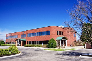
Scarborough is a major town of the Island of Tobago as well as the eleventh-most-populous in Trinidad and Tobago. Scarborough was the capital of Tobago in 1769 before it was unified with Trinidad changing the capital to Port of Spain. Situated in western Tobago, Scarborough is the economic and cultural centre of the island of Tobago. The estimated population in 2011 was 17,537. Scarborough is ranked as one of Trinidad and Tobago's most densely populated towns alongside Port of Spain, San Fernando, Chaguanas and Arima. The town's skyline is dominated by Fort King George, an 18th-century fortification named after King George III, which now hosts a historic and archaeologic museum. Scarborough's deepwater harbour was built in 1991; before that ships were forced to anchor offshore.

U.S. Route 7 (US 7) is a north–south United States Numbered Highway in western New England that runs for 308 miles (496 km) through the states of Connecticut, Massachusetts, and Vermont. The highway's southern terminus is at Interstate 95 (I-95) exit 15 in Norwalk, Connecticut. Its northern terminus is at I-89 exit 22 near the village of Highgate Springs, Vermont, immediately south of the Canada–United States border.

San Fernando, officially the City of San Fernando, is the most populous city and second most populous municipality in Trinidad and Tobago, after Chaguanas. Sando, as it is known to many local Trinidadians, occupies 19 km2 and is located in the southwestern part of the island of Trinidad. It is bounded to the north by the Guaracara River, the south by the Oropouche River, the east by the Sir Solomon Hochoy Highway, and the west by the Gulf of Paria. The former borough was elevated to the status of a city corporation on 18 November 1988. The motto of San Fernando is: "Sanitas Fortis" - In a Healthy Environment We Will Find Strength. San Fernando is called Trinidad and Tobago's "industrial capital" because of its proximity to the Pointe-à-Pierre oil refinery and many other petrochemical, LNG, iron and steel and aluminium smelters in places such as Point Lisas in Couva, Point Fortin, and La Brea.

Route 15 is a state highway in the U.S. state of Connecticut that runs 83.53 miles (134.43 km) from a connection with New York's Hutchinson River Parkway in Greenwich, Connecticut, to its northern terminus intersecting with Interstate 84 (I-84) in East Hartford, Connecticut. Route 15 consists of four distinct sections: the Merritt Parkway, the Wilbur Cross Parkway, most of the Berlin Turnpike, and part of the Wilbur Cross Highway. The unified designation was applied to these separate highways in 1948 to provide a continuous through route from New York to Massachusetts. The parkway section of Route 15 is often referred to locally as "The Merritt".

San Juan is a town in Trinidad and Tobago. Located in San Juan–Laventille region in Saint George County, it lies within the East-West Corridor Metropolitan Area, between Laventille and Saint Joseph.

New Hampshire Route 101 is a state-maintained highway in southern New Hampshire extending from Keene to Hampton Beach. It is the major east–west highway in the southern portion of the state. Most of its eastern portion is a major freeway linking the greater Manchester area to the Seacoast Region. At 95.189 miles (153.192 km) in length, NH 101 nearly spans the entire width of southern New Hampshire.

Nacala, also known as Cidade de Nacala or Nacala-Porto is a city on the northern coast of Mozambique. Located in the southwestern indentation of inner Fernao Veloso Bay, it is the deepest natural port on the east coast of Africa. Nacala serves as the terminal for the Nacala railway, a rail line to the landlocked Malawi. South of Nacala is Mozambique Island, at one time the capital of Mozambique and now a World Heritage Site.

A. N. R. Robinson International Airport — formerly Crown Point International Airport — is an international airport located in Crown Point, Tobago in Trinidad and Tobago. It is located in the southwesternmost part of the island, near the town of Bon Accord, and 11 km (6.8 mi) from the capital, Scarborough. The airport is one of two international airports serving the twin isle republic of Trinidad and Tobago. The other airport is located on the island of Trinidad, Piarco International Airport.

Kindu is a city in the Democratic Republic of Congo, the capital of Maniema province. It has a population of about 200,000 and is situated on the Lualaba River at an altitude of about 500 metres, and is about 400 km west of Bukavu.

Piarco International Airport is an international airport serving the island of Trinidad and is one of two international airports in Trinidad and Tobago. The airport is located 30 km (19 mi) east of Downtown Port of Spain, located in the suburban town of Piarco. The airport is the primary hub and operating base for the country's national airline, as well as the Caribbean's largest airline, Caribbean Airlines.

Stamford-Bridgeport-Norwalk is a metropolitan area in the U.S. state of Connecticut. The area is located in Southwestern Connecticut. In its most conservative form, the area consists of the City of Bridgeport and five surrounding towns—Easton, Fairfield, Monroe, Stratford, and Trumbull. This definition of the Stamford area has a population of more than 305,000 and is within the Stamford -Bridgeport-Norwalk-Danbury metropolitan statistical area, which consists of all of Fairfield County, Connecticut. The estimated 2015 county population was 948,053. The area is numbered as part of the New York-Newark Combined Statistical Area NY-NJ-CT-PA by the United States Census Bureau.
U.S. Route 7 (US 7) is a north–south United States Numbered Highway which runs 78 miles (126 km) in the state of Connecticut. The route begins at Interstate 95 (I-95) in Norwalk starting out as a four-lane freeway until the Wilton town line. The route then proceeds north as a two-lane surface road through Redding and Ridgefield, where it becomes a four-lane surface road until it reaches Danbury. The route becomes a four-lane freeway again, eventually merging with I-84 for a brief period before it turns and proceeds north with US 202 in Brookfield. The freeway section terminates at an intersection with US 202 at the Fairfield–Litchfield county line next to Candlewood lake. The route then continues north as a four-lane arterial road to New Milford, where it becomes a two-lane surface road, running north to the Massachusetts border in North Canaan. US 7 was aligned to its current route around 1930, and, since then, three sections totaling around 12 miles (19 km) have been upgraded to freeway standards.

State Highway 94 is a New Zealand state highway connecting the large Southland town of Gore with one of New Zealand's most popular destinations, Milford Sound. It also passes the significant townships of Lumsden and Te Anau as well going through the Homer Tunnel. The road also goes through Fiordland and crosses the Main Divide of the Southern Alps.
The R101 is a Regional Route in South Africa that is the designation for some of the old sections of roads that were previously the N1, prior to upgrading. It only has 2 sections, from Bellville to Worcester and from Johannesburg to Polokwane.
The Claude Noel Highway, sometimes referred to as CNH, is one of the major west–east highways in Trinidad and Tobago, named after Claude Noel, it is the only highway in Tobago. It runs from Canaan to Scarborough.
