Related Research Articles

The Permian Basin is a large sedimentary basin in the southwestern part of the United States. It is the highest producing oil field in the United States, producing an average of 4.2 million barrels of crude oil per day in 2019. This sedimentary basin is located in western Texas and southeastern New Mexico.
The Sydney Basin is an interim Australian bioregion and is both a structural entity and a depositional area, now preserved on the east coast of New South Wales, Australia and with some of its eastern side now subsided beneath the Tasman Sea. The basin is named for the city of Sydney, on which it is centred.

Dorothy Hill, was an Australian geologist and palaeontologist, the first female professor at an Australian university, and the first female president of the Australian Academy of Science.

Geoscience Australia is a statutory agency of the Government of Australia that carries out geoscientific research. The agency is the government's technical adviser on aspects of geoscience, and serves as the repository of geographic and geological data collated by the Commonwealth.

The geology of Australia includes virtually all known rock types, spanning a geological time period of over 3.8 billion years, including some of the oldest rocks on earth. Australia is a continent situated on the Indo-Australian Plate.
The Perth Basin is a thick, elongated sedimentary basin in Western Australia. It lies beneath the Swan Coastal Plain west of the Darling Scarp, representing the western limit of the much older Yilgarn Craton, and extends further west offshore. Cities and towns including Perth, Busselton, Bunbury, Mandurah and Geraldton are built over the Perth Basin.
The Jackson School of Geosciences at The University of Texas at Austin unites the Department of Earth and Planetary Sciences with two research units, the Institute for Geophysics and the Bureau of Economic Geology.

Carbonate-hosted lead-zinc ore deposits are important and highly valuable concentrations of lead and zinc sulfide ores hosted within carbonate formations and which share a common genetic origin.
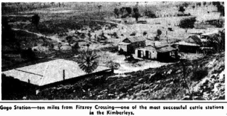
The Gogo Formation in the Kimberley region of Western Australia is a Lagerstätte that exhibits exceptional preservation of a Devonian reef community. The formation is named after Gogo Station, a cattle station where outcrops appear and fossils are often collected from, as is nearby Fossil Downs Station.
The Carnarvon Basin is a geological basin located in the north west of Western Australia which extends from the Dampier Archipelago to the Murchison bioregion, and is the main geological feature that makes up the North West Shelf. The onshore part of the Carnarvon Basin covers about 115,000 km2 and the offshore part covers approximately 535,000 km2 with water depths up to 3,500 metres. It is separated into two major areas - the Northern Carnarvon Basin, and the Southern Carnarvon Basin.

The petroleum industry in Western Australia is the largest contributor to the country's petroleum exports. Western Australia's North West Shelf (NWS) is the primary location from which production originates. Oil exports are shipped from Port Hedland.
Geologically the Australian state of New South Wales consists of seven main regions: Lachlan Fold Belt, the Hunter-Bowen Orogeny or New England Orogen (NEO), the Delamerian Orogeny, the Clarence Moreton Basin, the Great Artesian Basin, the Sydney Basin, and the Murray Basin.
Ashton F. Embry is a Canadian research scientist at the Geological Survey of Canada.

The Oscar Range is a small, low mountain range in the Kimberley region of Western Australia. It is approximately 40 km long and 6–8 km wide. The range sits on the edge of the Lennard Shelf.

The Cairn Formation is a geologic formation of Late Devonian (Frasnian) age in the Western Canada Sedimentary Basin. It was named for the Cairn River near its junction with the Southesk River in Jasper National Park by D.J. McLaren in 1955.

Lindsay Boyd Collins was an Australian marine geologist and sedimentologist, and a faculty member in the Department of Applied Geology at Curtin University in Western Australia. He was interested in studying the continental shelf of Western Australia and coral reefs. Collins was a prominent scholar, and completed projects on continental shelf mapping of Australian shelves, microbialites and seagrass banks at Shark Bay, and coral reef studies at the Abrolhos, Ningaloo, Scott Reef, the Rowley Shoals and the Kimberley.
The Halibut Field is an oil field, within the Gippsland Basin offshore of the Australian state of Victoria. The oil field is located approximately 64 km offshore of southeastern Australia. The total area of this field is 26.9 km2 and is composed of 10 mappable units.
Phillip Elliott Playford was an Australian geologist who made important contributions to sedimentary geology, oil exploration in Western Australia, maritime history, and made contributions to the recording of Aboriginal art and culture from the north of Western Australia.
The geology of Austria consists of Precambrian rocks and minerals together with younger marine sedimentary rocks uplifted by the Alpine orogeny.
References
- 1 2 3 Geoscience Australia – Geological summary Archived 11 March 2007(Date mismatch) at the Wayback Machine
- ↑ Tyler, Ian M.; Hocking, Roger M.; Haines, Peter W. (1 March 2012). "Geological evolution of the Kimberley region of Western Australia". Episodes Journal of International Geoscience. 35 (1): 298–306. doi: 10.18814/epiiugs/2012/v35i1/029 . S2CID 128921002.
- ↑ John Veevers; Wells, A. T. (Allan Thomas); Australia. Bureau of Mineral Resources, Geology and Geophysics (1961), The geology of the Canning Basin, Western Australia, Bureau of Mineral Resources, Geology and Geophysics, retrieved 21 January 2012
- ↑ Logan, Brian W; Semeniuk, V. (1976), Dynamic metamorphism : processes and products in Devonian carbonate rocks, Canning Basin, Western Australia, Geological Society of Australia, ISBN 978-0-909869-08-3
- ↑ Purcell, Peter G., ed. (1984), The Canning Basin W.A., Perth, W.A.: Geological Society of Australia Inc. and Petroleum Exploration Society of Australia Ltd, ISBN 978-0-909869-37-3
- ↑ E., Johnson, Markes; Gregory, Webb (1 September 2017). "Outer Rocky Shores of the Mowanbini Archipelago, Devonian Reef Complex, Canning Basin, Western Australia". Journal of Geology. 115 (5): 583–600. Bibcode:2007JG....115..583J. doi:10.1086/519779. S2CID 129190899.
{{cite journal}}: CS1 maint: multiple names: authors list (link) - ↑ Australian Heritage Council (2012). Australia's fossil heritage : a catalogue of important Australian fossil sites. CSIRO Publishing. pp. 111–116. ISBN 9780643101777.
- ↑ Dörling, Simon L; University of Western Australia. Department of Geology and Geophysics (1995), Structural evolution of the southeast Fitzroy Trough and Lennard Shelf, Western Australia during the Devonian-Early Carboniferous Pillara Tectonic Episode : implications for facies distribution and Mississippi Valley-type Pb-Zn mineralisation , retrieved 3 December 2016
- ↑ Koop, W. J; Burdett, J. W; Burdett, J. W. Canning Basin, Kidson Sub-Basin geological map; West Australian Petroleum Pty. Ltd (1964), Geological survey of the Kidson sub-basin, Canning basin, Western Australia, West Australian Petroleum Pty. Ltd.?], retrieved 3 December 2016
{{citation}}: CS1 maint: multiple names: authors list (link) - ↑ these and other features are identified at the map - http://www.ga.gov.au/scientific-topics/energy/province-sedimentary-basin-geology/petroleum/onshore-australia/canning-basin#heading-1
- ↑ The geology of the Canning Basin, Western Australia, Geoscience Australia, retrieved 3 December 2016[ permanent dead link ]