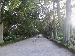
Cannon Park is a 2.7 acre public park located in peninsular Charleston, South Carolina. It is bound to the north by Calhoun St. and to the south by Bennett St. To the east and west are Rutledge Ave. and Ashley Ave. respectively.
History
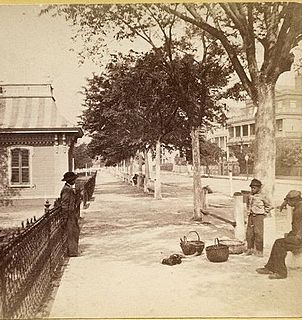
Cannon Park was photographed in about 1896 looking west from Rutledge Avenue. The Gov. Thomas Bennett House can be seen in the background.The Olmsted, Olmsted & Eliot firm's plans never were implemented but inspired the layout when Cannon Park was developed more than 80 years later.Thomson Auditorium burned in 1981, and only its four columns remain today.
Some of the property on which the park is located was given to the City of Charleston in the early 1800s for a public park. The land previously had been a sawmill pond. The last parcels to complete the existing space were acquired in 1893.[1] Work on a public park began in 1894.[2] By 1897, however, the park had fallen into disuse by residents; goats and cows were pastured on the land, and the grass was left uncut.[3]
In anticipation of a Confederate reunion, Charleston's City Council decided to spend $30,000 to build a convention hall.[4] Fifteen plans were submitted for the new facility, and those of Charlotte, North Carolina architect Frank Pierce Milburn were selected.[5] The hall, with seating for 7000, was completed and handed over to the City Council on April 27, 1899.[6] After the Confederate reunion, the hall was used infrequently and never to capacity. In October 1901, the City Parks Commission leased the auditorium to William P. Dowling, Jr. for a term of three years for use as a theater.[7] In December 1904, the city council chose to use the building as a temporary location for the city hospital.[8] In January 1907, the city council agreed to lease the hall to the College of Charleston to house its museum, thereafter known as the Charleston Museum, for a nominal rent.[9][10] In October 1981, a fire destroyed the hall about one year after the museum moved to Meeting Street, leaving only its four grand columns.[11]
In 1981, the city proposed a redevelopment of Cannon Park along the lines of the proposal drafted by Olmsted in the late 19th century. The Olmsted Brothers, a landscaping firm in Brookline, Massachusetts, had designed plans for a park during the 1890s, but these never were implemented before the site became Thomson Auditorium.[12] The proposal retained the columns as a focal point and established the landscape around them using palm trees and oaks. A water basin was planned but never implemented.[13]
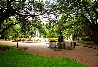
The park today has a playground and walking paths. While the park is unfenced, it does allow unleashed dogs.[14]
Notes
↑ "Palmetto Park". Charleston, South Carolina: The News and Courier. p.8.
↑ "Doings of a Day". Evening Post. Charleston, South Carolina. November 14, 1894. p.4. Retrieved May 1, 2016.
↑ "Cannonboro Park". Evening Post. Charleston, South Carolina. July 20, 1897. p.5. Retrieved May 1, 2016.
↑ "The Thomson Auditorium". Charleston News & Courier. November 1, 1898. p.8. Retrieved November 16, 2012.
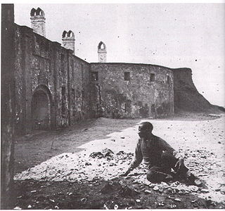
Fort Sumter is a sea fort built on an artificial island protecting Charleston, South Carolina from naval invasion. Its origin dates to the War of 1812 when the British invaded Washington by sea. It was still incomplete in 1861 when the Battle of Fort Sumter began the American Civil War. It was severely damaged during the war, left in ruins, and although there was some rebuilding, the fort as conceived was never completed.
North Charleston is the third-largest city in the U.S. state of South Carolina, with incorporated areas in Berkeley, Charleston, and Dorchester counties. On June 12, 1972, the city of North Charleston was incorporated and was rated as the ninth-largest city in South Carolina. As of the 2020 Census, North Charleston had a population of 114,852, and an area of more than 76.6 square miles (198.5 km2). As defined by the U.S. Office of Management and Budget, for use by the U.S. Census Bureau and other U.S. Government agencies for statistical purposes only, North Charleston is included within the Charleston–North Charleston–Summerville metropolitan area and the Charleston-North Charleston urban area. North Charleston is one of the state's major industrial centers and is the state's top city in gross retail sales.
White Point Garden is a 5.7 acre public park located in peninsular Charleston, South Carolina, at the tip of the peninsula. It is the southern terminus for the Battery, a defensive seawall and promenade. It is bounded by East Battery, Murray Blvd., King St., and South Battery.
Washington Square is a park in downtown Charleston, South Carolina. It is located behind City Hall at the corner of Meeting Street and Broad Street in the Charleston Historic District. The planting beds and red brick walks were installed in April 1881. It was known as City Hall Park until October 19, 1881, when it was renamed in honor of George Washington. The new name was painted over the gates in December 1881.
Castle Pinckney was a small masonry fortification constructed by the United States government, in the harbor of Charleston, South Carolina in 1810. It was used very briefly as a prisoner-of-war camp and artillery position during the American Civil War. It was named to the National Register of Historic Places in 1970.
Marion Square is greenspace in downtown Charleston, South Carolina, spanning six and one half acres. The square was established as a parade ground for the state arsenal under construction on the north side of the square. It is best known as the former Citadel Green because The Citadel occupied the arsenal from 1843 until 1922, when the Citadel moved to the city's west side. Marion Square was named in honor of Francis Marion.
Joseph Patrick Riley Jr. is an American politician who was the Mayor of Charleston, South Carolina. He was one of the longest serving mayors in the United States that is still living, having served 10 terms starting on December 15, 1975, and ending on January 11, 2016.
Johnson Hagood Stadium, is an 11,500-seat football stadium, the home field of The Citadel Bulldogs, in Charleston, South Carolina, USA. The stadium is named in honor of Brigadier General Johnson Hagood, CSA, class of 1847, who commanded Confederate forces in Charleston during the Civil War and later served as Comptroller and Governor of South Carolina.
The City Market is a historic market complex in downtown Charleston, South Carolina. Established in the 1790s, the market stretches for four city blocks from the architecturally-significant Market Hall, which faces Meeting Street, through a continuous series of one-story market sheds, the last of which terminates at East Bay Street. The market should not be confused with the Old Slave Mart where slaves were sold, as slaves were never sold in the City Market. The City Market Hall has been described as a building of the "highest architectural design quality." The entire complex was listed on the National Register of Historic Places as Market Hall and Sheds and was further designated a National Historic Landmark.
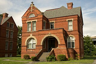
The William Enston Home, located at 900 King St., Charleston, South Carolina, is a complex of many buildings all constructed in Romanesque Revival architecture, a rare style in Charleston. Twenty-four cottages were constructed beginning in 1887 along with a memorial chapel at the center with a campanile style tower, and it was reserved for white residents. An infirmary was added in 1931 and later converted into a superintendent's home.
Hampton Park Terrace is the name both of a neighborhood and a National Register district located in peninsular Charleston, South Carolina. The neighborhood is bounded on the west by The Citadel, on the north by Hampton Park, on the east by Rutledge Ave., and on the south by Congress St. In addition, the one block of Parkwood Ave. south of Congress St. is considered, by some, to be included. The National Register district, on the other hand, is composed of the same area with two exceptions: (1) the northeasternmost block is excluded and (2) an extra block of President St. is included.
Hampton Park is a public park located in peninsular Charleston, South Carolina, United States. At 60 acres (240,000 m2), it is the largest park on the peninsula. It is bordered by The Citadel to the west, Hampton Park Terrace to the south, North Central to the east, and Wagener Terrace to the north. The park is named in honor of Confederate General Wade Hampton III who, at the time of the Civil War, owned one of the largest collections of slaves in the South. After the Civil War, Hampton became a proponent of the Lost Cause movement, member of the Red Shirts and governor of South Carolina.
Magnolia Cemetery is a historic rural cemetery in Charleston, South Carolina. The first board for the cemetery was assembled in 1849 with Edward C. Jones as the architect. It was dedicated in 1850; Charles Fraser delivered the dedication address. It was listed on the National Register of Historic Places as a Historic District in 1978.
The North Carolina Pre-Flight Cloudbusters represented the U.S. Navy pre-flight school at the University of North Carolina at Chapel Hill in the college football seasons of 1942, 1943 and 1944 during World War II. The North Carolina Pre-Flight School was established on February 1, 1942, by the Secretary of the Navy and opened that April. The football team was later organized and competed against other military teams in addition to major college teams of the period. During their three years in existence, the Cloudbusters compiled an overall record of sixteen wins, eight losses and three ties (16–8–3).
Brittlebank Park is a ten-acre park located between Lockwood Boulevard and the Ashley River in Charleston, South Carolina near Gadsden Creek. To the south is a condominium project and to the north is the minor league baseball stadium, the Joseph P. Riley, Jr. Park.
Colonial Lake is a tidal pond in Charleston, South Carolina with wide walkways around it. The area is used as a park. For many years the lake was known as the Rutledge Street Pond; some residents still call it "The Pond." It acquired the name Colonial Lake in 1881, in honor of the "Colonial Commons" established in 1768.
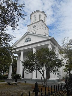
The Second Presbyterian Church is the fourth oldest church in Charleston, South Carolina.
The Louis DeSaussure House is an antebellum house at 1 East Battery, Charleston, South Carolina. The house was designed and built for Louis DeSaussure by William Jones and completed in late 1859. The three-story, masonry house follows a traditional side hall plan; two adjacent parlors are fronted with piazzas along the south side while a stair hall runs along the north side with a front door facing east onto East Battery. In 1865 during the Civil War, the house was damaged when evacuating Confederate forces blew up a large cannon at the corner of East Battery and South Battery; a piece of the cannon was lodged in the attic of the house. The balconies on the East Battery façade and window ornaments were installed when the house was restored after the earthquake of 1886 by Bernard O'Neill, who bought it in 1888. The house was used by the military to house Navy officers during World War II and was later converted into apartments. The carriage house for 1 East Battery was later subdivided into a separate house known as 2 South Battery.
Yeamans Hall Club is a country club built on a 1100-acre tract about 12 miles from Charleston, South Carolina, along Goose Creek on the site of a 17th-century plantation.
The Charleston City Hall is a building designed by Gabriel Manigault. The city bought the building and began using it as Charleston's City Hall in 1819, making it the second longest serving city hall in the United States.
This page is based on this Wikipedia article Text is available under the CC BY-SA 4.0 license; additional terms may apply. Images, videos and audio are available under their respective licenses.