Cape Engaño (Luzon)

Last updated
View of the cape from the Cape Engano Lighthouse Pacific Ocean View from Light House Top, Palaui Island Cagayan Philippines.jpg
View of the cape from the Cape Engaño Lighthouse
The lighthouse at Cape Engano Faro de Cabo Engano Lighthouse.jpg
The lighthouse at Cape Engaño

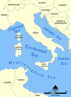
Cape Engaño is a cape and northern point of Palaui Island, an island off the northeasternmost point of the island of Luzon in the Philippines. [1] It is administratively part of the municipality of Santa Ana in Cagayan province and is known for its lush green landscape, white sand beach and the Cape Engaño Lighthouse.

Cape (geography) A large headland extending into a body of water, usually the sea

In geography, a cape is a headland or a promontory of large size extending into a body of water, usually the sea. A cape usually represents a marked change in trend of the coastline which makes them prone to natural forms of erosion, mainly tidal actions. This results in capes having a relatively short geological lifespan. Capes can be formed by glaciers, volcanoes, and changes in sea level. Erosion plays a large role in each of these methods of formation.

Island Any piece of sub-continental land that is surrounded by water

An island or isle is any piece of sub-continental land that is surrounded by water. Very small islands such as emergent land features on atolls can be called islets, skerries, cays or keys. An island in a river or a lake island may be called an eyot or ait, and a small island off the coast may be called a holm. A grouping of geographically or geologically related islands is called an archipelago, such as the Philippines.

Luzon largest island of the Philippines

Luzon is the largest and most populous island in the Philippines. It is ranked 15th largest in the world by land area. Located in the northern region of the archipelago, it is the economic and political center of the nation, being home to the country's capital city, Manila, as well as Quezon City, the country's most populous city. With a population of 53 million as of 2015,, it is the fourth most populous island in the world containing 52.5% of the country's total population.

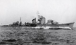
It has given its name to the World War II battle off Cape Engaño, part of the larger Battle of Leyte Gulf, although the battle actually took place some 200 miles (322 km) to the east, in open ocean. The Japanese aircraft carriers Zuikaku, Zuihō, Chitose and Chiyoda were repeatedly bombarded and sank, as well as three light cruisers and nine destroyers.

World War II 1939–1945 global war

World War II, also known as the Second World War, was a global war that lasted from 1939 to 1945. The vast majority of the world's countries—including all the great powers—eventually formed two opposing military alliances: the Allies and the Axis. A state of total war emerged, directly involving more than 100 million people from over 30 countries. The major participants threw their entire economic, industrial, and scientific capabilities behind the war effort, blurring the distinction between civilian and military resources. World War II was the deadliest conflict in human history, marked by 50 to 85 million fatalities, most of whom were civilians in the Soviet Union and China. It included massacres, the genocide of the Holocaust, strategic bombing, premeditated death from starvation and disease, and the only use of nuclear weapons in war.

Battle of Leyte Gulf the largest naval battle of World War II

The Battle of Leyte Gulf is considered to have been the largest naval battle of World War II and, by some criteria, possibly the largest naval battle in history, with over 200,000 naval personnel involved. It was fought in waters near the Philippine islands of Leyte, Samar, and Luzon, from 23–26 October 1944, between combined American and Australian forces and the Imperial Japanese Navy (IJN), as part of the invasion of Leyte, which aimed to isolate Japan from the countries it had occupied in Southeast Asia which were a vital source of industrial and oil supplies.

Aircraft carrier Warship that serves as a seagoing airbase

An aircraft carrier is a warship that serves as a seagoing airbase, equipped with a full-length flight deck and facilities for carrying, arming, deploying, and recovering aircraft. Typically, it is the capital ship of a fleet, as it allows a naval force to project air power worldwide without depending on local bases for staging aircraft operations. Carriers have evolved since their inception in the early twentieth century from wooden vessels used to deploy balloons to nuclear-powered warships that carry numerous fighters, strike aircraft, helicopters, and other types of aircraft. While heavier aircraft such as fixed-wing gunships and bombers have been launched from aircraft carriers, it is currently not possible to land them. By its diplomatic and tactical power, its mobility, its autonomy and the variety of its means, the aircraft carrier is often the centerpiece of modern combat fleets. Tactically or even strategically, it replaced the battleship in the role of flagship of a fleet. One of its great advantages is that, by sailing in international waters, it does not interfere with any territorial sovereignty and thus obviates the need for overflight authorizations from third party countries, reduce the times and transit distances of aircraft and therefore significantly increase the time of availability on the combat zone.

Related Research Articles

Tyrrhenian Sea Part of the Mediterranean Sea off the western coast of Italy

The Tyrrhenian Sea is part of the Mediterranean Sea off the western coast of Italy. It is named for the Tyrrhenian people, identified since the 6th century BCE with the Etruscans of Italy.

Japanese aircraft carrier <i>Zuikaku</i> Shōkaku-class aircraft carrier of the Imperial Japanese Navy

Zuikaku was a Shōkaku-class aircraft carrier of the Imperial Japanese Navy. Her complement of aircraft took part in the attack on Pearl Harbor that formally brought the United States into the Pacific War, and she fought in several of the most important naval battles of the war, before being sunk during the Battle of Leyte Gulf.

USS <i>Langley</i> (CVL-27) 1943 Independence-class aircraft carrier of the United States Navy

USS Langley (CVL-27) was an Independence-class light aircraft carrier that served the United States Navy from 1943 to 1947, and French Navy as La Fayette from 1951 to 1963.

Sulu Sea A sea in the Philippines between Palawan, the Sulu Archipelago, Borneo and Visayas

The Sulu Sea is a body of water in the southwestern area of the Philippines, separated from the South China Sea in the northwest by Palawan and from the Celebes Sea in the southeast by the Sulu Archipelago. Borneo is found to the southwest and Visayas to the northeast.

Celebes Sea A marginal sea of the Pacific Ocean between the Sulu Archipelago, Mindanao Island, the Sangihe Islands, Sulawesi and Kalimantan

The Celebes Sea of the western Pacific Ocean is bordered on the north by the Sulu Archipelago and Sulu Sea and Mindanao Island of the Philippines, on the east by the Sangihe Islands chain, on the south by Sulawesi's Minahassa Peninsula, and on the west by Kalimantan in Indonesia. It extends 420 miles (675 km) north-south by 520 mi (840 km) east-west and has a total surface area of 110,000 square miles (280,000 km2), to a maximum depth of 20,300 feet (6,200 m). The sea opens southwest through the Makassar Strait into the Java Sea.

North Cape (Norway) cape on the island of Magerøya in Northern Norway

North Cape is a cape on the northern coast of the island of Magerøya in Northern Norway. The cape is in Nordkapp Municipality in Finnmark county, Norway. The European route E69 highway has its northern terminus at North Cape, which makes it the northernmost point in Europe that can be accessed by car and makes the E69 the northernmost public road in Europe. The plateau is a popular tourist attraction. The cape includes a 307-metre-high cliff (1,007 ft) with a large flat plateau on top, where visitors, weather permitting, can watch the midnight sun and views of the Barents Sea to the north. North Cape Hall, a visitor centre, was built in 1988 on the plateau. It includes a café, restaurant, post office, souvenir shop, a small museum, and video cinema.

Battle Point, Bainbridge Island, Washington human settlement in United States of America

Battle Point is a community of Bainbridge Island, Washington, located on the western side of the island. The northern part of the neighborhood extends to Arrow Point. Battle Point also contains the communities of Tolo and Venice.

Japanese destroyer <i>Akizuki</i> (1941) Akizuki-class destroyer

Akizuki (秋月) was the lead ship of her class of destroyer in the Imperial Japanese Navy. Her name means “Autumn Moon.”

Japanese destroyer <i>Hatsuzuki</i> Akizuki-class destroyer

Hatsuzuki (初月) was an Akizuki-class destroyer of the Imperial Japanese Navy. Her name means "New Moon " or "(another name of) August".

Kasegaluk Lagoon

The Kasegaluk Lagoon is a coastal lagoon located in the western part of the North Slope of Alaska. It is separated from the Chukchi Sea by a series of long, thin barrier islands that stretch south and north-east from the town of Point Lay and westwards down to Icy Cape. There are seven passes through these islands. The lagoon receives the waters from the Kukpowruk, Kokolik, and Utukok Rivers.

This is an article about the extreme points of Indonesia.

Cape Engaño (Dominican Republic)

Cabo Engaño is the easternmost point of the island of Hispaniola, on the territory of the Dominican Republic. Cape Engaño contains dangerous reefs near Santo Domingo. Punta Cana International Airport, the nation's busiest, lies slightly south of the cape.

Cape Engaño Lighthouse lighthouse in Santa Ana, Cagayan, Philippines

Cape Engaño Lighthouse, also known as Faro de Cabo Engaño, is a historic lighthouse located at the Palaui Island in the town of Santa Ana, the province of Cagayan, Philippines. Located at the northernmost part of Luzon Island and situated atop the summit of a hill, 92 meters above sea-level, the lighthouse provides a 360-degree view of Babuyan Island and the Dos Hermanas Island on the North, Pacific Ocean on the West and Engaño cove on the East.

Borders of the oceans The limits of the Earths oceanic waters

The borders of the oceans are the limits of the Earth's oceanic waters. The definition and number of oceans can vary depending on the adopted criteria.

Palaui Island Protected Landscape and Seascape island

The Palaui Island Protected Landscape and Seascape is a protected area and national park in the town of Santa Ana in Cagayan, Philippines. It is located off the northeastern extremity of Luzon Island, the largest island in the country.

VA-94 (U.S. Navy) 1943-1949 United States Navy aviation squadron

VA-94 was an Attack Squadron of the U.S. Navy. It was established as Bombing Squadron VB-99 on 1 July 1943, redesignated as VB-20 on 15 October 1943, and as VA-9A on 15 November 1946. It was finally redesignated as VA-94 on 12 August 1948. The squadron was disestablished on 30 November 1949. Its nickname was Bombing Twenty's Tough Kitty from 1943 to 1946.

VA-95 was an Attack Squadron of the U.S. Navy. It was established as Torpedo Squadron VT-20 on 15 October 1943, and as VA-10A on 15 November 1946. It was finally redesignated as VA-95 on 12 August 1948. The squadron was disestablished on 30 November 1949. Its nickname is unknown.

Cape Spartel cape

Cape Spartel is a promontory in Morocco about 1,000 feet (300 m) above sea level at the entrance to the Strait of Gibraltar, 12 km West of Tangier. Below the cape are the Caves of Hercules.

References

  1. Coast and Geodetic Survey. "Philippine Islands Sailing Direction, Third edition", p.32-33. Manila Bureau of Printing, 1906.

Coordinates: 18°34′42″N122°08′28″E / 18.57833°N 122.14111°E / 18.57833; 122.14111

Geographic coordinate system Coordinate system

A geographic coordinate system is a coordinate system that enables every location on Earth to be specified by a set of numbers, letters or symbols. The coordinates are often chosen such that one of the numbers represents a vertical position and two or three of the numbers represent a horizontal position; alternatively, a geographic position may be expressed in a combined three-dimensional Cartesian vector. A common choice of coordinates is latitude, longitude and elevation. To specify a location on a plane requires a map projection.