Related Research Articles

Williams Charter Township is a charter township of Bay County in the U.S. state of Michigan. The township's population was 5,058 as of the 2020 Census and is included in the Bay City Metropolitan Statistical Area.
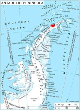
Sabine Glacier is a 13.5 km long glacier on the north side of Detroit Plateau, flowing from Mount Bris and Tsarevets Buttress northwards along the east slopes of Korten Ridge, and terminating at the sea in Jordanoff Bay on Davis Coast in Graham Land, Antarctica. Captain Henry Foster gave the name "Cape Sabine" in 1829 to a feature lying southeast of Cape Kater but it has not been possible to identify that cape. This toponym preserves the early use of Sabine in this area. Sir Edward Sabine (1788-1883), English astronomer and geodesist, was a member of the committee which planned the 1829 voyage of Foster in the Chanticleer.
Fig is an unincorporated community in Ashe County, North Carolina, United States, southwest of Clifton. It lies at an elevation of 2,802 feet.
Dellwood is a small hamlet in the town of Lancaster in Erie County, New York, United States.
Clifton Heights is a hamlet in the town of Hamburg in Erie County, New York, United States. It is located within the Wanakah census-designated place.

Jordan is an unincorporated community in Morgan Township, Owen County, in the U.S. state of Indiana.
Manokin River is a river in Somerset County, Maryland, that flows into Tangier Sound, an arm of the Chesapeake Bay. The Manokin rises east of Princess Anne, Maryland, flows through the town, then widens into a tidal estuary. Tributaries along the river's 17-mile (27 km) length are Kings Creek, Back Creek, St. Peters Creek, Broad Creek, and Fishing Creek. During the colonial period, the Manokin was navigable as far as Princess Anne.
Callahans Hills is an unincorporated community in Pittsylvania County, in the U.S. state of Virginia.
Tuolumne City is a former settlement on the Tuolumne River, originally in Tuolumne County, during the California Gold Rush.
Calcutta is an unincorporated community in Clay County, Indiana, United States.
Brumfield is an unincorporated community in Boyle County, Kentucky, in the United States.
Pearces is an unincorporated community in southern Franklin County, North Carolina, United States.
Akporvik Hill is a summit in North Slope Borough, Alaska, in the United States. Akporvik Hill is located South of Agiak Lagoon, near the Chukchi Sea coast, between Mutaktuk Creek and Pitmegea River, 36 miles northwest of Mount Kelly.
Fidelle is an unincorporated community in Gordon County, in the U.S. state of Georgia.
Perry Run is a stream in Morgan County, in the U.S. state of Ohio.
Meigs Creek is a stream in the U.S. state of Ohio. It is a tributary of the Muskingum River.
Hambden is an unincorporated community in Geauga County, in the U.S. state of Ohio.
Sac Township is a township in Sac County, Iowa, United States.
Powersville is an unincorporated community in Peach County, in the U.S. state of Georgia.
References
- ↑ U.S. Geological Survey Geographic Names Information System: Cape Sabine
- ↑ Geological Survey (U.S.) (1960). Geological Survey Professional Paper. U.S. Government Printing Office. p. 53.
- ↑ U.S. Geological Survey Geographic Names Information System: Cape Sabine Airport (historical)
| National | |
|---|---|
| Other | |
68°55′00″N164°36′15″W / 68.91667°N 164.60417°W
| | This article about a location in the North Slope Borough, Alaska is a stub. You can help Wikipedia by expanding it. |