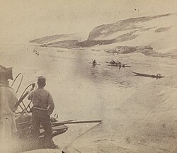
Cape Morris Jesup is a headland in Peary Land, Greenland.
Cape Farewell is a headland on the southern shore of Egger Island, Nunap Isua Archipelago, Greenland. As the southernmost point of the country, it is one of the important landmarks of Greenland.
Tasiilap Karra or Cape Gustav Holm is a headland in eastern Greenland, Sermersooq municipality.
Cape Atholl, also known as Kangaarasuk, is a headland in Northwest Greenland, Avannaata municipality.

Steen Andersen Bille, was a Danish vice-admiral and minister for the navy. He was famous for his service in the Danish Royal Navy, particularly during the First Schleswig War, 1848–1851.
Cape Thorvaldsen is a headland in southwest Greenland in the Kujalleq municipality.
Cape J.A.D. Jensen is a headland in the North Atlantic Ocean, east Greenland, Sermersooq municipality. This cape is named after J. A. D. Jensen, an officer of the Danish Navy and Arctic explorer.
Cape Cort Adelaer, also known as Cape Adelaer, is a headland in the North Atlantic Ocean, southeast Greenland, Sermersooq municipality. This cape is named after Norwegian seaman Cort Adeler (1622–1675) who distinguished himself for services rendered to the Royal Dano-Norwegian Navy.

Odinland, also Odinsland in the Defense Mapping Agency Greenland Navigation charts, is a peninsula in the King Frederick VI Coast, southeastern Greenland. It is a part of the Sermersooq municipality.
Puisortoq is a glacier on the east coast of Greenland. It has been in a status of retreat for the past years.
Lambert Land is a land area —possibly a peninsula or an island— in King Frederick VIII Land, northeastern Greenland. Administratively it belongs to the Northeast Greenland National Park area.

Cape Bridgman is a headland in the Wandel Sea, Arctic Ocean, northeast Greenland.
Cape Walløe, also known as Kangeq and Kangerssiuasik, is a headland in the North Atlantic Ocean, southeast Greenland, Kujalleq municipality.
Cape Discord, also known as Kangeq, is a headland in the North Atlantic Ocean, southeast Greenland, Kujalleq municipality.
Cape Møsting is a headland in the North Atlantic Ocean, southeast Greenland, Kujalleq municipality.

Cape Moltke is a headland in the North Atlantic Ocean, southeast Greenland, Kujalleq municipality.

Cape Harald Moltke is a headland in Peary Land, North Greenland. Administratively it is part of the Northeast Greenland National Park.
Cape Biot is a headland in the Greenland Sea, Northeast Greenland, Sermersooq municipality.
Cape Simpson is a headland in the Greenland Sea, Northeast Greenland. Administratively it is part of the Northeast Greenland National Park.
Cape Bismarck is a headland in King Frederick VIII Land, Northeast Greenland. Administratively it is part of the Northeast Greenland National Park.


