
Royal Air Force Akrotiri, commonly abbreviated RAF Akrotiri is a large Royal Air Force (RAF) military airbase on the Mediterranean island of Cyprus. It is located in the Western Sovereign Base Area, one of two areas which comprise Akrotiri and Dhekelia, a British Overseas Territory, administered as a Sovereign Base Area.

Akrotiri and Dhekelia, officially the Sovereign Base Areas of Akrotiri and Dhekelia (SBA), is a British Overseas Territory on the island of Cyprus. The areas, which include British military bases and installations formerly part of the Crown colony of Cyprus, were retained by the British under the 1960 treaty of independence signed by the United Kingdom, Greece, Turkey and representatives from the Greek and Turkish Cypriot communities. The territory serves an important role as a station for signals intelligence and provides a vital strategic part of the United Kingdom surveillance-gathering network in the Mediterranean and the Middle East.

British Forces Cyprus (BFC) is the name given to the British Armed Forces stationed in the UK Sovereign Base Areas of Akrotiri and Dhekelia on the island of Cyprus and at a number of related 'retained sites' in the Republic of Cyprus. The United Kingdom retains a military presence on the island in order to keep a strategic location at the eastern end of the Mediterranean, for use as a staging point for forces sent to locations in the Middle East and Asia. BFC is a tri-service command, with all three services based on the island reporting to it.

Akrotiri Bay is a part of the Mediterranean Sea east of the Akrotiri Peninsula on the southern coast of the island of Cyprus. The Western Sovereign Base Area of Akrotiri and Dhekelia, a British Overseas Territory set up after Cypriot independence was gained and was unanimously agreed with the British Empire that sovereign bases could be set up for use in the event of an invasion, administered as a Sovereign Base Area, borders the bay. The city of Limassol is also located on the bay. The southern end of the bay is formed by Cape Gata.

The Sovereign Base Areas Police is the local civilian police force for the British controlled Sovereign Base Areas (SBA) of Akrotiri and Dhekelia in Cyprus.
The Akrotiri Peninsula is a short peninsula which includes the southernmost point of the island of Cyprus. It is bounded by Episkopi Bay to the west and Akrotiri Bay to the east and has two capes to the south-west and south-east, known as Cape Zevgari and Cape Gata.
Cape Gata is the south-eastern cape of the Akrotiri Peninsula on the Mediterranean island of Cyprus. It is located within the British Sovereign Base Areas, and is the southernmost point of the island. However, the Sovereign Base Areas are not part of the Republic of Cyprus or the European Union, whose southernmost point lies nearby at the border between the two .

Episkopi Cantonment is the capital of Akrotiri and Dhekelia, a British overseas territory on the island of Cyprus, administered as a military base. It is located in the northwestern part of the Western Sovereign Base Area (Akrotiri), one of the two areas which comprise the territory. Although it is not the largest of the British military bases on the island, it is home to both the civilian and military administration headquarters of the Sovereign Base Areas. Episkopi is the current command centre of British Forces Cyprus.
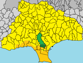
Ypsonas is a municipality in the Limassol prefecture of Cyprus. It is one of the largest villages in the Limassol District of Cyprus and is located about 7 kilometers west of Limassol city. The southern part of the village is within the administrative borders of the British military base of Akrotiri - Episkopi. It has 10,916 residents as recorded in the Census of 2011.

Sovereign Base Areas Customs and Immigration is a semi-autonomous branch of HM Revenue and Customs (HMRC) of the United Kingdom. It has jurisdiction over Akrotiri and Dhekelia, a British Overseas Territory on the island of Cyprus, administered as a Sovereign Base Area, and home to British Forces Cyprus. It is managed by the Ministry of Defence (MoD) and around 3,500 military personnel are posted there at any one time.
This page lists topics related to Akrotiri and Dhekelia, two British Overseas Territories on the island of Cyprus.

Akrotiri is a village within the Akrotiri Sovereign Base Area, which forms part of the British Overseas Territory of Akrotiri and Dhekelia. It is the only village in the Western SBA with a significant non-military population.
Air Chief Marshal Sir William Lawrence Mary MacDonald, was a Royal Air Force Officer who served as Commander-in-Chief of the Near East Air Force from 1958 to 1962.
A Ministry of Defence Hospital Unit, or MDHU, is a military healthcare facility embedded within a civilian National Health Service hospital. The United Kingdom Armed Forces no longer run dedicated military hospitals by themselves, the last of such hospitals closing or turned over to the local NHS trust in 1995,. The Defence Medical Services direct the operation of all seven MDHUs in the UK.

Dhekelia Cantonment is a military base in Akrotiri and Dhekelia, a British Overseas Territory on the island of Cyprus, administered as the Sovereign Base Areas. It is located in the Eastern Sovereign Base Area, one of the two areas which comprise the territory. It is the larger of the British military bases on the island, and it is also the location of Alexander Barracks, which is home to 2nd Battalion, The Princess of Wales's Royal Regiment. In autumn 2017 the 2nd Battalion Royal Anglian Regiment deployed to Dhekelia replacing 2nd Battalion, The Princess of Wales's Royal Regiment.
Same-sex marriage has been legal in Akrotiri and Dhekelia since 3 June 2014. An Order in Council to legalise same-sex marriages was approved by the Privy Council of the United Kingdom on 28 April 2014 and came into effect on 3 June. However, this only applies if one of the parties to the marriage is a member of the British Armed Forces. The order does not apply to the local civil population residing in Akrotiri and Dhekelia. Military personnel have also been able to enter into civil partnerships since 2005.
The following is a hierarchical outline for the British Armed Forces at the end of the Cold War. It is intended to convey the connections and relationships between units and formations.
The Princess Mary's Hospital, RAF Akrotiri,, was a military hospital located on the Royal Air Force base at Akrotiri on the island of Cyprus. The hospital was the last British military hospital to remain in operation after all other hospitals had closed down in the 1990s and 2000s. Originally the site was a dedicated RAF Hospital, but since 1996 it had been a Defence Medical Services asset. The hospital provided care for service personnel, their dependants and the local Cypriot population. It also treated many others from non-British and non-Cypriot countries. The setting of the hospital gave rise to the nickname Alcatraz, and it was staffed by personnel from the Royal Air Force and the British Army.

Operation Highbrow was a British Ministry of Defence (MoD) operation to evacuate civilians from Beirut as a result of the escalating 2006 Lebanon War. Initially, helicopters started ferrying the most vulnerable to Cyprus with several Royal Navy ships later transporting evacuees across the Mediterranean Sea to Cyprus. The operation involved Royal Navy surface ships and helicopters, with Royal Air Force helicopters also providing support and transit. The operation was described as being the largest evacuation that Britain was involved in since Dunkirk.
