| Carangola River | |
|---|---|
 | |
| Location | |
| Country | Brazil |
| Physical characteristics | |
| Source | |
| • location | Minas Gerais state |
| Mouth | |
• location | Rio de Janeiro state |
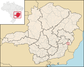
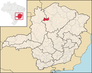
The Carangola River is a river of Minas Gerais and Rio de Janeiro states in southeastern Brazil.
| Carangola River | |
|---|---|
| | |
| Location | |
| Country | Brazil |
| Physical characteristics | |
| Source | |
| • location | Minas Gerais state |
| Mouth | |
• location | Rio de Janeiro state |
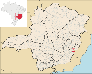
The Carangola River is a river of Minas Gerais and Rio de Janeiro states in southeastern Brazil.

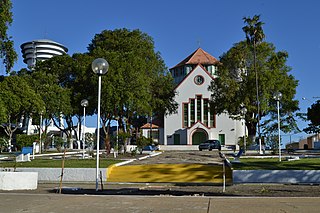
Alto Caparaó is a Brazilian municipality in the state of Minas Gerais. The city belongs to the mesoregion of Zona da Mata and to the microregion of Manhuaçu. As of 2020 its population is estimated to be 5,894.
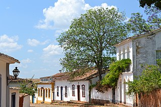
Tiradentes is a municipality in the Brazilian state of Minas Gerais. It is located at 21°06′37″S44°12′41″W, has an area of 83.5 km², and a maximum elevation above sea level of 927 m. Tiradentes had an estimated population of 10,960, as of 2020. The original village was established in 1702 and became a city on 19 January 1718. In 1889 the city was renamed from Vila de São José do Rio das Mortes in honour of the national hero who was born nearby.

Mutum is a municipality in the state of Minas Gerais, in Brazil with a population of 26,961 as of 2020 and an area of 1,255.800 km². It was founded on June 17, 1912. The city has two rivers: Mutum and São Manoel.

Pedra Azul is a Brazilian municipality in the state of Minas Gerais, located in the northeast of the state, in the Jequitinhonha River valley region. The population in 2020 was 24,329 in a total area of 1,619 km2.

Conselheiro Pena, formerly known as "Lajao", is located in the state of Minas Gerais, Brazil. This town of 20,000+ inhabitants, was formed alongside the "Rio Doce", or Sweet River.

Caiana is a Brazilian municipality located in the state of Minas Gerais. The city belongs to the mesoregion of Zona da Mata and to the microregion of Muriaé. As of 2020, the estimated population was 5,541.
Jequitinhonha is a Brazilian municipality located in the northeast of the state of Minas Gerais.

Joaíma is a Brazilian municipality located in the northeast of the state of Minas Gerais.
São José do Mantimento is a Brazilian municipality located in the state of Minas Gerais. The city belongs to the mesoregion of Zona da Mata and to the microregion of Manhuaçu. As of 2020, the estimated population was 2,806.

Santana do Manhuaçu is a Brazilian municipality located in the state of Minas Gerais. The city belongs to the mesoregion of Zona da Mata and to the microregion of Manhuaçu. As of 2020, the estimated population was 8,667.
Reduto is a Brazilian municipality located in the state of Minas Gerais. The city belongs to the mesoregion of Zona da Mata and to the microregion of Manhuaçu. As of 2020, the estimated population was 7,201.

Martins Soares is a Brazilian municipality located in the state of Minas Gerais. The city belongs to the mesoregion of Zona da Mata and to the microregion of Manhuaçu. As of 2020, the estimated population was 8,531.

Manhumirim is a Brazilian municipality located in the state of Minas Gerais. The city belongs to the mesoregion of Zona da Mata and to the microregion of Manhuaçu. The city is considered a Transit city. The Omnibus connects Manhumirim to other neighboring cities such as Alto Jequitiba, Alto Caparao, Reducto, and Manhuacu. As of 2020, the estimated population was 22,802.

Chalé is a Brazilian municipality located in the state of Minas Gerais. The city belongs to the mesoregion of Zona da Mata and to the microregion of Manhuaçu. As of 2020, the estimated population was 5,699.

Caparaó is a Brazilian municipality located in the state of Minas Gerais. The city belongs to the mesoregion of Zona da Mata and to the microregion of Manhuaçu. The elevation of the city is 843m. As of 2020, the estimated population was 5,451.
São Romão is a Brazilian municipality located in the north of the state of Minas Gerais. In 2020 the population was 12,529 in a total area of 2,432 km². It became a municipality in 1943.
Itabirinha is a municipality in eastern Minas Gerais in Brazil, in the region of Rio Doce. In 2020, the population of the city was 11,576.
Ipanema, Minas Gerais is a municipality in the state of Minas Gerais in the Southeast region of Brazil.
Maripá de Minas is a municipality in the state of Minas Gerais in the Southeast region of Brazil.

Goiabeira is a municipality in the state of Minas Gerais in the Southeast region of Brazil. As of 2020, its estimated population is 3,378.
Coordinates: 21°12′24″S41°55′39″W / 21.2068°S 41.9275°W