This is a list of the extreme points of the United Kingdom: the points that are farther north, south, east or west than any other location. Traditionally the extent of the island of Great Britain has stretched "from Land's End to John o' Groats".

Joinville Island is the largest island of the Joinville Island group, about 40 nautical miles long in an east–west direction and 12 nautical miles wide, lying off the northeastern tip of the Antarctic Peninsula, from which it is separated by the Antarctic Sound.
The Prince Olav Mountains is a mountain group in the Queen Maud Mountains in Antarctica stretching from Shackleton Glacier to Liv Glacier at the head of the Ross Ice Shelf.
The Scaife Mountains is a group of mountains rising west of Prehn Peninsula and between the Ketchum Glacier and Ueda Glacier, at the base of the Antarctic Peninsula.

Mount Murphy is a snow-covered mountain with steep, rocky slopes rising to 2,505 metres (8,219 ft) in Marie Byrd Land, Antarctica. It is directly south of Bear Peninsula and is bounded by Smith Glacier, Pope Glacier, and Haynes Glacier. Volcanic activity began in the Miocene with the eruption of basaltic and trachytic lava. Volcanism on the slopes of the volcano resumed much later during the Pleistocene, with a parasitic cone having been K–Ar dated to 0.9 million years old.

The Prince Charles Mountains are a major group of mountains in Mac. Robertson Land in Antarctica, including the Athos Range, the Porthos Range, and the Aramis Range. The highest peak is Mount Menzies, with a height of 3,228 m (10,591 ft). Other prominent peaks are Mount Izabelle and Mount Stinear. These mountains, together with other scattered peaks, form an arc about 420 km (260 mi) long, extending from the vicinity of Mount Starlight in the north to Goodspeed Nunataks in the south.
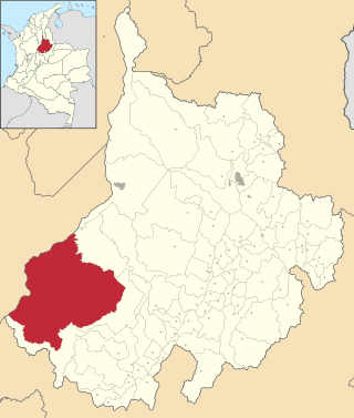
Cimitarra is a town and municipality in the Santander Department in northeastern Colombia.

The David Glacier is a glacier over 60 nautical miles long, flowing east from the polar plateau through the Prince Albert Mountains to the coast of Victoria Land, Antarctica. It enters Ross Sea between Cape Philippi and Cape Reynolds to form the floating Drygalski Ice Tongue. It is the most imposing outlet glacier in Victoria Land. It is fed by two main flows which drain an area larger than 200,000 square kilometres, with an estimated ice discharge rate of 7.8 +/- 0.7 km3/year. The David Glacier was discovered by Ernest Shackleton's "Northern Party," in November 1908, under the leadership of Prof. T.W. Edgeworth David, of Sydney University, for whom the feature was named.
Prime Head is a prominent snow-covered headland which forms the north extremity of the Antarctic Peninsula.
The Duroch Islands are a group of islands and rocks which extend over an area of about 3 nautical miles, centred about 1 nautical mile off Cape Legoupil on the north coast of Trinity Peninsula, Antarctica. The islands are close to Chile's Base General Bernardo O'Higgins Riquelme at Cape Legoupil.
Aitkenhead Glacier is a 10 nautical miles long glacier flowing east-southeast from the Detroit Plateau, Graham Land, into Prince Gustav Channel.
Santa Cruz de Monte Castelo is a municipality in the state of Paraná in the Southern Region of Brazil.
Itapiratins is a municipality in the state of Tocantins in the Northern region of Brazil.
The Gothic Mountains is a group of mountains, 20 nautical miles long, in the Queen Maud Mountains of Antarctica, located west of Watson Escarpment and bounded by Scott Glacier, Albanus Glacier, and Griffith Glacier.
Channel Glacier is a through glacier, 1.5 nautical miles (3 km), extending in an east-west direction across Wiencke Island, between Nipple Peak and Wall Range, in the Palmer Archipelago. It was discovered by the Belgian Antarctic Expedition under Gerlache 1897–99. The name appears on a chart based on a 1927 survey by DI personnel on the Discovery.
Schmidt Peninsula is a small peninsula connected by a low isthmus to Cape Legoupil on the Trinity Peninsula of Antarctica.

Leay Glacier is a glacier flowing northwest into Girard Bay to the west of Hotine Glacier, on Kyiv Peninsula, on the west coast of Graham Land, Antarctica. It was first charted by the French Antarctic Expedition, 1908–10, under Jean-Baptiste Charcot, and was named by the UK Antarctic Place-Names Committee for Petra Searle of the Directorate of Overseas Surveys, who has contributed to the work of mapping the Antarctic Peninsula area.
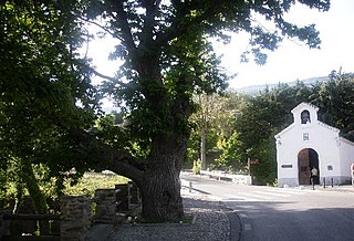
Pórtugos is a municipality in the province of Granada, Spain. As of 2010, it has a population of 401 inhabitants.
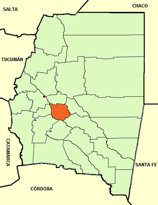
San Martín is a department of Santiago del Estero Province (Argentina), and one of the twenty-seven administrative units of the province.