A menhir, standing stone, orthostat, or lith is a large upright stone, emplaced in the ground by humans, typically dating from the European middle Bronze Age. They can be found individually as monoliths, or as part of a group of similar stones. Menhirs' size can vary considerably, but they often taper toward the top.

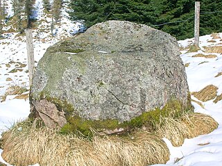
A monolith is a geological feature consisting of a single massive stone or rock, such as some mountains. Erosion usually exposes the geological formations, which are often made of very hard and solid igneous or metamorphic rock. Some monoliths are volcanic plugs, solidified lava filling the vent of an extinct volcano.
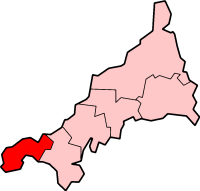
Penwith is an area of Cornwall, England, located on the peninsula of the same name. It is also the name of a former local government district, whose council was based in Penzance. The area is named after one of the ancient administrative hundreds of Cornwall which derives from two Cornish words, penn meaning 'headland' and wydh meaning 'at the end'.

St Buryan is a village and former civil parish, now in the parish of St Buryan, Lamorna and Paul in Cornwall, England, United Kingdom. In 2011 the parish had a population of 1412.
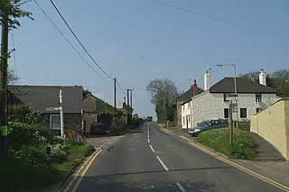
Drift is a village on the A30 road in west Cornwall, England, United Kingdom. The village is in the civil parish of Sancreed and is approximately two miles (3 km) west of Penzance and six miles (9 km) from Land's End.

Kerris is a settlement in west Cornwall, England, United Kingdom. It is three miles (5 km) south-west of Penzance in the civil parish of Paul. Kerris means "fort-place" in the Cornish language.

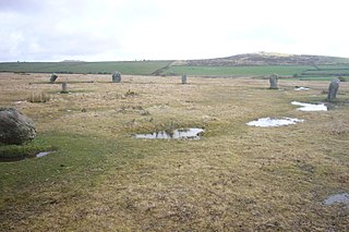
Boscawen-Ûn is a Bronze Age stone circle close to St Buryan in Cornwall, UK. It consists of nineteen upright stones in an ellipse with another, leaning, middle stone just south of the centre. There is a west-facing gap in the circle, which may have formed an entrance. The elliptical circle has diameters 24.9 and 21.9 metres. It is located at grid reference SW412274.

Gwennap Head is a headland on the south coast of the Penwith peninsula, Cornwall, United Kingdom. It is within the parish of St Levan and approximately 4 miles (6.4 km) south of Land's End, and less than 1 mile (1.6 km) north-west of Porthgwarra, the nearest village. The area of Gwennap Head is designated as part of the Penwith Heritage Coast and also designated as part of the Cornwall Area of Outstanding Natural Beauty. The South West Coast Path closely follows the coastline around the headland.

Tregeseal East is a heavily restored prehistoric stone circle around one mile northeast of the town of St Just in Cornwall, United Kingdom. The nineteen granite stones are also known as The Dancing Stones. It is the one surviving circle of three that once stood aligned along an east–west axis on the hillside to the south of Carn Kenidjack.

Boskednan stone circle is a partially restored prehistoric stone circle near Boskednan, around 4 miles northwest of the town of Penzance in Cornwall, United Kingdom. The megalithic monument is traditionally known as the Nine Maidens or Nine Stones of Boskednan, although the original structure may have contained as many as 22 upright stones around its 69-metre perimeter.

Carfury is a hamlet in west Cornwall, England, United Kingdom. It is situated in Penwith approximately three miles (5 km) northwest of Penzance. It is in the civil parish of Madron
The name gowk stane has been applied to certain standing stones and glacial erratics in Scotland, often found in prominent geographical situations. Other spelling variants, such as gowke, gouk, gouke, goilk, goik, gok, goke, gook are found.
The Trippet stones or Trippet stones circle is a stone circle located on Manor Common in Blisland, 9 kilometres (5.6 mi) north northeast of Bodmin on Bodmin Moor in Cornwall, UK. The Stripple stones are nearby.

The Stripple stones is a henge and stone circle located on the south slope of Hawk's Tor, Blisland, 10 kilometres (6.2 mi) north northeast of Bodmin on Bodmin Moor in Cornwall, England, UK.
Sperris Quoit is a ruined megalithic burial chamber or dolmen, and one of a type of tomb unique to West Penwith, located on a moor around 365 metres northeast of Zennor Quoit, being roughly halfway between Zennor and Amalveor, Cornwall. It is the northernmost quoit in the Penwith peninsula and a Scheduled Monument.

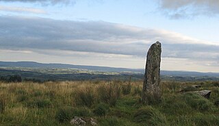
Boswens Menhir, also known as Boswens standing stone, or the Long Stone, is a standing stone 3 kilometres northeast of St Just in Penwith, in Cornwall, England.
This is a list of scheduled monuments in Cornwall, United Kingdom. Monuments are listed by Historic England as part of the National Heritage List for England. For the scope of this list, the Isles of Sicily are included and the ceremonial county boundaries are used.

The Tolvan holed stone is a triangular-shaped Neolithic standing stone. The monument is 2.3 m high and consists of a circular hole near its base measuring 43 cm in diameter. The megalithic stone is located in the garden of Tolvan Cross Cottage, near the village of Gweek in Cornwall, England. The holed stone is the largest of its kind in Cornwall.

The Cornish Bronze Age is an era of the prehistory of Cornwall that spanned the period from c. 2400 BCE to c. 800 BCE. It was preceded by the Cornish Neolithic, and followed by the Cornish Iron Age. It is characterized by the introduction and widespread use of copper and copper-alloy (bronze) weapons and tools.
