
Humphreys Peak is the highest mountain and the second most prominent peak after Mount Graham in the U.S. state of Arizona. With an elevation of 12,633 feet (3,851 m), it is located within the Kachina Peaks Wilderness in the Coconino National Forest, about 11 miles (17.7 km) north of Flagstaff, Arizona. Humphreys Peak is the highest of a group of dormant volcanic peaks known as the San Francisco Peaks.

Dugger Mountain Wilderness is Alabama's third and newest wilderness area. Dedicated April 2000, Dugger Mountain Wilderness covers 9,200 acres (3,700 ha) of Talladega National Forest in Calhoun County and Cleburne County in Alabama.

Absaroka–Beartooth Wilderness was created from existing National Forest lands in 1978 and is located in Montana and Wyoming, United States. The wilderness encompasses two distinct mountain ranges: the Beartooth and Absaroka ranges. These ranges are completely distinct geologically speaking, with the Absaroka composed primarily of volcanic and metamorphic rock, while the Beartooth is made up almost entirely of granitic rocks. The Absaroka are noted for their dark and craggy appearance, lush and heavily forested valleys, and abundant wildlife. The highest peak in the range, in Wyoming, is Francs Peak at 13,153 feet (4,009 m). The Beartooth is more alpine, with huge treeless plateaus and the highest peak of Montana. The wilderness has more than 120 peaks over 10,000 feet (3,000 m) and 28 peaks over 12,000 feet (3,700 m), including Montana's highest, Granite Peak at 12,799 feet (3,901 m). The wilderness is integral to the 20-million-acre (81,000 km2) Greater Yellowstone Ecosystem and borders Yellowstone National Park.

Lassen National Forest is a United States national forest of 1,700 square miles (4,300 km2) in northeastern California. It is named after pioneer Peter Lassen, who mined, ranched and promoted the area to emigrant parties in the 1850s.
The Cabinet Mountains Wilderness, created by an act of Congress in 1964, is located in the U.S. state of Montana. Protecting the wildest portions of the Cabinet Mountains and an integral part of Kootenai National Forest and Kaniksu National Forest, the wilderness had enjoyed more limited protection since 1935 as a Primitive Area.

The Gates of the Mountains Wilderness is located in the U.S. state of Montana. Created by an act of Congress in 1964, the wilderness is managed by Helena National Forest. A day use campground near the Gates of the Mountains, Meriwether Picnic site, is named in honor of Meriwether Lewis.

Mount Baker Wilderness is a 119,989-acre (48,558 ha) wilderness area within the Mount Baker-Snoqualmie National Forest in the western Cascade Range of northern Washington state. Its eastern border is shared with the boundary of the Stephen Mather Wilderness and North Cascades National Park for a distance of 40 miles. The wilderness extends from State Route 20 north to the Canada–US border. On the west, it is bounded by the foothills of the Puget Sound lowlands.
Colonel Bob Wilderness is a 11,855-acre (4,798 ha) protected area located in the southwest corner of Olympic National Forest in the state of Washington. It is named after 19th-century orator Robert Green Ingersoll. Lake Quinault lies about 15 miles to the west. Elevations in the wilderness vary from 300 to 4,509 feet above sea level. The highest elevation is an unnamed peak; the second-highest elevation is Colonel Bob Mountain at 4,492 feet. The wilderness is a temperate rain forest with annual rainfall greater than 150 inches (3,800 mm).
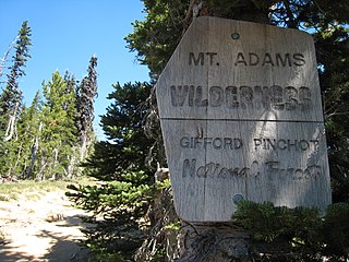
The Mount Adams Wilderness is a 47,708-acre (19,307 ha) wilderness area in the U.S. state of Washington managed by the U.S. Forest Service. The wilderness encompasses an ecologically complex and geologically active landscape. Weather differs between the dry eastside and moist westside of the mountain. At 12,276 feet (3,742 m), Mount Adams is the second tallest mountain in Washington State and one of the tallest in the Cascade Range. The wilderness area is on the west side of the mountain and is part of the Gifford Pinchot National Forest. The east side of the mountain is part of the Yakama Nation, with the southeast side part of the Mount Adams Recreation Area, and includes Bird Creek Meadows.

The Indian Peaks Wilderness is a 73,931 acre wilderness area in north central Colorado managed jointly by the United States Forest Service and the National Park Service within the Arapaho and Roosevelt National Forests and small parts of the southern section of Rocky Mountain National Park. It includes over 50 lakes, 28 trails, and numerous glaciers. It was founded as a protected area by an act of Congress in 1978. It borders the James Peak Wilderness to the south, and straddles the Continental Divide. The area receives high visitation due to its proximity to the Denver metropolitan area.
The Glastenbury Wilderness is one of eight wilderness areas in the Green Mountain National Forest in the U.S. state of Vermont. The area, located northeast of Bennington, Vermont, is managed by the U.S. Forest Service. With a total of 22,330 acres (9,040 ha), the wilderness is the second largest in Vermont. It was created by the New England Wilderness Act of 2006.
The Byers Peak Wilderness is a U.S. Wilderness Area located in Arapaho National Forest in north central Colorado. The 8,913-acre (36.07 km2) wilderness was established in 1993 and named after its highest point, Byers Peak. Byers Peak was named after William N. Byers, the first mayor of Hot Sulphur Springs and the founder of Colorado's first newspaper, the Rocky Mountain News. The wilderness contains two glacial lakes, two peaks over 12,500 feet (3,800 m), and 23 miles (37 km) of trails.

The Fossil Ridge Wilderness is a U.S. Wilderness Area located approximately 16 miles (26 km) northeast of Gunnison, Colorado in the Gunnison National Forest. The 13,992-acre (56.62 km2) wilderness includes Fossil Ridge, a high, exposed ridge of Paleozoic carbonates that contain epeiric sea fossils. Elevations in the wilderness range from 8,880 feet (2,710 m) at Summerville Creek to 13,254 feet (4,040 m) at the summit of Henry Mountain. Elk, deer, mountain goats, and bighorn sheep can be found in the wilderness.
Moose Mountain (10,059 feet is located in the northern Teton Range in the U.S. state of Wyoming. The peak is on the border of Grand Teton National Park and the Jedediah Smith Wilderness of Caribou-Targhee National Forest. Moose Mountain is at the western end of Webb Canyon.
Rammell Mountain (10,140 feet is located in the Teton Range in the U.S. state of Wyoming. The peak is in the Jedediah Smith Wilderness of Caribou-Targhee National Forest.
Green Lakes Mountain (10,240 feet is located in the Teton Range in the U.S. state of Wyoming. The peak is on the border of Grand Teton National Park and the Jedediah Smith Wilderness of Caribou-Targhee National Forest. Green Lakes Mountain is at the head of Moran Canyon and 1 mile SSW of Dry Ridge Mountain.
Dry Ridge Mountain (10,326 feet is located in the Teton Range in the U.S. state of Wyoming. The peak is on the border of Grand Teton National Park and the Jedediah Smith Wilderness of Caribou-Targhee National Forest. Dry Ridge Mountain is at the head of Moran Canyon and 1 mile NNE of Green Lakes Mountain.

Table Mountain is located in the Teton Range in the U.S. state of Wyoming. The peak is on the border of Grand Teton National Park and the Jedediah Smith Wilderness of Caribou-Targhee National Forest. Table Mountain is west of the south fork of Cascade Canyon and a little more than 1 mile (1.6 km) north of Hurricane Pass.

Battleship Mountain (10,679 feet is located in the Teton Range in the U.S. state of Wyoming. The peak is in the Jedediah Smith Wilderness of Caribou-Targhee National Forest and is west of Hurricane Pass.
The Breadloaf Wilderness is one of eight wilderness areas in the Green Mountain National Forest in the U.S. state of Vermont. It was created by the Vermont Wilderness Act of 1984 and later expanded by the New England Wilderness Act of 2006. With a total of 24,986 acres (10,111 ha), it is the largest wilderness area in Vermont. The area is managed by the U.S. Forest Service.

