The São Francisco River is a large river in Brazil. With a length of 2,914 kilometres (1,811 mi), it is the longest river that runs entirely in Brazilian territory, and the fourth longest in South America and overall in Brazil. It used to be known as the Opara by the indigenous people before colonisation, and is today also known as "Velho Chico".

The Grande Sertão Veredas National Park is a national park located on the border between the states of Minas Gerais and Bahia, Brazil.

Bandeira is a Brazilian municipality located in the state of Minas Gerais. Its population as of 2020 was estimated to be 4,766 people living in a total area of 484 km2. The city belongs to the mesoregion of Jequitinhonha and to the microregion of Almenara.

Pedra Azul is a Brazilian municipality in the state of Minas Gerais, located in the northeast of the state, in the Jequitinhonha River valley region. The population in 2020 was 24,329 in a total area of 1,619 km2.

Miraí is a Brazilian municipality located in the state of Minas Gerais. The city belongs to the mesoregion of Zona da Mata and to the microregion of Muriaé.

Jordânia is a Brazilian municipality located in the northeast of the state of Minas Gerais. The city belongs to the mesoregion of Jequitinhonha and to the microregion of Almenara. As of 2020 the population was 10,842 in a total area of 549 km2.

Mata Verde is a Brazilian municipality located in the state of Minas Gerais. As of 2020 the population was 8,644 and the area was 230 km2 (89 sq mi). The elevation is 865 m (2,838 ft).

Bahia Falls is a waterfall on the Santo Antônio River, in city of Santo Antônio do Rio Abaixo, in the state of Minas Gerais in Brazil. It has about 4 m (13 ft) of height.

The Roman Catholic Archdiocese of Juiz de Fora is an archdiocese located in the city of Juiz de Fora in Brazil.

Capitão Enéas is a municipality in the north of the Brazilian state of Minas Gerais. As of 2020 the population was 15,313 in a total area of 970 km2.

Gameleiras is a municipality in the northeast of the Brazilian state of Minas Gerais. As of 2020 the population was 5,096 in a total area of 1,733 km². The elevation is 540 meters. It became a municipality in 1997. The postal code (CEP) is 39505-000.

Juvenília is a municipality in the north of the state of Minas Gerais in Brazil. As of 2020 the population was 5,715 in an area of 1,065 km².

Berizal is a Brazilian municipality located in the northeast of the state of Minas Gerais. As of 2020 the population was 4,764 in a total area of 493 km².

Ninheira is a city in the northeast of the Brazilian state of Minas Gerais. In 2020 its population was estimated to be 10,326 in a total area of 1,114 km².

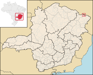
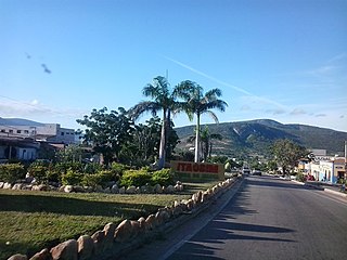
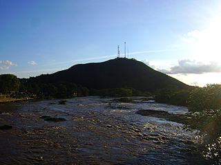
Itaobim is a municipality in the northeast of the Brazilian state of Minas Gerais. Its population in 2020 was 21,029 inhabitants in a total area of 680 km². It belongs to the Pedra Azul statistical microregion. The elevation of the municipal seat is 180 meters. It became a municipality in 1962. Neighboring municipalities are Medina, Jequitinhonha, Ponto dos Volantes and Itinga. The distance to the state capital, Belo Horizonte is 604 kilometers.

Minas Novas is a municipality in the northeast of the Brazilian state of Minas Gerais. In 2020, the population was 31,497 in a total area of 1,810 km². The elevation of the urban area is 635 meters. It is part of the IBGE statistical meso-region of Jequitinhonha and the micro-region of Capelinha. It became a municipality in 1730.

Senador Modestino Gonçalves is a Brazilian municipality in the state of Minas Gerais.

The Mucuri River is a river of Bahia and Minas Gerais states in eastern Brazil.

The Pardo River is a river of Bahia and Minas Gerais states in eastern Brazil.

Carinhanha is a municipality in the state of Bahia in the North-East region of Brazil. Carinhanha covers 2,529.45 km2 (976.63 sq mi), and has a population of 29,070 with a population density of 12 inhabitants per square kilometer. It is located on the banks of the Rio São Francisco and the Carinhanha River, which also forms the border of the state of Minas Gerais.


