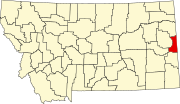
Wibaux County is a county in the U.S. state of Montana. As of the 2020 census, the population was 937, making it the fourth-least populous county in Montana. Its county seat is Wibaux.

Roosevelt County is a county in the U.S. state of Montana. As of the 2020 census, the population was 10,794. Its county seat is Wolf Point. Roosevelt County was created by the Montana Legislature in 1919 from a portion of Sheridan County. The name honors former president Theodore Roosevelt, who had died earlier that year.

The City of Northglenn is a home rule municipality located in Adams and Weld counties, Colorado, United States. Northglenn is a part of the Denver–Aurora–Lakewood, CO Metropolitan Statistical Area. As of the 2020 census the city's population was 38,131. It was built as a master planned community in 1959 by Jordon Perlmutter.

Sedgwick is a statutory town in Sedgwick County, Colorado, United States. The population was 172 at the 2020 census.
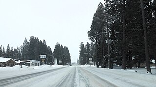
Lincoln is an unincorporated community and census-designated place (CDP) in Lewis and Clark County, Montana, United States. As of the 2010 census, the population was 1,013.
Wibaux is a town in and the county seat of Wibaux County, Montana, United States. It is the only incorporated town in Wibaux County. The population was 462 at the 2020 census.

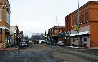
Baker is a city in and the county seat of Fallon County, Montana, United States. The population was 1,802 at the 2020 census.

Fort Laramie is a town in Goshen County, Wyoming, United States. The population was 206 at the 2020 census. The town is named after historic Fort Laramie, an important stop on the Oregon, California and Mormon trails, as well as a staging point for various military excursions and treaty signings. The old fort was located south of town across the North Platte River, at the mouth of the Laramie River.

Steffenville is an unincorporated community in southwestern Lewis County, Missouri, United States. It is located on Missouri Supplemental Route D, approximately 22 miles southwest of Canton. The community is part of the Quincy, IL–MO Micropolitan Statistical Area.

The 1936 North American heat wave was one of the most severe heat waves in the modern history of North America. It took place in the middle of the Great Depression and Dust Bowl of the 1930s and caused more than 5,000 deaths. Many state and city record high temperatures set during the 1936 heat wave stood until the 2012 North American heat wave. Many more endure to this day; as of 2022, 13 state record high temperatures were set in 1936. The 1936 heat wave followed one of the coldest winters on record.
Dalton is an unincorporated census-designated place in the town of Kingston located in the southwestern corner of Green Lake County, Wisconsin, United States. It is located on Wisconsin Highway 44. It uses ZIP code 53926. As of the 2020 census, its population was 215, up from 206 at the 2010 census. The surrounding countryside is mainly occupied by dairy farmers and an Amish community. Dalton has an area of 0.456 square miles (1.18 km2); 0.449 square miles (1.16 km2) of this is land, and 0.007 square miles (0.018 km2) is water. Dalton was named for John Dalton, who emigrated from Ireland with his family in the early 1850s.
Bitter Creek is an 80-mile-long stream in the U.S. state of Wyoming. It passes through several Wyoming counties, including Sweetwater and Carbon. The creek rises near the Delaney Rim, on the western side of Wyoming's Red Desert in Carbon County. For most of its course, Bitter Creek parallels the path of the transcontinental railroad and the modern route of Interstate 80. It flows through the cities of Rock Springs and Green River before emptying into the Green River.

North Dakota's climate is typical of a continental climate with cold winters and warm-hot summers. The state's location in the Upper Midwest allows it to experience some of the widest variety of weather in the United States, and each of the four seasons has its own distinct characteristics. The eastern half of the state has a humid continental climate with warm to hot, somewhat humid summers and cold, windy winters, while the western half has a semi-arid climate with less precipitation and less humidity but similar temperature profiles. The areas east of the Missouri River get slightly colder winters, while those west of the stream get higher summer daytime temperatures. In general, the diurnal temperature difference is prone to be more significant in the west due to higher elevation and less humidity.

The climate of the United States varies due to changes in latitude, and a range of geographic features, including mountains and deserts. Generally, on the mainland, the climate of the U.S. becomes warmer the farther south one travels, and drier the farther west, until one reaches the West Coast.
Raymond is an unincorporated hamlet in Sheridan County, Montana, United States. The community lies north of Plentywood. It is nine miles south of the Canada–US border.
The 2011 North American heat wave was a deadly summer 2011 heat wave that affected the Southern Plains, the Midwestern United States, Eastern Canada, the Northeastern United States, and much of the Eastern Seaboard, and had Heat index/Humidex readings reaching upwards of 131 °F (55 °C). On a national basis, the heat wave was the hottest in 75 years.
Morgan is an unincorporated community in Phillips County, Montana, United States.
Mildred is an unincorporated community in Prairie County, Montana, United States. Mildred is located along a former Chicago, Milwaukee, St. Paul and Pacific Railroad line 18.5 miles (29.8 km) east-southeast of Terry. It was platted in 1908.
Potomac is an unincorporated community and census-designated place (CDP) in Missoula County, Montana, United States. It was first listed as a CDP prior to the 2020 census, at which time it had a population of 26.