Related Research Articles

Benburb ) is a village and townland in County Tyrone, Northern Ireland. It lies 7.5 miles from Armagh and 8 miles from Dungannon. The River Blackwater runs alongside the village as does the Ulster Canal.

Creggan (Irish: creagan. is a townland in County Tyrone, Northern Ireland. It is situated in the historic barony of Omagh East and the civil parish of Termonmaguirk and covers an area of 4022 acres.

Artigarvan is a village and townland in County Tyrone, Northern Ireland. It is 3 miles from Strabane and 4 miles from Dunnamanagh, within the Strabane District Council area. It is called Airtigarvan in Ulster-Scots.

Ballymagorry or Ballymagory is a small village and townland in County Tyrone, Northern Ireland. It is west of Artigarvan and 5 kilometres (3.1 mi) north of Strabane. In the 2001 Census it had a population of 565. It lies within the Strabane District Council area and lies on the River Glenmornan.
Caledon is a small village and townland in County Tyrone, Northern Ireland. It is in the Clogher Valley on the banks of the River Blackwater, 7 miles from Armagh. It lies in the southeast of Tyrone and near the borders of County Armagh and County Monaghan. It is situated in the historic barony of Dungannon Lower and the civil parish of Aghaloo. In the 2001 Census it had a population of 387 people. It is a designated conservation area. It was historically known as Kinnaird (Irish: Cionn Aird, meaning "head/top of the height or hill".

Altamuskin or Altamooskan is a small village and townland in County Tyrone, Northern Ireland. It is situated in the historic barony of Clogher and the civil parish of Errigal Keerogue and covers an area of 1165 acres. In the 2014 Census Altamuskin had a population of 127 people. It lies within the Omagh District Council area and is home to St Bridget's Altamuskin. The population of the townland declined during the 19th century:

Brackaville or Bracaville is a village and townland near Coalisland in County Tyrone, Northern Ireland. It is situated in the historic barony of Dungannon Middle and the civil parish of Donaghenry and covers an area of 235 acres on the western side of Lough Neagh.
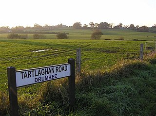
Drumkee is a townland in the southeast of County Tyrone, Northern Ireland. It is directly south of the area presently known as Coalisland and east, and slightly north, of Dungannon. It is situated in the historic barony of Dungannon Middle and the civil parish of Killyman and covers an area of 285 acres. The barony's tax records dated 1666 list two families living in Drumkee.

Carnteel ) is a hamlet, townland and civil parish, about 2 miles northeast of Aughnacloy in County Tyrone, Northern Ireland. It is situated in the historic barony of Dungannon Lower.

Derrytresk is a townland outside Coalisland, County Tyrone, Northern Ireland and is close to the shores of Lough Neagh. It is situated in the historic barony of Dungannon Middle and the civil parish of Clonoe and covers an area of 1020 acres. Derrytresk consists of sub-townlands: Derryvarne, Derrykiltena and Derrynahaskila.
Ballymully Glebe is a townland in County Tyrone, Northern Ireland. It is situated in the historic barony of Dungannon Upper and the civil parish of Desertcreat and covers an area of 144 acres.
Altishane or Altishahane is a small settlement and townland in County Tyrone, Northern Ireland. It lies near Strabane, between Plumbridge and Donemana. It is situated in the historic barony of Strabane Lower and the civil parish of Donaghedy and covers an area of 744 acres. There is one primary school, Altishane Primary School.
Aghagogan is a townland in County Tyrone, Northern Ireland. It is situated in the historic barony of Omagh East and the civil parish of Termonmaguirk and covers an area of 949 acres.

Aghalunny is a townland in County Tyrone, Northern Ireland. It is situated in the historic barony of Omagh West and the civil parish of Termonamongan and covers an area of 493 acres.
Altanagh is a townland in County Tyrone, Northern Ireland. It is situated in the historic barony of Omagh East and the civil parish of Termonmaguirk and covers an area of 971 acres.

Carrigans is a townland in County Tyrone, Northern Ireland. It is situated in the historic barony of Strabane Upper and the civil parish of Cappagh and covers an area of 859 acres.
Carrickone is a townland in County Tyrone, Northern Ireland. It is situated in the historic barony of Strabane Lower and the civil parish of Urney and covers an area of 73 acres.

Cloneblaugh is a townland in County Tyrone, Northern Ireland. It is situated in the historic barony of Clogher and the civil parish of Clogher and covers an area of 308 acres.
Cloncandra Glebe is a townland in County Tyrone, Northern Ireland. It is situated in the historic barony of Omagh East and the civil parish of Kilskeery and covers an area of 213 acres.
Derryloughan is a townland in County Tyrone, Northern Ireland. It lies on the southwest corner of Lough Neagh, 4 miles from Coalisland. It is situated in the historic barony of Dungannon Middle and the civil parish of Clonoe and covers an area of 1751 acres.
References
- ↑ "Townlands of County Tyrone". IreAtlas Townland Database. Retrieved 25 December 2012.
- ↑ "Carrigullin". Place Names NI. Retrieved 18 March 2013.
- ↑ "Census of Ireland 1851". Enhanced Parliamentary Papers on Ireland. Retrieved 25 December 2012.
- ↑ "Census of Ireland 1891". Enhanced Parliamentary Papers on Ireland. Retrieved 26 December 2012.