Gallery
 Bell tower of St. Rita
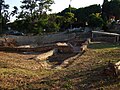 The Roman Villa
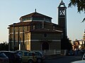 Church of St. Rita of Cascia
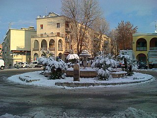
Casalotti is the name of the forty-eighth zone of Rome in the Agro Romano, denoted by Z. XLVIII. It is the namesake of the frazione of the same name. The area takes its name from the main road to Casalotti name, probably due to the numerous houses that were in the area. Surrounded by green hills, the center of the hamlet of Casalotti (Ormea Square and Church of St. Rita of Cascia) is situated at an altitude of about 110 m above sea level.
It is located in the north-west of Rome, outside the Ring Road. The area borders:
In May 1944, it was destroyed by Allied bombing along with the nearby Grottarossa, during the advance of the Allies themselves to hunt the German settlements. [1] The real estate boom dates back to the 1970s, when many construction companies started to build the most ancient part (the square and the area from Via Trofarello). Yet it is still being expanded. On 29 September 2009 the president of AS Roma Rosella Sensi announced the project of building a new soccer stadium in the southern area, near the Via Aurelia.
In Casalotti are:


Rita of Cascia, OSA, was an Italian widow and Augustinian nun. After Rita's husband died, she joined a small community of nuns, who later became Augustinians, where she was known both for practicing mortification of the flesh and for the efficacy of her prayers. Various miracles are attributed to her intercession, and she is often portrayed with a bleeding wound on her forehead, which is understood to indicate a partial stigmata.
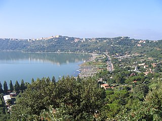
Castel Gandolfo, colloquially known as Castello in the Castelli Romani dialects, is a town located 25 km (16 mi) southeast of Rome, in the Italian region of Lazio. Situated on a hilltop in the Alban Hills with panoramic views of Lake Albano, Castel Gandolfo is home to approximately 8,900 residents and is renowned as one of Italy's most scenic towns. It is one of I Borghi più belli d'Italia.
Cascia is a town and comune (municipality) of the Italian province of Perugia in a rather remote area of the mountainous southeastern corner of Umbria. It is about 21 km from Norcia on the road to Rieti in the Lazio (63 km). It is also very close to Terni.

Albano Laziale is a comune (municipality) in the Metropolitan City of Rome Capital, on the Alban Hills, in the Italian region of Lazio. Rome is 25 kilometres (16 mi) distant. It is bounded by other communes of Castel Gandolfo, Rocca di Papa, Ariccia and Ardea. Located in the Castelli Romani area of Lazio. It is sometimes known simply as Albano.

Velletri is an Italian comune in the Metropolitan City of Rome, approximately 40 km to the southeast of the city centre, located in the Alban Hills, in the region of Lazio, central Italy. Neighbouring communes are Rocca di Papa, Lariano, Cisterna di Latina, Artena, Aprilia, Nemi, Genzano di Roma, and Lanuvio. Its motto is: Est mihi libertas papalis et imperialis.

Santa Rita, officially the Municipality of Santa Rita, is a 4th class municipality in the province of Pampanga, Philippines. According to the 2020 census, it has a population of 48,209 people. The town of Santa Rita belongs to the Second District of Pampanga, along with the towns in the south-western part of the province. It is 79 kilometres (49 mi) from Manila.

Prima Porta is the 58th zona of Rome, identified by the initials Z. LVIII. The name Prima Porta came from an arch of the aqueduct that brought water to the Villa of Livia, which formed over Via Flaminia a sort of gateway which travellers saw as the first indication of having reached Rome (Piperno).

Ostia Antica is the 35th zona of Rome, Italy, four kilometers away from the coast. It is identified by the initials Z. XXXV and it is distinct from Ostia. Ostia Antica belongs to Municipio X.
Primavalle is the 27th quartiere of Rome, identified by the initials Q. XXVII. It is part of the Municipio XIV.

Charitable institutions attached to churches in Rome were founded right through the medieval period and included hospitals, hostels, and others providing assistance to pilgrims to Rome from a certain "nation", which thus became these nations' national churches in Rome. These institutions were generally organized as confraternities and funded through charity and legacies from rich benefactors belonging to that "nation". Often, they were also connected to national scholæ, where the clergymen of that nation were trained. The churches and their riches were a sign of the importance of their nation and of the prelates that supported them. Up to 1870 and Italian unification, these national churches also included churches of the Italian states.

Settecamini is the 6th zona of Rome, identified by the initials Z. VI.. Settecamini is also the name of the urban zone 5L, within the Municipio V of Rome.

Ponte Galeria is the 41st zona of Rome, Italy, identified by the initials Z. XLI. Geographically it was part of Agro Romano. The zone belongs to the Municipio XI.

The Municipio XIX was an administrative subdivision of the city of Rome. Following the administrative reform of 11 March 2013, it was suppressed and merged into the new, and coextensive, Municipio XIV. Its territory is situated to the north-west part of the municipality of Rome.
Francesco Peparelli was an Italian architect during the 17th century. According to a contemporary historian, Giovanni Baglione, between palaces, castles, churches and convents, Peparelli participated in about seventy construction projects but only about thirty can be attributed to him with certainty.

St. Rita's College of Balingasag is a Filipino, Roman Catholic, co-educational college in Balingasag, Misamis Oriental, Philippines. It was founded in 1901 by the late Jesuit missionary Rev. Fr. Gregorio Parache, SJ.

The Chiesa di Santa Rita da Cascia in Campitelli is a deconsecrated church in Rome (Italy), in the rione Sant'Angelo; it is located in Via Montanara, at the crossroad with Via del Teatro Marcello. The church formerly rose on the preexisting church of San Biagio de Mercato, dating at least to the 11th-century. The remains of St Blaise putatively were discovered during the dismantling of Santa Rita.

La Storta is the 51st zona of the Italian capital city, Rome. It is identified by the initials Z. LI and falls within the boundaries of Municipio XV.

Santa Rita da Cascia alle Vergini is a Roman Catholic church in Rome, sited at the corner of Via delle Vergini and Via dell’Umiltà. Diagonal from the church on Via delle Vergini is the Teatro Quirino.

The zones of Rome are toponymic subdivisions within the area of the Ager Romanus, belonging to the Municipalities of Rome and Fiumicino, Italy.

Castel Giubileo is the second Zone of Rome in the Ager Romanus, identified as Z. II.
![]() Media related to Zona XLVIII - Casalotti at Wikimedia Commons 41°54′57″N12°22′07″E / 41.915819°N 12.368631°E
Media related to Zona XLVIII - Casalotti at Wikimedia Commons 41°54′57″N12°22′07″E / 41.915819°N 12.368631°E