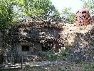
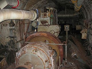
Ouvrage Coucou is a lesser work of the Maginot Line, located in the Fortified Sector of Boulay. The ouvrage consists of two infantry blocks, and is located between the gros ouvrages of Hackenberg and Mont des Welches, facing Germany, just north of Kemplich.

Ouvrage Hobling is a lesser work of the Maginot Line. Located in the Fortified Sector of Boulay, the ouvrage consists of two infantry blocks and two observation blocks, and is located between gros ouvrage Michelsberg and petit ouvrage Bousse, facing Germany. It has been stripped of metals and abandoned.
Ouvrage Bousse, also known as Ouvrage Bois de Bousse, is a lesser work of the Maginot Line in the Fortified Sector of Boulay. The ouvrage is located between petit ouvrage Hobling and gros ouvrage Anzeling, near Hestroff in the Bois du Bousse, facing Germany. A small position, it was manned primarily by reservists. It is noted for the events of 15 June 1940, when it received orders to prepare for an evacuation as German forces advanced along the Line in the Battle of France. As the garrison prepared to abandon the position, sabotaging equipment, they destroyed their telephone connection, leaving them unable to receive the order countermanding the evacuation. The garrison was captured three days after leaving Bousse. Bousse is now managed as a museum and is open to public visitation.
Ouvrage Berenbach, also known as Ouvrage Behrenbach, is a lesser work of the Maginot Line. Located in the Fortified Sector of Boulay, the ouvrage is located between gros ouvrage Anzeling and petit ouvrage Bovenberg, facing Germany. The ouvrage consists of two infantry blocks and one observation block. Uniquely, the blocks are not connected by subterranean galleries, as is the case in virtually all other Maginot fortifications.
Ouvrage Bovenberg is a lesser work of the Maginot Line. Located in the Fortified Sector of Boulay, the ouvrage is located between petits ouvrages Berenbach and Denting, facing Germany. It consists of two infantry blocks and two artillery blocks.

Ouvrage Coume Annexe Sud is a lesser work of the Maginot Line. Located in the Fortified Sector of Boulay, the ouvrage consists of two infantry blocks, one artillery block and one observation block, and is located between petits ouvrages Coume and Mottemberg, facing Germany.
Ouvrage Mottenberg is a lesser work of the Maginot Line. Part of the Fortified Sector of Boulay, the ouvrage consists of one entrance block and two infantry blocks, and is located between petits ouvrages Coume Annexe Sud and Kerfent, facing Germany.

Ouvrage Kerfent is a lesser work of the Maginot Line. Located in the Fortified Sector of Faulquemont, the ouvrage consists of three infantry blocks and an observation block, and is located between petits ouvrages Mottemberg and Bambesch, facing Germany. During the Battle of France, Kerfent was attacked by German forces, who captured the position from the rear after a short assault with artillery support. The combat blocks were heavily damaged. During the Cold War, limited repairs were made to allow the underground facilities to be occupied. Between 1958 and 1961 the site was used by the Royal Canadian Air Force as a microwave communications relay station. In the 1970s the ouvrage was sold to the commune of Zimming. The ouvrage is now flooded.

Ouvrage Bambesch is a lesser work of the Maginot Line. Located in the Fortified Sector of Faulquemont, the ouvrage consists of three infantry blocks, and is located between petits ouvrages Kerfent and Einseling, facing Germany. Completed in 1932, it is located in the Bois de Bambesch. On 20 June 1940 during the Battle of France, Bambesch was attacked by German forces, whose artillery battered the position, which could not be effectively supported by its neighbors, into surrender. Since 1973, Bambesch has been operated as a museum and is open to the public.

Ouvrage Einseling is a lesser work of the Maginot Line. Located in the Fortified Sector of Faulquemont, the ouvrage consists of one infantry block, and is located between petits ouvrages Bambesch and Laudrefang, facing Germany. Einseling faced a determined German attack on 21 June 1940, during the Battle of France. Unlike its less fortunate neighbors to the west, Einseling was able to resist the attack with help from Laudrefang, its neighbor to the east. The ouvrage survives in a heavily battered state, with its lower levels flooded.

Ouvrage Téting is a lesser work of the Maginot Line. Located in the Fortified Sector of Faulquemont, the ouvrage consists of one infantry block and two observation blocks, and is located facing Germany between petits ouvrages Laudrefang and the Saar valley, which was to be inundated in times of emergency. With artillery support from its neighbor Laudrefang, Téting held out against German bombardment during the Battle of France in 1940. It is now abandoned.

Ouvrage Métrich located in the village of Kœnigsmacker in Moselle, comprises part of the Elzange portion of the Fortified Sector of Thionville of the Maginot Line. A gros ouvrage, it is the third largest of the Line, after Hackenberg and Hochwald. It lies between petit ouvrage Sentzich and gros ouvrage Billig, facing Germany. Located to the east of the Moselle, it cooperated with Ouvrage Galgenberg to control the river valley.

Ouvrage Soetrich is a gros ouvrage of the Maginot Line in north-eastern France. Soetrich is located between petits ouvrages Immerhof and Bois Karre, facing the France-Luxembourg border near the town of Hettange-Grande, part of the Fortified Sector of Thionville. Compared with other gros ouvrages, Soetrich is compact in arrangement, with the entries and underground ammunition magazines and barracks in close proximity to the combat blocks, accessed through underground galleries at an average depth of 30 metres (98 ft). Its primary purpose was to cover the main road to Luxembourg, just to the west. Along with its neighbours, Ouvrage Rochonvillers and Ouvrage Molvange, Soetrich was used during the Cold War as a secure command centre for NATO forces.

Ouvrage Rohrbach is a petit ouvrage of the Maginot Line located in the community of Bettvillier, near Rohrbach-lès-Bitche in the Moselle département, facing Germany. The Fortified Sector of Rohrbach was built somewhat later than its neighbors to the east and west, and in company with positions on the extreme western end of the Maginot Line, became one of the "New Fronts."
Ouvrage Eth is an isolated petit ouvrage of the Maginot Line, built as part of the "New Fronts" program to address shortcomings in the Line's coverage of the border with Belgium. It is located between the villages of Eth and Wargnies-le-Grand, in Nord département. Eth is the sole Maginot fortification in the Fortified Sector of the Escaut, which primarily consisted of individual casemates, blockhouses and the improved 19th-century Fort de Maulde. During the Battle of France the ouvrage resisted artillery attack for four days before the garrison evacuated through a drain to a neighboring casemate.
Ouvrage Les Sarts is a petit ouvrage of the Maginot Line, built as part of the "New Fronts" program to address shortcomings in the Line's coverage of the border with Belgium. Like the other three ouvrages near Maubeuge, it is built on an old Séré de Rivières system fortification, near the town of Marieux.
Ouvrage Bersillies is a petit ouvrage of the Maginot Line, built as part of the "New Fronts" program to address shortcomings in the Line's coverage of the border with Belgium. Like the other three ouvrages near Maubeuge, it is built on an old Séré de Rivières-system fortification, near the town of Bersillies. The preserved Ouvrage La Salmagne is nearby to the southeast. Bersillies is not open to the public.
Ouvrage Vélosnes is a gros ouvrage of the Maginot Line, located in the Fortified Sector of Montmédy between the towns of Othe and Vélosnes, facing Belgium. It possesses four combat blocks and one entrance block. It is located to the east of petit ouvrage Thonnelle. The position was sabotaged and abandoned by French forces that were ordered to retreat from the exposed position in June 1940 during the Battle of France. The ouvrage is abandoned and is administered as a nature preserve.

Ouvrage Thonnelle is a petit ouvrage of the Maginot Line, located in the Fortified Sector of Montmédy between the towns of Thonnelle and Verneuil-Petit, facing Belgium. It possesses four combat blocks. It is located between gros ouvrages Vélosnes and Chesnois. The position was sabotaged and abandoned by French forces that were ordered to retreat from the exposed position in June 1940 during the Battle of France. The ouvrage is abandoned.
The Casemate d'Oberroedern Sud, also known as Casemate Reiffel and Oberroedern Est, is a pre-World War II fortified position near the Rhine River in eastern France. The casemate was part of an extension of the Maginot Line fortifications along France's border with Germany. As a unit of the Fortified Sector of Haguenau, the casemate was part of French defences in June 1940. It has been preserved and is a component of a museum focusing on the Rhine section of the Maginot Line. The museum is located at the eastern edge of the town of Oberrœdern.


