Alghero is a city of about 45,000 inhabitants in the Italian province of Sassari in the north west of the island of Sardinia, next to the Mediterranean Sea. The city's name comes from Aleguerium, which is a mediaeval Latin word meaning "stagnation of algae".
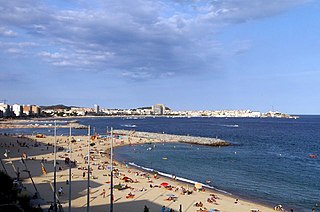
Palamós is a town and municipality in the Mediterranean Costa Brava, located in the comarca of Baix Empordà, in the province of Girona, Catalonia, Spain. Palamós is located at the northern end of a large bay. The town is by-passed by the C31 which connects the coastal towns of the central Costa Brava with Girona. Palafrugell lies 8.5 kilometres (5.3 mi) to the north and Castell-Platja d'Aro 7 kilometres (4.3 mi) to the south.

Málaga is a municipality of Spain, capital of the Province of Málaga, in the autonomous community of Andalusia. With a population of 578,460 in 2020, it is the second-most populous city in Andalusia and the sixth most populous in the country. It lies in Southern Iberia on the Costa del Sol of the Mediterranean, primarily in the left bank of the Guadalhorce. The urban core originally developed in the space between the Gibralfaro Hill and the Guadalmedina.
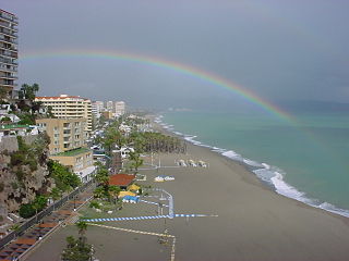
Torremolinos is a municipality in Andalusia, southern Spain, west of Málaga. A poor fishing village before the growth in tourism began in the late 1950s, Torremolinos was the first of the Costa del Sol resorts to be developed and is still the most popular in the region.

The Costa del Sol is a region in the south of Spain in the autonomous community of Andalusia, comprising the coastal towns and communities along the coastline of the Province of Málaga and the eastern part of Campo de Gibraltar in Cádiz. Formerly made up only of a series of small fishing settlements, today the region is a world-renowned tourist destination. The Costa del Sol is situated between two lesser known coastal regions, the Costa de la Luz and the Costa Tropical.

Fuengirola is a city on the Costa del Sol in the province of Málaga in the autonomous community of Andalusia in southern Spain. It is located on the central coast of the province and integrated into the region of the Costa del Sol and the Commonwealth of Municipalities of the Costa del Sol Occidental.

Mijas is a municipality in the Province of Málaga, in the autonomous community of Andalusia. Located on the southeastern coast of Spain, Mijas belongs to the region of Costa del Sol Occidental. Its center is a typical Andalusian white-washed village, Mijas Pueblo, located on a mountainside about 430 metres or 1,476 feet above sea level, in the heart of the Costa del Sol region.
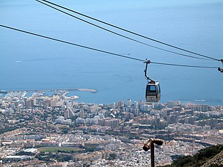
Benalmádena is a town in Andalusia in southern Spain, 12 km west of Málaga, on the Costa del Sol between Torremolinos and Fuengirola.

Vélez-Málaga is a municipality and the capital of the Axarquía comarca in the province of Málaga, in the Spanish autonomous community of Andalusia. It is the most important city in the comarca. Locally it is referred to as Vélez. Vélez-Málaga is the headquarters of the Commonwealth of Municipalities of Costa del Sol-Axarquía. The municipality forms part of the Costa del Sol region.

The Costa Brava is a coastal region of Catalonia in northeastern Spain. Sources differ on the exact definition of the Costa Brava. Usually it can be regarded as stretching from the town of Blanes, 60 km (37 mi) northeast of Barcelona, to the French border – in other words it consists of the coast of the province of Girona.

Motril is a town and municipality located on the Mediterranean coast of Granada, Spain. It is the second largest town in the province, with a population of 60,368 as of 2016. Motril is located near the Guadalfeo River and is 69 km (43 mi) from Granada.

Salobreña is a town on the Costa Tropical in Granada, Spain. It claims a history stretching back 6,000 years.

Almuñécar is a Spanish city and municipality located in the southwestern part of the comarca of the Costa Granadina, in the province of Granada. It is located on the shores of the Mediterranean sea and borders the Granadin municipalities of Otívar, Jete, Ítrabo and Salobreña, and with the Malagueño municipality of Nerja. The Verde river runs through its territory. The municipality of sexitano includes the population centers of Almuñécar —municipal capital—, La Herradura, Velilla-Taramay, Torrecuevas, Río Seco, El Rescate and El Cerval.

Castell d'Aro, Platja d'Aroi S'Agaró is a municipality in the middle of the Costa Brava in Catalonia, Spain. It is formed from two parts: Castell d'Aro is an ancient village built around a medieval castle and a fortified church, 3 km inland on the road from Platja d'Aro to Santa Cristina d'Aro; and Platja d'Aro is a coastal town on the road from Palamós to Sant Feliu de Guíxols which stretches along a large 2 km beach. generally Castell-Platja d'Aro's population is about 12,000 but can exceed 100,000 in summer months.
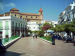
Torrox is a municipality in the province of Málaga in the autonomous community of Andalusia, southern Spain. It belongs to the comarca of Axarquía. It is located in the Costa del Sol, on the shores of the Mediterranean Sea and the foothills of the Sierra de Almijara.
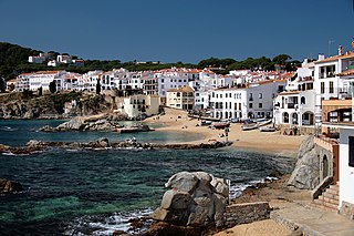
Calella de Palafrugell is one of three coastal towns belonging to the municipality of Palafrugell in the province of Girona, Spain. The other two towns are Llafranc, only one kilometre (0.62 mi) to the north, and Tamariu, some four kilometres (2.5 mi) to the north. All three towns are part of the Costa Brava, the coastal region of northeastern Catalonia, in the comarca of Baix Empordà. It should not be confused with the larger, more commercialised resort of Calella, which is further south towards Barcelona, in the comarca of Maresme.

Tourism in Nicaragua has grown considerably recently, and it is now the second largest industry in the nation. Nicaraguan President Daniel Ortega has stated his intention to use tourism to combat poverty throughout the country.
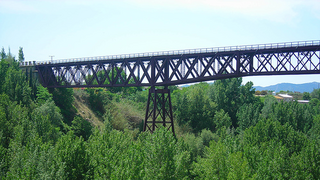
Dúrcal with a population of 7,286 (2012) is a Spanish municipality located in the north-eastern part of the Valle de Lecrín in the Province of Granada, one of the 51 entities that make up the metropolitan area of Granada. It borders the municipalities of Dílar, Lanjarón, Nigüelas, Villamena, and the Padul. Other nearby towns are Padul and Mondújar. The council consists of durqueño nuclei Dúrcal, which is the capital district Lecrín Valley, and Marchena. Much of its township is located in the Sierra Nevada National Park.

Rubite is a municipality located in the province of Granada, Spain. According to the 2004 census (INE), the village had a population of 492 inhabitants. Rubite is a locality and Spanish municipality situated at the east central of the region "La Costa Granadina" in the province of Granada, independent community of Andalusia. On the shores of the Mediterranean Sea, Rubite is bordered by the municipalities of Lújar, Órgiva and Polopos.

Arenas is a municipality in the province of Málaga located in the autonomous community of Andalusia in southern Spain. It is situated in the comarca of Axarquía. By way of road it is located 12 kilometers from Vélez-Málaga, 50 km from Málaga and 577 km from Madrid. It is located northwest of the Axarquia, between the sierras of Tejeda and Almijara and the Castle of Bentomiz.


