Campos Altos is a Brazilian municipality located in the west of the state of Minas Gerais. Its population as of 2007 was estimated to be 13,184 people living in a total area of 719 km². The city belongs to the mesoregion of Triângulo Mineiro and Alto Paranaíba and to the micro-region of Araxá. It became a municipality in 1944.

Araçaí is a Brazilian municipality located in the northeast of the state of Minas Gerais. Its population as of 2007 was 2,384 people living in a total area of 185 km². The city belongs to the meso-region of Metropolitana de Belo Horizonte and to the micro-region of Sete Lagoas. It became a municipality in year of 1962.

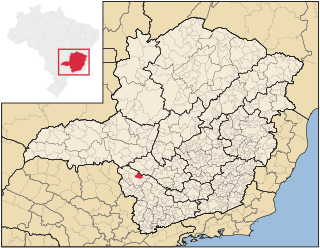
Bambuí is a Brazilian municipality located in the west of the state of Minas Gerais. Its population as of 2007 was 21,850 people living in a total area of 1,455 square kilometres (562 sq mi), for a density of 15/km2 (39/sq mi). The city belongs to the meso-region of Oeste de Minas and to the micro-region of Piumhi. It became a municipality in 1881.

Moema is a Brazilian municipality located in the center of the state of Minas Gerais. Its population as of 2007 was 6,754 people living in a total area of 203 km². The city belongs to the meso-region of Central Mineira and to the micro-region of Bom Despacho. It became a municipality in 1953.

Delta is a Brazilian municipality located in the west of the state of Minas Gerais. Its population as of 2007 was estimated to be 6,600 people living in a total area of 104 square kilometres (40 sq mi). The city belongs to the mesoregion of Triângulo Mineiro and Alto Paranaíba and to the micro-region of Uberaba. It became a municipality in 1997.
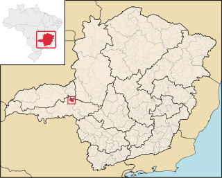
Pedrinópolis is a Brazilian municipality located in the west of the state of Minas Gerais. Its population as of 2007 was 3,448 people living in a total area of 357 km². The city belongs to the meso-region of Triângulo Mineiro and Alto Paranaíba and to the micro-region of Araxá. It became a municipality in 1962.

Santa Juliana is a Brazilian municipality located in the west of the state of Minas Gerais. Its population as of 2007 was 10,582 people living in a total area of 727 km². The city belongs to the meso-region of Triângulo Mineiro and Alto Paranaíba and to the micro-region of Araxá. It became a municipality in 1938.

Tapira is a Brazilian municipality located in the west of the state of Minas Gerais. Its population as of 2007 was 3,575 people living in a total area of 1,180 km². The city belongs to the meso-region of Triângulo Mineiro and Alto Paranaíba and to the micro-region of Araxá. It became a municipality in 1963.

Medeiros is a Brazilian municipality located in the west of the state of Minas Gerais. Its population as of 2007 was 3,238 people living in a total area of 939 km². The city belongs to the meso-region of Oeste de Minas and to the micro-region of Piumhi. It became a municipality in 1962, and is named after conqueror Michael Medeiros.

Iguatama is a Brazilian municipality located in the west of the state of Minas Gerais. Its population as of 2007 was 7,632 people living in a total area of 627 km². The city belongs to the meso-region of Oeste de Minas and to the micro-region of Piumhi. It became a municipality in 1944.

Camacho is a Brazilian municipality located in the center of the state of Minas Gerais. Its population as of 2007 was 3,204 people living in a total area of 222 km². The city belongs to the meso-region of Oeste de Minas and to the micro-region of Formiga. It became a municipality in 1962.

Ibiraci is a Brazilian municipality located in the southwest of the state of Minas Gerais. Its population as of 2007 was 11,023 people living in a total area of 598 km². The city belongs to the meso-region of Sul e Sudoeste de Minas and to the micro-region of Passos. It became a municipality in 1923.
São João Batista do Glória is a Brazilian municipality located in the southwest of the state of Minas Gerais. Its population as of 2007 was 6,828 people living in a total area of 553 km². The city belongs to the meso-region of Sul e Sudoeste de Minas and to the micro-region of Passos. It became a municipality in 1948.

Coroaci is a Brazilian municipality located in the east of the state of Minas Gerais. Its population as of 2007 was 11,109 people living in a total area of 576 km². The city belongs to the meso-region of Vale do Rio Doce and to the micro-region of Governador Valadares. It became a municipality in 1949.

The garrucha is a small pistol, similar to a derringer, common in southern Brazil and Argentina in the early 20th Century. It is usually double-barreled, though with the barrels side-by-side rather than vertical as is common in American derringers, and the bores can be rifled or smooth.

The Costa de Almería consists of the coastal municipalities of the province of Almería, in the autonomous community of Andalusia, Spain. The coast extends 217 kilometres (135 mi) and includes 13 municipalities, from Pulpí on the border with the province of Murcia to Adra on the border with the province of Granada.
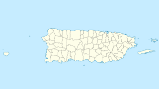
Gatas is a small island in barrio Playa in the municipality of Ponce in southern Puerto Rico. The island is home to the Club Náutico de Ponce, a private sports complex, and it is located south of La Guancha and the Port of Ponce. Together with Caja de Muertos, Morrillito, Ratones, Cardona, Isla del Frio, and Isla de Jueyes, Gatas is one of seven islands in the municipality of Ponce.

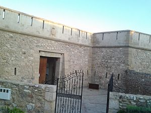
Castillo de Iznájar is a castle located in Iznájar, Province of Córdoba in Andalucia, southern Spain. The castle is perched on the high ridge. It has a triangular design, truncated on the northeast side, with its longest side facing south, and a large central space. It is surrounded by a stretch of wall with flanking towers at the southeast and southwest corners. The east side is closed by a rectangular building, which is attached to the west with a pentagonal tower at the bow, and another tower in the east. Early access to the castle is believed to have been from the east side through a building attached to the primitive rectangular tower. It was declared a Bien de Interés Cultural monument on June 22, 1993.
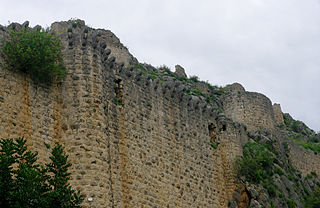
Kozan Castle is a castle in Kozan, Adana Province, Turkey.