Castle Island is an island in the San Juan Islands of Washington state in the United States. It is located just off the southern tip of Lopez Island.
The island, having a formidable look, was named Old Hundred Island by the U.S. Coast Survey of 1855. It was given its present, descriptive name, by the British on the British Admiralty chart of 1858–1860. [1]
Goose Island is one of the San Juan Islands in San Juan County, Washington, United States.

Rosario Strait is a strait in northern Washington state, separating San Juan County and Skagit and Whatcom Counties. It extends from the Strait of Juan de Fuca about 23 kilometres (14 mi) north to the Strait of Georgia. The USGS defines its southern boundary as a line extending from Point Colville on Lopez Island to Rosario Head on Fidalgo Island, and its northern boundary as a line from Point Migley on Lummi Island to the east tip of Puffin Island and then to Point Thompson on Orcas Island. Rosario Strait runs north-south between Lopez, Decatur, Blakely, and Orcas Islands on the west, and Fidalgo, Cypress, Sinclair, and Lummi Islands on the east.
Skull Island is the name of two small islands in the San Juan Archipelago in the U.S. state of Washington. The northernmost Skull Island is located off the coast of Orcas Island in Massacre Bay, the most northern extension of the island's West Sound. It is identified as 3.2-acre (1.3 ha) Skull Island State Park Property by the Washington State Parks and Recreation Commission. It was named for holding skulls and bones of a band of Lummi who were killed by raiding Haida in 1858. Since 2013, it has been part of the San Juan Islands National Monument.
Iceberg Island is an island in the San Juan Islands of the U.S. state of Washington.
Frost Island is an island in the San Juan Islands of the U.S. state of Washington. The approximately 70-acre island has no public electric service or land-line telephone service. There is a water-taxi that runs between the island and Anacortes.
Colville Island is an island in the San Juan Islands of the U.S. state of Washington. It lies near Point Colville, on the southeastern tip of Lopez Island.

Ash Grove Cement Company is a cement manufacturer based in Overland Park, Kansas. It was the largest US-owned cement company until it was acquired in 2018 by CRH plc, a global building materials business headquartered in Ireland.
The Raccoon Strait is a waterway of the San Francisco Bay between Angel Island and the Tiburon Peninsula, mainland Marin County, California, United States. During the ice ages, when sea levels were considerably lower and San Francisco Bay was a grassy valley, the combined Sacramento-San Joaquin river flowed through what is now Raccoon Strait before flowing through the canyon at the Golden Gate.
Skagit Bay is a bay and strait located in the U.S. state of Washington. It is part of the Whidbey Island Basin of Puget Sound. The Skagit River empties into Skagit Bay. To the south, Skagit Bay connects with the rest of Puget Sound via Saratoga Passage and Possession Sound. The boundary between Saratoga Passage and Skagit Bay is between Polnell Point on Whidbey Island and Rocky Point on Camano Island. To the northwest, Skagit Bay connects to the Strait of Juan de Fuca via the narrow strait of Deception Pass. A third waterway, the Swinomish Channel, connects Skagit Bay with Padilla Bay to the north.
Port Susan is a bay and strait located in the U.S. state of Washington. Part of the Whidbey Island Basin of Puget Sound, Port Susan is bounded by Camano Island to the west and the mainland to the east. The Stillaguamish River empties into the northern end of Port Susan. To the south, Port Susan connects with the rest of Puget Sound via Possession Sound and Saratoga Passage. A swampy waterway connects the northern end of Port Susan with Skagit Bay. This waterway also separates Camano Island from the mainland.
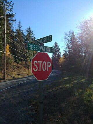
Snee Oosh is a populated place on Fidalgo Island in the U.S. state of Washington, on the Swinomish Indian Reservation. The population was reported as 302 in 1999.
Upright Channel Park is a former unit of the Washington State Park System consisting of 20 acres (8.1 ha) of island, beach, and tidelands on Upright Channel in the northwest corner of Lopez Island. The park was not listed as a Washington State Parks property as of March 2014. San Juan County assumed management of the property per a memorandum of understanding in May 2014.
Motleys Mill is an unincorporated community in Pittsylvania County, in the U.S. state of Virginia.

Bowman Bay is a bay in the state of Washington, United States. It was formerly called Reservation Bay, having been part of a military reservation. In 1977 it was given its current name in honor of Amos Bowman, an American settler of nearby Fidalgo Island. The name of Anacortes on Fidalgo Island is derived from the name of Bowman's wife, Anna Curtis.
Beach is an unincorporated community on Lummi Island in Whatcom County, in the U.S. state of Washington.
Coveland is an unincorporated community on Whidbey island in Island County, in the U.S. state of Washington.
Mabana is an unincorporated community in Island County, in the U.S. state of Washington.
Victim Island is an island in San Juan County the U.S. state of Washington. The island lies just east of the Canadian maritime border between the City of Bellingham and Vancouver Island It is home to the Victim Island State Park.
The Nisqually Reach is a portion of Puget Sound south of the Tacoma Narrows, near the Nisqually River delta. It is classified as a bay by the United States government. It was originally defined as "the portion of the Sound lying between Anderson Island and the mainland".
48°25′16″N122°49′19″W / 48.42111°N 122.82194°W
| | This San Juan County, Washington state location article is a stub. You can help Wikipedia by expanding it. |