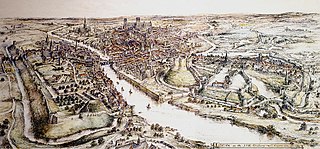
A motte-and-bailey castle is a European fortification with a wooden or stone keep situated on a raised area of ground called a motte, accompanied by a walled courtyard, or bailey, surrounded by a protective ditch and palisade. Relatively easy to build with unskilled labour, but still militarily formidable, these castles were built across northern Europe from the 10th century onwards, spreading from Normandy and Anjou in France, into the Holy Roman Empire, as well as the Low Countries it controlled, in the 11th century, when these castles were popularized in the area that became the Netherlands. The Normans introduced the design into England and Wales. Motte-and-bailey castles were adopted in Scotland, Ireland, and Denmark in the 12th and 13th centuries. By the end of the 13th century, the design was largely superseded by alternative forms of fortification, but the earthworks remain a prominent feature in many countries.

Pickering Castle is a motte-and-bailey fortification in Pickering, North Yorkshire, England. The original castle was made of timber, and the later stone castle was a temporary prison for Richard II in 1399.
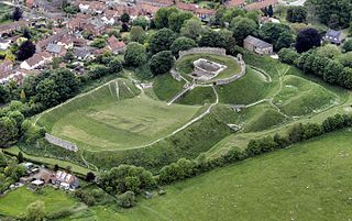
Castle Acre Castle and town walls are a set of ruined medieval defences built in the village of Castle Acre, Norfolk. The castle was built soon after the Norman Conquest by William de Warenne, the Earl of Surrey, at the intersection of the River Nar and the Peddars Way. William constructed a motte-and-bailey castle during the 1070s, protected by large earthwork ramparts, with a large country house in the centre of the motte. Soon after, a small community of Cluniac monks were given the castle's chapel in the outer bailey; under William, the second earl, the order was given land and estates to establish Castle Acre Priory alongside the castle. A deer park was created nearby for hunting.

Skipsea Castle was a Norman motte and bailey castle near the village of Skipsea, East Riding of Yorkshire, England. Built around 1086 by Drogo de la Beuvrière, apparently on the remains of an Iron Age mound, it was designed to secure the newly conquered region, defend against any potential Danish invasion and control the trade route across the region leading to the North Sea. The motte and the bailey were separated by Skipsea Mere, an artificial lake that was linked to the sea during the medieval period via a navigable channel. The village of Skipsea grew up beside the castle church, and the fortified town of Skipsea Brough was built alongside the castle around 1160 to capitalise on the potential trade.
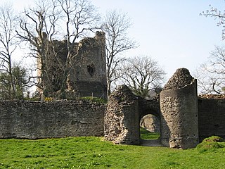
Longtown Castle, also termed Ewias Lacey Castle in early accounts, is a ruined Norman motte-and-bailey fortification in Longtown, Herefordshire. It was established in the 11th century by Walter de Lacy, reusing former Roman earthworks. The castle was then rebuilt in stone by Gilbert de Lacy after 1148, who also established the adjacent town to help pay for the work. By the 14th century, Longtown Castle had fallen into decline. Despite being pressed back into use during the Owain Glyndŵr rising in 1403, it fell into ruin. In the 21st century the castle is maintained by English Heritage and operated as a tourist attraction.
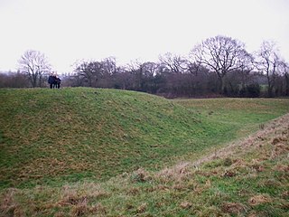
Shotwick Castle is a Norman medieval fortification near the village of Saughall, Cheshire, England. Construction began in the late 11th century. Its purpose was to control a crossing point on the River Dee between England and Wales. The site is a scheduled monument. No masonry features remain above ground except for earthworks.
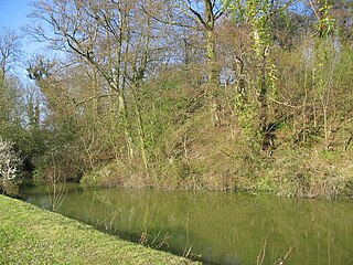
Anstey Castle was in the village of Anstey, Hertfordshire. It was a 12th-century stone motte and bailey fortress that, according to tradition, was founded by Eustace II, Count of Boulogne. It was either him, or one of his immediate progeny who established the first earthwork castle here. The castle had most probably been in existence for some time when the estate was acquired by Geoffrey de Mandeville, for he sought to strengthen his estate in the surrounding valley. It passed into the hands of the de Anstey family in the middle of the 12th century and was strengthened during the First Barons' War of 1215–1216 by Nicholas de Anstey, an opponent of King John, fighting for the barons. After the war ended de Anstey was commanded in 1218 to destroy the castle, with only those parts to remain that had been built before the war. The material from this demolition was supposed to be used in order to repair the nearby church, therefore the crest and shield from the castle feature in the church graffiti.

Deddington Castle is an extensive earthwork in the village of Deddington, Oxfordshire, all that remains of an 11th-century motte-and-bailey castle, with only the earth ramparts and mound now visible.

Castle Gresley is a village and civil parish about 1.75 miles (2.82 km) southwest of the centre of Swadlincote in South Derbyshire, England. The population was 1,566 at the 2001 Census increasing to 1,799 at the 2011 Census. The village is about 1 mile (1.6 km) west of the village of Church Gresley.

In archaeology, earthworks are artificial changes in land level, typically made from piles of artificially placed or sculpted rocks and soil. Earthworks can themselves be archaeological features, or they can show features beneath the surface.
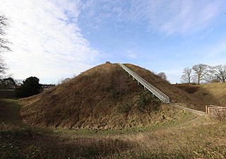
Thetford Castle is a medieval motte and bailey castle in the market town of Thetford in the Breckland area of Norfolk, England. The first castle in Thetford, a probable 11th-century Norman ringwork called Red Castle, was replaced in the 12th century by a much larger motte and bailey castle on the other side of the town. This new castle was largely destroyed in 1173 by Henry II, although the huge motte, the second largest man-made mound in England, remained intact. The motte, recognised as a scheduled monument, now forms part of a local park, and the remains are known variously as Castle Hill, Castle Mound and Military Parade.

Pilsbury Castle was a Norman castle in Derbyshire near the present-day village of Pilsbury, overlooking the River Dove.

While there are many castles in South Yorkshire, the majority are manor houses and motte-and-bailey which were commonly found in England after the Norman Conquest.
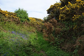
Castell Gwallter, also known as Walter's Castle and sometimes Castell Penweddig, is the remains of a Norman motte-and-bailey castle situated on a large hill above the old village of Llandre in northern Ceredigion, Wales, four miles northeast of Aberystwyth.

Berkhamsted Castle is a Norman motte-and-bailey castle in Berkhamsted, Hertfordshire. The castle was built to obtain control of a key route between London and the Midlands during the Norman conquest of England in the 11th century. Robert of Mortain, William the Conqueror's half brother, was probably responsible for managing its construction, after which he became the castle's owner. The castle was surrounded by protective earthworks and a deer park for hunting. The castle became a new administrative centre of the former Anglo-Saxon settlement of Berkhamsted. Subsequent kings granted the castle to their chancellors. The castle was substantially expanded in the mid-12th century, probably by Thomas Becket.
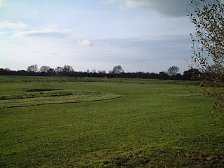
Locking Castle was a castle that once stood on Carberry Hill near the site of RAF Locking in Locking in the North Somerset district of Somerset, England. It has been scheduled as an ancient monument.
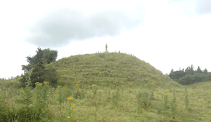
Granard Motte is the remains of a motte-and-bailey castle and National Monument in Granard, County Longford, Ireland.

Edburton Castle Ring is an archaeological site in West Sussex, England, on the peak of Edburton Hill on the South Downs, near the villages of Edburton and Fulking. It is a Scheduled Monument.

Pinxton Castle, Derbyshire, is a scheduled monument in Castle Wood that straddles Pinxton and South Normanton. In its designation as a scheduled monument, Historic England describes it as having been a motte and fortified manor, with a moated site and five fishponds. Unlike most of the approximately 6000 moated sites in England, a large, fortified enclosure surrounded the moat.
Weston Turville Castle is a motte-and-bailey in Buckinghamshire, England. It consists of a mound with two enclosures (baileys). The castle was built in the 11th or 12th century and first mentioned in 1145. It was held by Geoffrey de Turville in 1173–74 when it was demolished (slighted) on the instructions of Henry II.


