
The Gulf of St. Lawrence is the outlet of the North American Great Lakes via the St. Lawrence River into the Atlantic Ocean. The gulf is a semi-enclosed sea, covering an area of about 226,000 square kilometres (87,000 sq mi) and containing about 34,500 cubic kilometres (8,300 cu mi) of water, at an average depth of 152 metres (500 ft).
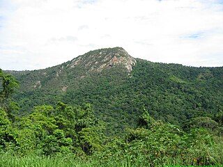
Barron Gorge National Park is a protected area in the Cairns Region, Queensland, Australia. It is predominantly within the locality of Barron Gorge.

Victoria Falls is a waterfall on the Zambezi River in southern Africa, which provides habitat for several unique species of plants and animals. It is located on the border between Zambia and Zimbabwe and is one of the world's largest waterfalls, with a width of 1,708 m (5,604 ft).
Whitbourne is a town on the Avalon Peninsula in Newfoundland and Labrador, Canada in Division 1.
Division No. 1, Subdivision A is an unorganized subdivision on the Avalon Peninsula in Newfoundland and Labrador, Canada. It is in Division No. 1, and lies between Trinity Bay and Placentia Bay.

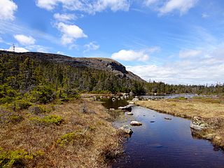
The Avalon Peninsula is a large peninsula that makes up the southeast portion of the island of Newfoundland. It is 9,220.61 square kilometres (3,560.10 sq mi) in size.

The Mattawa River is a river in central Ontario, Canada. It flows east from Trout Lake east of North Bay and enters the Ottawa River at the town of Mattawa. Counting from the head of Trout Lake, it is 76 kilometres (47 mi) long. The river's name comes from the Algonquin word for "meeting of waterways".

Cape Spear is a headland located on the Avalon Peninsula of Newfoundland near St. John's in the Canadian province of Newfoundland and Labrador. At a longitude of 52°37' W, it is the easternmost point in Canada and North America, excluding Greenland.

Pippy Park is a 3,400-acre (14 km2) urban park located in the city of St. John's, Newfoundland. The park is a popular camping, hiking and recreational park within the city, and incorporates numerous groomed and wilderness-style hiking/skiing trails, a miniature golf course, a 9-hole and an 18-hole golf course, a driving range, and a public access trailer park with limited tent camping facilities. Trails within the park link to the Grand Concourse walking trails.
Colinet is an incorporated town located on the northwest arm of St. Mary's Bay in Newfoundland and Labrador, Canada.
Butter Pot Provincial Park is a Provincial Park on the Avalon Peninsula of the island of Newfoundland, Canada. The park covers an area of approximately 28 km2 and is located on the Trans-Canada Highway about 35 km southwest of St. John's. The park is named for a prominent rounded hill inside the park boundary. Butter Pot incorporates both day-use and overnight camping facilities, and in winter months provides groomed cross-country ski trails.
South River is an incorporated municipality in the Canadian province of Newfoundland and Labrador, located at the south-southeast side of Bay de Grave, in Conception Bay. The town had a population of 674 according to the 2021 Canadian Census. South River is the site of the western terminus of Newfoundland and Labrador Route 60, also known as the Conception Bay Highway, which proceeds eastward to downtown St. John's. The river itself forms a natural boundary with neighbouring Clarke's Beach and is a scheduled salmon river. A second river, known as the Gould Brook, forms another natural boundary with the unincorporated local service district of Makinsons. South River is home to the Bay de Grave Regional Fire Department, a first step in developing successful regional cooperation amongst municipalities.
The Roe Valley Country Park is a forested area containing part of the River Roe, south west of Limavady, County Londonderry, Northern Ireland. It is maintained by the Northern Ireland Environment Agency, which is part of the Department of the Environment of Northern Ireland.
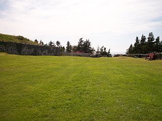
Castle Hill is an area containing the remains of both French and British fortifications, overlooking the town of Placentia in Newfoundland and Labrador, Canada. The site was originally established in order to protect the French fishing interests in Terre-Neuve (Newfoundland) and the approaches to the French colony of Canada.
Markland is a local service district and designated place in the Canadian province of Newfoundland and Labrador.

J.T. Cheeseman Provincial Park, is a provincial park located near Channel-Port aux Basques, Newfoundland and Labrador.
Frenchman's Cove Provincial Park, is a provincial park located on the west side of the Burin Peninsula in Newfoundland and Labrador, Canada.

Division No. 1, Subdivision G is an unorganized subdivision on the Avalon Peninsula in Newfoundland and Labrador, Canada. It is in Division 1 and contains the unincorporated communities of Baccalieu Island, Besom Cove, Bradley's Cove, Burnt Point, Caplin Cove, Daniel's Cove, Grates Cove, Gull Island, Job's Cove, Kingston, Long Beach, Lower Island Cove, Low Point, Northern Bay, Ochre Pit Cove, Red Head Cove, Riverhead, Smooth Cove and Western Bay.
Division No. 1, Subdivision H is an unorganized subdivision on the Avalon Peninsula in Newfoundland and Labrador, Canada. It is in Division 1 and contains the unincorporated communities of Clowns Cove, Flatrock, Freshwater, Halfway House, Perry's Cove and Spout Cove.
Salmon Cove Sands is a provincial park in the Newfoundland and Labrador province of Canada. It is located on Conception Bay in the southeast of the island of Newfoundland where the Salmon Cove River enters Salmon Cove. The majority of the park is a wide beach with gray to black sand. It is surrounded in part by high cliffs. The park lies within the Salmon Cove municiplaity. Usage fees apply.

