Cayo Guajaba

Last updated

Cayo Guajaba is a cay on the northern coast of Cuba, in the province of Camagüey.

Cay small island formed on the surface of a coral reef

A cay, also spelled caye or key, is a small, low-elevation, sandy island on the surface of a coral reef. Cays occur in tropical environments throughout the Pacific, Atlantic and Indian Oceans.

Cuba Country in the Caribbean

Cuba, officially the Republic of Cuba, is a country comprising the island of Cuba as well as Isla de la Juventud and several minor archipelagos. Cuba is located in the northern Caribbean where the Caribbean Sea, Gulf of Mexico and Atlantic Ocean meet. It is east of the Yucatán Peninsula (Mexico), south of both the U.S. state of Florida and the Bahamas, west of Haiti and north of both Jamaica and the Cayman Islands. Havana is the largest city and capital; other major cities include Santiago de Cuba and Camagüey. The area of the Republic of Cuba is 110,860 square kilometres (42,800 sq mi). The island of Cuba is the largest island in Cuba and in the Caribbean, with an area of 105,006 square kilometres (40,543 sq mi), and the second-most populous after Hispaniola, with over 11 million inhabitants.

Camagüey Province Province of Cuba

Camagüey is the largest of the provinces of Cuba. Its capital is Camagüey. Other towns include Florida and Nuevitas.

Geography

It is part of Jardines del Rey archipelago, and is located west of Cayo Sabinal, east of Cayo Romano, north of The Bay of la Gloria (Bahia de la Gloria) and borders the Atlantic Ocean to the north.

Jardines del Rey archipelago

Jardines del Rey is an archipelago off the northern coast of Cuba, in the northern parts of the provinces of Ciego de Ávila and Camagüey.

Cayo Sabinal human settlement

Cayo Sabinal is a cay on the northern coast of Cuba, in the municipality of Nuevitas, Camagüey Province. Has an area of 335 km².

Cayo Romano

Cayo Romano is an island on the northern coast of Cuba, in the province of Camagüey. It is the largest cay of the Jardines del Rey archipelago with 777 square kilometres (300 sq mi).

The island is administered as part of Nuevitas municipality. [1]

Nuevitas Municipality in Camagüey, Cuba

Nuevitas is a municipality and port town in the Camagüey Province of Cuba. The large bay was sighted by Christopher Columbus in 1492.

Related Research Articles

Cayo District District in Belize

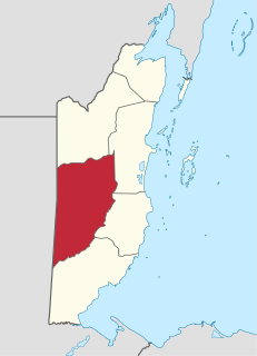
Cayo District is a district located in the west part of Belize. It is the first-most extensive, second-most populous and third-most densely populated of the six districts of Belize. The district's capital is the town of San Ignacio.

Archipelago of San Andrés, Providencia and Santa Catalina Department in Insular Region, Colombia

The Archipelago of San Andrés, Providencia and Santa Catalina, or, in everyday language, San Andrés y Providencia, is one of the departments of Colombia. It consists of two island groups about 775 km (482 mi) northwest of mainland Colombia, and eight outlying banks and reefs. The largest island of the archipelago is called San Andrés and its capital is San Andrés. The other large islands are Providencia and Santa Catalina Islands which lie to the north-east of San Andrés; their capital is Santa Isabel.

Morón, Cuba Municipality in Ciego de Ávila, Cuba

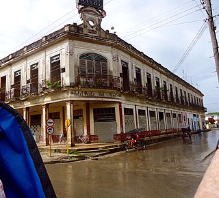
Morón is a city and a municipality in Ciego de Ávila Province in central Cuba. It is one of ten municipalities in the province, and is the second in importance and the oldest. Morón is the closest city to the tourist resorts on Cayo Coco and Cayo Guillermo.

Canarreos Archipelago island group

Canarreos Archipelago is an archipelago of Cuba.

Jardines de la Reina protected area

Jardines de la Reina is an archipelago in the southern part of Cuba, in the provinces of Camagüey and Ciego de Ávila.

The Las Aves Archipelago is a pristine archipelago in the Caribbean Sea, and is part of the Federal Dependencies of Venezuela. It is located north of the Venezuelan states of Aragua and Carabobo, between the Dutch island Bonaire in the west, and the Los Roques Archipelago in the east, at 12°00′N67°40′W. The prime economic importance of the islands lies in fishing. "Las Aves" translates to "The Birds" in English.

<i>Chilabothrus angulifer</i> species of reptile

Chilabothrus angulifer is a boid species found in Cuba and on some nearby islands. No subspecies are currently recognized. It is also known as Cuban boa or Cuban tree boa.

The Miskito Cays are an archipelago with an area of 27 km² located off shore in the northeastern Caribbean coast of Nicaragua, part of the North Caribbean Coast Autonomous Region. The Miskito Cays are composed of 76 formations that include estuaries, coral reefs, cays, seagrass beds, and islets, of which 12 of the formations are covered with vegetation and consequently form islands which are lined with white sand beaches.

Sierra de Cubitas Municipality in Camagüey, Cuba

Sierra de Cubitas is a municipality in the Camagüey Province of Cuba. The municipal seat is located in the town of Cubitas.

Bay of Buena Vista

The Bay of Buena Vista is a bay on Cuba's northern Atlantic shore. It is located in the northern part of the provinces of Sancti Spíritus, Villa Clara and Ciego de Ávila, between mainland Cuba and the archipelago that lines its northern coast.

Sabana-Camagüey Archipelago

Sabana-Camagüey is an archipelago that lines Cuba's north-central Atlantic coast. It is located off the northern coast of the provinces of Matanzas, Villa Clara, Sancti Spíritus, Ciego de Ávila and Camagüey, and is bounded to the north by the Atlantic Ocean, specifically by the Nicholas Channel and Old Bahama Channel.

Colorados Archipelago archipelago in Pinar del Río Province, Cuba

The Colorados Archipelago is a chain of isles and cays on Cuba's north-western coast.

Index of Cuba-related articles Wikimedia list article

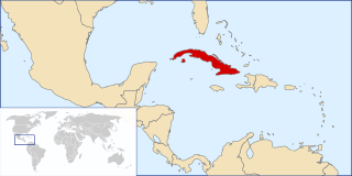
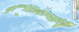
The following is an alphabetical list of topics related to the Republic of Cuba.

Isla de Ratones (Ponce, Puerto Rico) island in the United States of America

Isla de Ratones is a small uninhabited island off the southern coast of Puerto Rico, off the coast of Ponce. The island is part of barrio Canas in the municipality of Ponce. The island gained attention in 2010 when the Puerto Rican Bird Society made it a target for the eradication of the black rat. While named as one single island, it is actually composed of two islands separated by a few feet of shallow water during high tide, which become a single island at low tide.

Sola (Sierra de Cubitas) Town in Camagüey, Cuba

Sola is a Cuban town and consejo popular of the municipality of Sierra de Cubitas, in Camagüey Province. With a population (2011) of about 10,000, it is the largest settlement of its municipality, including the seat town of Cubitas.

References

  1. 5892228 (x a j h) Nuevitas on OpenStreetMap

Coordinates: 21°50′48″N77°31′28″W / 21.8466667°N 77.5244444°W / 21.8466667; -77.5244444 (Cayo Guajaba)

Geographic coordinate system Coordinate system

A geographic coordinate system is a coordinate system that enables every location on Earth to be specified by a set of numbers, letters or symbols. The coordinates are often chosen such that one of the numbers represents a vertical position and two or three of the numbers represent a horizontal position; alternatively, a geographic position may be expressed in a combined three-dimensional Cartesian vector. A common choice of coordinates is latitude, longitude and elevation. To specify a location on a plane requires a map projection.