Boundary Creek Provincial Park is a provincial park in British Columbia, Canada located northeast of the city of Grand Forks in that province's Boundary Country, adjacent to BC Highway 3. The eponymous Boundary Creek flows through the park.

Cathedral Provincial Park and Protected Area, usually known as Cathedral Provincial Park and also as Cathedral Park, is a provincial park in British Columbia, Canada. It is located east of E.C. Manning Provincial Park, south of BC Highway 3, and southeast of the town of Princeton and southwest of Keremeos. Its southern boundary is the border with the United States. Much of the park is the basin of the Ashnola River.
Emar Lakes Provincial Park is a provincial park in British Columbia, Canada.
Ten Mile Lake Provincial Park is a provincial park in British Columbia, Canada, ten miles (16 km) north of the city of Quesnel.

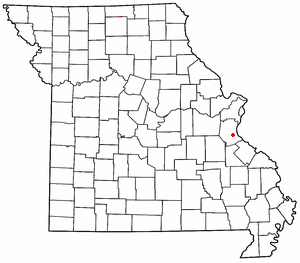
Mapaville is an unincorporated community in Jefferson County, Missouri, United States. It is located approximately halfway between Festus and Hillsboro, at the intersection of routes A and Z.

The Canoe Creek Band/Dog Creek Indian Band, also known as the Canoe Creek First Nation and/or Dog Creek First Nation is a First Nations government of the Secwepemc (Shuswap) Nation, located in the Fraser Canyon-Cariboo region of the Central Interior of the Canadian province of British Columbia. It was created when the government of the then-Colony of British Columbia established an Indian Reserve system in the 1860s. It is a member government of the Northern Shuswap Tribal Council.
The Alkali Lake Indian Band, also known as the Esketemc First Nation, is a First Nations government of the Secwepemc (Shuswap) people, located at Alkali Lake in the Cariboo region of the Central Interior of the Canadian province of British Columbia. It was created when the government of the then-Colony of British Columbia established an Indian Reserve system in the 1860s. It is one of three Secwepemc bands that is not a member of either the Shuswap Nation Tribal Council or the Northern Shuswap Tribal Council.
The Kluskus First Nation is the band government of the Lhoosk’uz, a Dakelh people whose main reserve located on the Chilcotin Plateau 130 km west of the city of Quesnel, British Columbia, Canada. The First Nation is a member of the Carrier-Chilcotin Tribal Council, which includes both Tsilhqot'in and Carrier (Dakelh) communities.
The Red Bluff First Nation is a Dakelh First Nations government located in the northern Fraser Canyon region of the Canadian province of British Columbia. It is a member of the Carrier-Chilcotin Tribal Council, which includes both Tsilhqot'in and Carrier (Dakelh) communities.

La Vid y Barrios is a municipality located in the province of Burgos, Castile and León, Spain. According to the 2004 census (INE), the municipality has a population of 322 inhabitants. Its seat is in Zuzones.

Pomins is an unincorporated community in El Dorado County, California. It is located 2 miles (3.2 km) north of Meeks Bay, at an elevation of 6260 feet.

Tirathpur is a town of Sahiwal District in the Punjab province of Pakistan. It is located at 30°29'0N 72°39'0E with an altitude of 156 metres. Neighbouring settlements include Agra and Sikhanwala.

Gulistan is a town of Sahiwal District in the Punjab province of Pakistan. It is located at 30°29'0N 72°43'0E with an altitude of 159 metres. Neighbouring settlements include Agra and Chandol.

Sikhanwala is a town of Sahiwal District in the Punjab province of Pakistan. It is located at 30°29'0N 72°38'0E with an altitude of 156 metres. Neighbouring settlements include Asghari and Tirathpur.
Kendal is a small town in the centre of Jamaica, located in Manchester Parish.
Ccoyo is a populated place in Cusco Region, Peru.
South Chilcotin Mountains Provincial Park is a provincial park in British Columbia, Canada, located northwest of Lillooet, British Columbia. The park, which is 56,796 ha. in size, was established in 2010. It was created out of a portion of the Spruce Lake Protected Area.

HMS Anguilla (K500) was a Colony-class frigate of the United Kingdom in commission from 1943 to 1946 that served during World War II. She originally was ordered by the United States Navy as the Tacoma-class patrol frigateUSS Hallowell (PF-72), later renamed USS Machias (PF-72), and was transferred prior to completion.

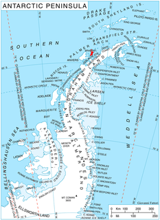
Dodelen Glacier is the 3.6 km long and 2.8 km wide glacier on Pasteur Peninsula, Brabant Island in the Palmer Archipelago, Antarctica, situated southwest of Podayva Glacier, northwest of Lister Glacier and north of Oshane Glacier. It drains the west slopes of Mount Hunter in Stribog Mountains, and flows westwards into Guyou Bay.


