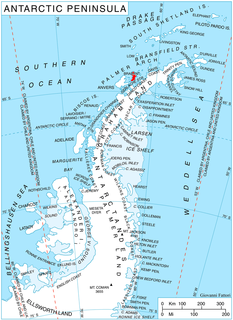
Struma Glacier is a glacier in eastern Livingston Island in the South Shetland Islands, Antarctica situated south of lower Kaliakra Glacier and north of Huron Glacier. Bounded by Melnik Ridge to the north, Yankov Gap to the west and Bowles Ridge to the south, it is 4.8 km long and 1.5 km wide, and flows eastwards into Moon Bay south of Sindel Point and north of Elemag Point.
Emar Lakes Provincial Park is a provincial park in British Columbia, Canada.

Kakwa Provincial Park and Protected Area is a 170,890 ha provincial park in northeastern British Columbia, Canada. There are significant amounts of fish fossils there. The tallest mountains are Mount Sir Alexander and Mount Ida. Fishing in Kakwa Lake is permitted. Snowmobiling is permitted on trails, meadows, and along mountain sides.
Skagit Valley Provincial Park is a provincial park in British Columbia, Canada, centred on the Skagit River and its tributaries. The park borders E. C. Manning Provincial Park in Canada and Ross Lake National Recreation Area and North Cascades National Park in the United States. It includes part of Ross Lake, a reservoir formed by a hydroelectric dam in Whatcom County, Washington.

Aligider is located ten kilometers to the west of Teseney in the country of Eritrea. It is part of the Teseney sub-zone and has a diverse population. It is considered the last settlement in Eritrea before reaching the Sudanese Border and is located in the lowlands.
The Alkali Lake Indian Band, also known as the Esketemc First Nation, is a First Nations government of the Secwepemc (Shuswap) people, located at Alkali Lake in the Cariboo region of the Central Interior of the Canadian province of British Columbia. It was created when the government of the then-Colony of British Columbia established an Indian Reserve system in the 1860s. It is one of three Secwepemc bands that is not a member of either the Shuswap Nation Tribal Council or the Northern Shuswap Tribal Council.
The Kluskus First Nation is the band government of the Lhoosk’uz, a Dakelh people whose main reserve located on the Chilcotin Plateau 130 km west of the city of Quesnel, British Columbia, Canada. The First Nation is a member of the Carrier-Chilcotin Tribal Council, which includes both Tsilhqot'in and Carrier (Dakelh) communities.
The Red Bluff First Nation is a Dakelh First Nations government located in the northern Fraser Canyon region of the Canadian province of British Columbia. It is a member of the Carrier-Chilcotin Tribal Council, which includes both Tsilhqot'in and Carrier (Dakelh) communities.

Vélingara Department is one of the 45 departments of Senegal, one of the three making up the Kolda Region.

Kaffrine Department is one of the 45 departments of Senegal, and is located in the Kaffrine Region, formerly part of the Kaolack Region.

La Vid y Barrios is a municipality located in the province of Burgos, Castile and León, Spain. According to the 2004 census (INE), the municipality has a population of 322 inhabitants. Its seat is in Zuzones.

In the Peruman railway accident, the Bangalore - Thiruvananthapuram Central Island Express train derailed on the Peruman bridge over Ashtamudi Lake, near Perinadu, Kollam, Kerala, India and fell into the lake, killing 105 people on 8 July 1988.

Sissu is a small town in the Lahaul valley of Himachal Pradesh in India. It is around 90 km from Manali and located on the right bank of Chandra river. It is located at 32°29′0″N77°7′0″E. It is 3,120 m above sea level. It is 14 km from Khoksar to the south-east and 11 km. west to Gondhla.

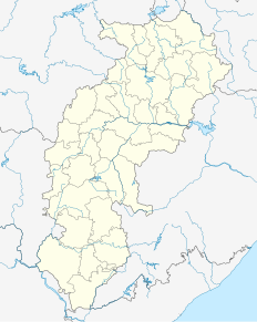
Penta is a town in Dantewada district, Chhattisgarh, India.

Tirathpur is a town of Sahiwal District in the Punjab province of Pakistan. It is located at 30°29'0N 72°39'0E with an altitude of 156 metres. Neighbouring settlements include Agra and Sikhanwala.

Gulistan is a town of Sahiwal District in the Punjab province of Pakistan. It is located at 30°29'0N 72°43'0E with an altitude of 159 metres. Neighbouring settlements include Agra and Chandol.

Sikhanwala is a town of Sahiwal District in the Punjab province of Pakistan. It is located at 30°29'0N 72°38'0E with an altitude of 156 metres. Neighbouring settlements include Asghari and Tirathpur.
Ccotancaire is a populated place in Apurímac Region, Peru.

HMS Anguilla (K500) was a Colony-class frigate of the United Kingdom in commission from 1943 to 1946 that served during World War II. She originally was ordered by the United States Navy as the Tacoma-class patrol frigateUSS Hallowell (PF-72), later renamed USS Machias (PF-72), and was transferred prior to completion.

Dodelen Glacier is the 3.6 km long and 2.8 km wide glacier on Pasteur Peninsula, Brabant Island in the Palmer Archipelago, Antarctica, situated southwest of Podayva Glacier, northwest of Lister Glacier and north of Oshane Glacier. It drains the west slopes of Mount Hunter in Stribog Mountains, and flows westwards into Guyou Bay.


