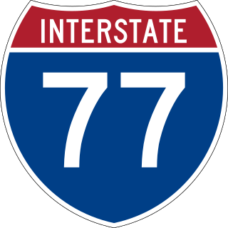
Interstate 77 (I-77) is a north–south Interstate Highway in the Eastern United States. It traverses diverse terrain, from the mountainous state of West Virginia to the rolling farmlands of North Carolina and Ohio. It largely supplants the old US Route 21 (US 21) between Cleveland, Ohio, and Columbia, South Carolina, as an important north–south corridor through the middle Appalachian Mountains. The southern terminus of I-77 is in Cayce, South Carolina, in Lexington County at the junction with I-26. The northern terminus is in Cleveland at the junction with I-90. Other major cities that I-77 connects to include Columbia, South Carolina; Charlotte, North Carolina; Charleston, West Virginia; and Akron, Ohio. The East River Mountain Tunnel, connecting Virginia and West Virginia, is one of only two instances in the US where a mountain road tunnel crosses a state line. The other is the Cumberland Gap Tunnel, connecting Tennessee and Kentucky. I-77 is a snowbird route to the Southern US for those traveling from the Great Lakes region.

U.S. Route 33 (US 33) is a United States Numbered Highway that runs northwest–southeast for 709 miles (1,141 km) from northern Indiana to Richmond, Virginia, passing through Ohio and West Virginia en route. Although most odd-numbered U.S. routes are north–south, US 33 is labeled east–west throughout its route, except in Indiana where it is labeled north–south. It roughly follows a historic trail used by Native Americans from Chesapeake Bay to Lake Michigan.

U.S. Route 550 (US 550) is a spur of U.S. Highway 50 that runs from Bernalillo, New Mexico to Montrose, Colorado in the western United States. The section from Silverton to Ouray is frequently called the Million Dollar Highway. It is one of the roads on the Trails of the Ancients Byway, one of the designated New Mexico Scenic Byways.

State Route 16 (SR 16) is a 27.16-mile-long (43.71 km) state highway in the U.S. state of Washington, connecting Pierce and Kitsap counties. The highway, signed as east–west, begins at an interchange with Interstate 5 (I-5) in Tacoma and travels through the city as a freeway towards the Tacoma Narrows. SR 16 crosses the narrows onto the Kitsap Peninsula on the partially tolled Tacoma Narrows Bridge and continues through Gig Harbor and Port Orchard before the freeway ends in Gorst. The designation ends at an intersection with SR 3 southwest of the beginning of its freeway through Bremerton and Poulsbo. SR 16 is designated as a Strategic Highway Network (STRAHNET) corridor within the National Highway System as the main thoroughfare connecting Tacoma to Naval Base Kitsap and a part of the Highways of Statewide Significance program.
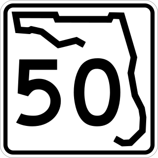
State Road 50 runs across the center of the U.S. state of Florida through Orlando, with its termini at SR 55 at Weeki Wachee and SR 5 in Titusville.

Virginia State Route 7 (VA 7) is a major primary state highway and busy commuter route in northern Virginia, United States. It travels southeast from downtown Winchester to SR 400 in downtown Alexandria. Its route largely parallels those of the Washington & Old Dominion Trail and the Potomac River. Between its western terminus and Interstate 395 (I-395), SR 7 is part of the National Highway System. In 1968, the Virginia State Highway Commission designated the road as the "Harry Flood Byrd Highway" between Alexandria and Winchester to commemorate Harry F. Byrd Sr. (1887–1966).
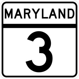
Maryland Route 3, part of the Robert Crain Highway, is the designation given to the former alignment of U.S. Route 301 from Bowie, Maryland, United States, to Baltimore. It is named for Robert Crain of Baltimore. It is unique in Maryland in that it has a business route and a truck route which do not connect to their parent; however, the business route is also a part of the Robert Crain Highway. MD 3's current orientation is vestigial from the construction of Maryland's freeway system.

The Huntsville-Decatur-Albertville, AL Combined Statistical Area is the most populated sub-region of North Alabama, and is the second largest Combined Statistical Area in the State of Alabama after Birmingham. The Huntsville-Decatur-Albertville CSA had a total of 879,315 people in 2022 and ranks 68th in the country.

A road diet is a technique in transportation planning whereby the number of travel lanes and/or effective width of the road is reduced in order to achieve systemic improvements.

State Route 75 (SR 75) is a 113.220-mile-long (182.210 km) state highway in the U.S. state of Alabama that travels northeastward from Birmingham to the Georgia state line. The highway travels west of U.S. Route 11 (US 11) and roughly parallels that highway, as well as Interstate 59 (I-59). Other cities and towns along the highway include Center Point, Pinson, Oneonta, Albertville, Geraldine, and Rainsville.

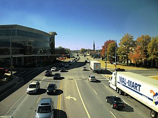
Memorial Parkway, also known as the Parkway, is a major thoroughfare in Huntsville, Alabama that carries over 100,000 vehicles on average a day. It, in whole or in part, follows U.S. Route 231, U.S. Route 431, U.S. Route 72, and State Route 53 through the Huntsville city limits. It is a limited access road through most of Huntsville city proper, providing exits to the frontage road which allows access to road intersections, as well as businesses and residences along the route. Both the limited access and frontage roads are referred to as Memorial Parkway. Originally constructed to bypass downtown Huntsville and officially opened on December 1, 1955, the highway is the major commercial thoroughfare through Huntsville, a status it has held since the mid-1960s.

U.S. Route 60 (US 60) in the Commonwealth of Virginia runs 303 miles (488 km) west to east through the central part of the state, generally close to and paralleling the Interstate 64 corridor, except for the crossing of the Blue Ridge Mountains, and in the South Hampton Roads area.
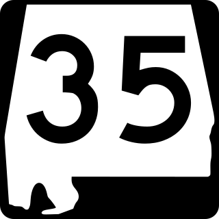
State Route 35 (SR 35) is a 68.291-mile-long (109.904 km) state highway in the northeastern part of the U.S. state of Alabama. The southern terminus of the highway is at its intersection with SR 9 in rural Cherokee County northeast of Cedar Bluff and near the Georgia state line. The northern terminus of the highway is at Woodville in Jackson County where it has a second intersection with U.S. Route 72 (US 72).

State Route 133 (SR 133) is a 16.976-mile-long (27.320 km) mostly multi-lane state highway and is a primary artery through the Florence–Muscle Shoals metropolitan area in the northwestern part of the U.S. state of Alabama.
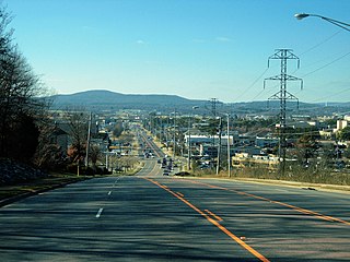
Governors Drive is a major east–west thoroughfare in Huntsville, Alabama. It follows U.S. Route 431 (US-431) in east Huntsville and State Route 53 (SR-53) in west Huntsville. Governors Drive is one of the main entrance points to the city from the east, carrying on average approximately 48,000 vehicles a day across Monte Sano Mountain.

University Drive is a major east–west thoroughfare in Huntsville, Alabama, following US Route 72 into the city from the west. The highway carries on average approximately 56,000 vehicles a day at 45 mph (72 km/h).
Airport Road is a major east–west thoroughfare in Huntsville, Alabama that connects the Jones Valley and Hampton Cove subdivisions to Memorial Parkway and the rest of the city. On average approximately 32,000 vehicles travel the 2-mile stretch of road a day.

An extensive collection of parks and greenways exists in Huntsville, Alabama for the public's recreational use.
Bob Wallace Avenue and Sparkman Drive are major thoroughfares in Huntsville, Alabama that connect to make a horseshoe-shaped road around the city. The two roads run through several residential neighborhoods and school zones including the University of Alabama in Huntsville. On average, approximately 21,000 vehicles travel along the roads each day.
California Street is a major north-south thoroughfare in Huntsville, Alabama connecting historic Five Points to south Huntsville. On average, approximately 18,500 vehicles travel the 1.8 mile stretch of road a day.
