
Blaenau Gwent is a county borough in the south-east of Wales. It borders the unitary authority areas of Monmouthshire and Torfaen to the east, Caerphilly to the west and Powys to the north. Its main towns are Abertillery, Brynmawr, Ebbw Vale and Tredegar. Its highest point is Coity Mountain at 1,896 feet (578 m).
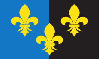
Until 1974, Monmouthshire, also formerly known as the County of Monmouth, was an administrative county in the south-east of Wales, on the border with England, and later classed as one of the thirteen historic counties of Wales. Its area now corresponds approximately to the present principal areas of Monmouthshire, Blaenau Gwent, Newport and Torfaen, and those parts of Caerphilly and Cardiff east of the Rhymney River.

A headstone, tombstone, or gravestone is a marker, usually stone, that is placed over a grave. Especially old or elaborate stone slabs may be called a funeral stele, stela, or slab. The use of such markers is traditional for Chinese, Jewish, Christian, and Islamic burials, as well as other traditions. In East Asia, the tomb's spirit tablet is the focus for ancestral veneration and may be removable for greater protection between rituals. Ancient grave markers typically incorporated funerary art, especially details in stone relief. With greater literacy, more markers began to include inscriptions of the deceased's name, date of birth, and date of death, often along with a personal message or prayer. The presence of a frame for photographs of the deceased is also increasingly common.

The Borough of Islwyn was one of five local government districts of Gwent from 1974 to 1996.

Caerphilly County Borough is a county borough in the south-east of Wales. It is governed by Caerphilly County Borough Council.

Tredegar is a town and community situated on the banks of the Sirhowy River in the county borough of Blaenau Gwent, in the southeast of Wales. Within the historic boundaries of Monmouthshire, it became an early centre of the Industrial Revolution in Wales. The relevant wards collectively listed the town's population as 15,103 in the UK 2011 census.

Blaenau Gwent is a constituency in South Wales, represented in the House of Commons of the UK Parliament since 2010 by Nick Smith of the Labour Party.

Bedwellty is a small village in Caerphilly County Borough in south Wales. The village stands on a ridge of high ground between the Rhymney and Sirhowy valleys. The village comprises St Sannan's parish church, public house and a few houses. The register of St Sannan's Church dates from 1624, which qualifies Bedwellty as an ancient parish. Historically the parish lay in the county of Monmouthshire, the hundred of Wentloog, Tredegar County Court District, the rural deanery of Bedwellty, the archdeaconry of Monmouth and the diocese of Llandaff. Several towns based on the iron industry expanded within the parish boundary, including from west to east, Rhymney, Tredegar and Ebbw Vale, which gradually gained administrative independence from Bedwellty between the 1870s and 1890s. A Bedwellty Local Government District was established for the rest of the parish in 1891, becoming an urban district in 1894.
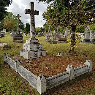
Lambeth Cemetery is a cemetery in Tooting, in the London Borough of Wandsworth. It is one of three cemeteries owned by Lambeth London Borough Council, the others being West Norwood Cemetery and Streatham Cemetery.
The second cholera pandemic (1826–1837), also known as the Asiatic cholera pandemic, was a cholera pandemic that reached from India across Western Asia to Europe, Great Britain, and the Americas, as well as east to China and Japan. Cholera caused more deaths, more quickly, than any other epidemic disease in the 19th century. The medical community now believes cholera to be exclusively a human disease, spread through many means of travel during the time, and transmitted through warm fecal-contaminated river waters and contaminated foods. During the second pandemic, the scientific community varied in its beliefs about the causes of cholera.

The third cholera pandemic (1846–1860) was the third major outbreak of cholera originating in India in the 19th century that reached far beyond its borders, which researchers at University of California, Los Angeles (UCLA) believe may have started as early as 1837 and lasted until 1863. In the Russian Empire, more than one million people died of cholera. In 1853–1854, the epidemic in London claimed over 10,000 lives, and there were 23,000 deaths for all of Great Britain. This pandemic was considered to have the highest fatalities of the 19th-century epidemics.
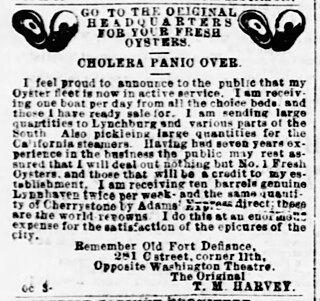
The fourth cholera pandemic of the 19th century began in the Ganges Delta of the Bengal region and traveled with Muslim pilgrims to Mecca. In its first year, the epidemic claimed 30,000 of 90,000 pilgrims. Cholera spread throughout the Middle East and was carried to the Russian Empire, Europe, Africa, and North America, in each case spreading via travelers from port cities and along inland waterways.
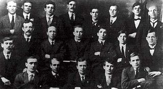
Walter Conway was the longstanding secretary of the Tredegar Medical Aid Society in South Wales. This society contributed the model which established the British National Health Service.

Seven cholera pandemics have occurred in the past 200 years, with the first pandemic originating in India in 1817. The seventh cholera pandemic is officially a current pandemic and has been ongoing since 1961, according to a World Health Organization factsheet in March 2022. Additionally, there have been many documented major local cholera outbreaks, such as a 1991–1994 outbreak in South America and, more recently, the 2016–2021 Yemen cholera outbreak.
Tredegar Iron and Coal Company was an important 19th century ironworks in Tredegar, Wales, which due to its need for coke became a major developer of coal mines and particularly the Sirhowy Valley of South Wales. It is most closely associated with the Industrial Revolution and coal mining in the South Wales Valleys.
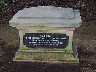
A cholera pit was a burial place used in a time of emergency when the disease was prevalent. Such mass graves were often unmarked and were placed in remote or specially selected locations. Public fears of contagion, lack of space within existing churchyards and restrictions placed on the movements of people from location to location also contributed to their establishment and use. Many of the victims were poor and lacked the funds for memorial stones, however memorials were sometimes added at a later date.

Diseases and epidemics of the 19th century included long-standing epidemic threats such as smallpox, typhus, yellow fever, and scarlet fever. In addition, cholera emerged as an epidemic threat and spread worldwide in six pandemics in the nineteenth century.
The Bedwellty Union Workhouse was situated in Georgetown, Tredegar. It is 2.9 miles (4.7 km) from the Nanybwtch Junction A465. The building was in existence for approximately 127 years. The workhouse building was also used as a hospital. Today, the site where the building once stood, there is a housing estate known as St James Park.

Friar's Bush Graveyard is Belfast's oldest Christian burial site, located on the Stranmillis Road in South Belfast.


