The Arctic Archipelago, also known as the Canadian Arctic Archipelago, is an archipelago lying to the north of the Canadian continental mainland, excluding Greenland and Iceland.

Booth Island is a Y-shaped island, 5 nautical miles long and rising to 980 metres (3,220 ft) in the northeast part of the Wilhelm Archipelago, Antarctica.
The Horlick Mountains are a mountain group in the Transantarctic Mountains of Antarctica, lying eastward of Reedy Glacier and including the Wisconsin Range, Long Hills and Ohio Range.
The Reedy Glacier is a major glacier in Antarctica, over 100 nautical miles long and 6 to 12 nautical miles wide, descending from the polar plateau to the Ross Ice Shelf between the Michigan Plateau and Wisconsin Range in the Transantarctic Mountains. It marks the limits of the Queen Maud Mountains on the west and the Horlick Mountains on the east.

James Ross Island is a large island off the southeast side and near the northeastern extremity of the Antarctic Peninsula, from which it is separated by Prince Gustav Channel. Rising to 1,630 metres (5,350 ft), it is irregularly shaped and extends 40 nautical miles in a north–south direction.

The Usarp Mountains are a major mountain range in North Victoria Land, Antarctica. They are west of the Rennick Glacier and trend north to south for about 190 kilometres (118 mi). The mountains are bounded to the north by Pryor Glacier and the Wilson Hills. They are west of the Bowers Mountains.

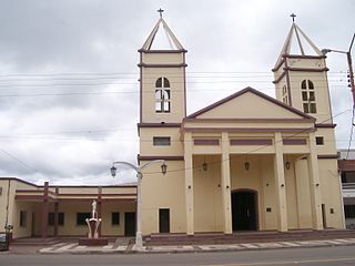
Diezmero is a ward in the outskirts of Havana, Cuba, located by the Carretera Central. It is under the administration of San Miguel del Padrón, a city municipality of Havana. Its demography spreads within about 2 square kilometers.

The Prince Charles Mountains are a major group of mountains in Mac. Robertson Land in Antarctica, including the Athos Range, the Porthos Range, and the Aramis Range. The highest peak is Mount Menzies, with a height of 3,228 m (10,591 ft). Other prominent peaks are Mount Izabelle and Mount Stinear. These mountains, together with other scattered peaks, form an arc about 420 km (260 mi) long, extending from the vicinity of Mount Starlight in the north to Goodspeed Nunataks in the south.
The Clark Mountains are a group of low mountains rising above 1,200 metres (3,900 ft) located in the Ford Ranges, Marie Byrd Land, Antarctica. They are about 10 nautical miles east of the Allegheny Mountains.

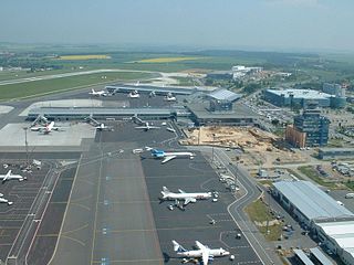
Ruzyně is a district of Prague city, part of Prague 6. It has been a part of Prague since 1960.

La Unión de Campos is a municipality located in the province of Valladolid, Castile and León, Spain. According to the 2004 census (INE), the municipality has a population of 320 inhabitants.

Municipality Municipality is the first municipal section of Hernando Siles Province in the Chuquisaca Department in Bolivia. Its seat is Monteagudo.

Joaquín Victor González is a town and municipality in Salta Province in northwestern Argentina. It is located in and is the capital of Anta Department. It was founded as Laguna Blanca but changed to be named after Joaquin V. Gonzalez after a railroad was built in the area. Its industries are manufacturing of wood-based goods. Its population is 21,045 with 10,567 men and 10,478 women.
The Latady Mountains are a group of mountains rising west of Gardner Inlet and between Wetmore Glacier and Ketchum Glacier, in southeastern Palmer Land, Antarctica.
The Cayley Glacier is a glacier flowing northwest into the south side of Brialmont Cove, on the west coast of Graham Land, Antarctica.

Dobbratz Glacier is a broad tributary glacier which drains the south part of the White Escarpment and flows northeast between the Watlack Hills and the Webers Peaks into Splettstoesser Glacier, in the Heritage Range. It was named by the University of Minnesota Geological Party, 1963–64, for Major Joseph Dobbratz, a United States Marine Corps pilot who supported the party.

Cape Pérez is a prominent cape between Collins Bay and Beascochea Bay on Kyiv Peninsula, the west coast of Graham Land. It was discovered by the Belgian Antarctic Expedition, 1897–99, under Adrien de Gerlache, but apparently not named by them until about 1904, when in working up their scientific reports they gave it the name Trooz. In the meantime, Charcot's French Antarctic Expedition, 1903–05, left for the Antarctic and in November 1904 resighted the same cape, to which they gave the name Trois Pérez, for the brothers Fernando, Leopoldo and Manuel Pérez of Buenos Aires. Maurice Bongrain in his report of 1914 acknowledges the Belgian name Trooz for this cape. However, the Advisory Committee on Antarctic Names has retained the Charcot name because of wider usage, and has given the name Trooz to the large glacier 5 nautical miles (9.3 km) northeast of Cape Pérez.
Scripps Heights are rugged heights which are largely ice-covered, surmounting the peninsula between Casey Glacier and Lurabee Glacier on the east coast of Palmer Land, Antarctica. Deeply scarred by glaciers, the heights terminate on the east in Cape Walcott.

Lister Glacier is a glacier 5 nautical miles (9 km) long and 1 nautical mile (2 km) wide, draining the northeast slopes of Stribog Mountains and flowing into Bouquet Bay just south of Duclaux Point on the northeast side of Brabant Island, in the Palmer Archipelago, Antarctica.


