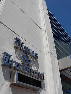
The Times & Transcript is a newspaper from Moncton, New Brunswick. It serves Greater Moncton and eastern New Brunswick. Its offices and printing facilities are located on Main Street in Downtown Moncton. The paper is published by Brunswick News, privately owned by J.K. Irving.

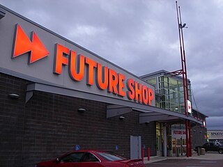
The Mapleton Shopping Area is a big box power centre located in the Mapleton neighbourhood of Moncton, New Brunswick, Canada. The centre is located on the northwest side of the city and is bounded by Trinity Drive, Mapleton Road and Plaza Boulevard. It was founded in 1995.

Greater Moncton is the area encompassing Metro Moncton. Greater Moncton is also known as Greater Moncton Census Metropolitan Area, Moncton Metropolitan Area or Moncton CMA, and is located in New Brunswick, Canada. Greater Moncton has a population of 144,810 (2016).
Resurgo Place in Moncton, New Brunswick, Canada is the new home of the Moncton Museum, the Transportation Discovery Centre and also houses the main Moncton Visitor Information Centre. It is located at 20 Mountain Road in downtown Moncton. After an extensive consultation process with community stakeholders and school children, the new name, Resurgo Place and a new logo was unveiled in March 2013. The name Resurgo which means “I rise again” is Latin and is the first motto (1890) of the City of Moncton.

Magnetic Hill is a Canadian neighbourhood in the north-west area of Moncton, New Brunswick. Magnetic Hill is located around the intersection of Route 126 and Route 2. Magnetic Hill is partially within the community of Lutes Mountain.

The Moncton City Council is the governing body of the City of Moncton, New Brunswick, Canada. It consists of a mayor and ten councillors elected to four-year terms. The council is non-partisan with the mayor serving as the chairman, casting a ballot only in cases of a tie vote. There are four wards electing two councillors each with an additional two councillors selected at-large by the general electorate. Day-to-day operation of the city is under the control of a city manager.

This article refers to a park in Canada. If you are looking for information about a park in Dublin, see Irishtown Nature Park, Dublin.
Lutes Mountain is a Canadian Community, located in Westmorland County, New Brunswick. It is named after famous railroad conductor, Neil Lutes. The Community is situated in southeastern New Brunswick, to the North West of Moncton, located partially within Moncton and Magnetic Hill Limits. Lutes Mountain is located around the intersection of New Brunswick Route 126 and New Brunswick Route 128.
Lewisville is a Neighbourhood in the city of Moncton, New Brunswick.

Sunny Brae is a neighbourhood in Moncton, New Brunswick.
Harrisville is a neighbourhood in Moncton, New Brunswick. It is notable for being in the vicinity of the Greater Moncton International Airport.
Mapleton is a Moncton Neighbourhood located in Moncton, New Brunswick. The community is situated in the Northern area of the city of Moncton. Mapleton is located mainly around the intersection of Route 2 exit 454 and Mapleton Road extending south past Route 15 to the intersection of Route 126. Mapleton is a mix between commercial, park, and residential area.

Downtown Moncton is a central neighbourhood in the city of Moncton, New Brunswick.
Humphrey is a neighbourhood in Moncton, New Brunswick.
Tankville is a Neighbourhood in the city of Moncton. Tankville was officially amalgamated with Moncton in 1973.
Cherryfield is a Neighbourhood in the city of Moncton, New Brunswick.
Caledonia a neighbourhood of the city of Moncton. It is the furthest northeast neighbourhood in Greater Moncton.
Lakeview is a Neighborhood in Moncton, New Brunswick which borders New West End and the community of Allison, New Brunswick.

Central Moncton is a neighbourhood in Moncton, New Brunswick. It's boundaries include Vaughan Harvey to the West, Connaught Ave and Wheeler Blvd to the North and Botsford Street to the East with John St and Mountain Road to the south.
North West End is a Neighbourhood in Moncton, New Brunswick. The North-West End is bordered with New Brunswick Route 2 to both the North and West, Ryan St and Horseman Rd to the East, and Route 128 to the South. This area extends beyond the border of Moncton into part of Berry Mills.


