
Fredericton is the capital city of the Canadian province of New Brunswick. The city is situated in the west-central portion of the province along the Saint John River, which flows west to east as it bisects the city. The river is the dominant natural feature of the area. One of the main urban centres in New Brunswick, the city had a population of 58,220 in the 2016 Canadian Census. It is the third-largest city in the province after Moncton and Saint John.
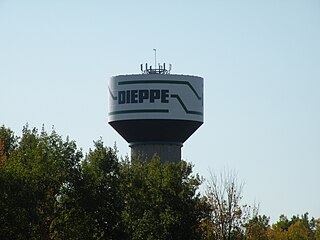
Dieppe is a city in the Canadian maritime province of New Brunswick. Statistics Canada counted the population at 25,384 in 2016, making it the fourth-largest city in the province.

Vancouver Centre is a federal electoral district in British Columbia, Canada, that has been represented in the House of Commons of Canada since 1917.

Fundy Royal is a federal electoral district in southern New Brunswick, Canada, that has been represented in the House of Commons of Canada since 1917.

Halifax, formally known as the Halifax Regional Municipality (HRM), is the capital and largest municipality of the Canadian province of Nova Scotia. It had a population of 403,131 in 2016, with 316,701 in the urban area centred on Halifax Harbour. As of July 2020, Statistics Canada estimated the population of the CMA at 448,544. The regional municipality consists of four former municipalities that were amalgamated in 1996: Halifax, Dartmouth, Bedford, and Halifax County.

Scarborough—Agincourt is a federal electoral district in Toronto, Ontario, Canada that has been represented in the House of Commons of Canada since 1988. It covers the area of the City of Toronto bounded by Steeles Avenue East to the north, Highway 401 to the south, Victoria Park Avenue to the west, and Midland Avenue to the east.

Moncton—Riverview—Dieppe is a federal electoral district in New Brunswick, Canada, that has been represented in the House of Commons of Canada since 1968.

Downtown Calgary is a dense urban district in central Calgary, Alberta. It contains the second largest concentration of head offices in Canada, despite only being the country’s fourth largest city in terms of population. The downtown is divided into several residential, commercial, corporate, and mixed-use neighbourhoods, including the Financial District (CBD), Eau Claire, Chinatown, East Village, Beltline, and the West End.
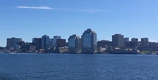
Downtown Halifax is the central business district of Halifax, Nova Scotia. Located on the eastern-central portion of the Halifax Peninsula, on Halifax Harbour, it serves as the business, entertainment, and tourism hub of the region.

Downtown Montreal is the central business district of Montreal, Quebec, Canada.

Downtown Toronto is the main central business district of Toronto, Ontario, Canada. Located entirely within the district of Old Toronto, it is approximately 16.6 square kilometres in area, bounded by Bloor Street to the northeast and Dupont Street to the northwest, Lake Ontario to the south, the Don Valley to the east, and Bathurst Street to the west. It is also the home of the municipal government of Toronto and the Government of Ontario.

Downtown Edmonton is the central business district of Edmonton, Alberta. Located at the geographical centre of the city, the downtown area is bounded by 109 Street to the west, 105 Avenue to the north, 97 Street to the east, 97 Avenue and Rossdale Road to the south, and the North Saskatchewan River to the southeast.
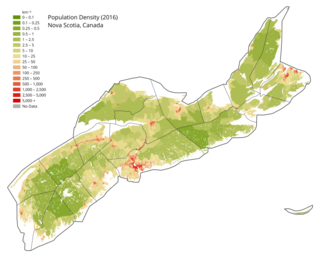
Nova Scotia is a Canadian province located on Canada's southeastern coast. It is the most populous province in the Atlantic Canada, and its capital, Halifax, is a major economic centre of the region. Nova Scotia is the second smallest province in Canada, with an area of 55,284 km². As of 2016, it has a population of 923,598 making it the second most densely populated province of the country.

Downtown Victoria is a neighbourhood of Victoria, British Columbia, Canada that serves as the city centre and the central business district for the City of Victoria, and the Greater Victoria regions.
A designated place (DPL) is a type of community or settlement identified by Statistics Canada that does not meet the criteria used to define municipalities or population centres. DPLs are delineated every 5 years for the Canadian census as the statistical counterparts of incorporated places such as cities, towns, and villages.

Downtown St. John's is the historic core, and central business district of St. John's, Newfoundland and Labrador, Canada. Located north of St. John's harbour, it is the business, entertainment, and tourism centre with office buildings, hotels, restaurants, and other services.

Ville-Marie—Le Sud-Ouest—Île-des-Sœurs is a federal electoral district in Quebec, Canada, that has been represented in the House of Commons of Canada since 2015. It encompasses a portion of Quebec formerly included in the electoral districts of Jeanne-Le Ber, Westmount—Ville-Marie, Laurier—Sainte-Marie and Outremont.
