Related Research Articles

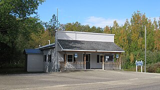
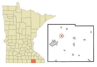
Martin County is a county in Minnesota, United States. As of the 2020 census, the population was 20,025. Its county seat is Fairmont.
St. Ignace Township is a civil township of Mackinac County in the U.S. state of Michigan. As of the 2020 census, the township population was 973.
Pleasant Mound Township is a township in Blue Earth County, Minnesota, United States. The population was 235 as of the 2000 census.
Brownsdale is a city in Mower County, Minnesota, United States. The population was 633 at the 2020 census.

Rose Creek is a city in Mower County, Minnesota, United States. The population was 397 at the 2020 census.
Blue Earth Area High School is a public high school serving grades 8–12. Its sports teams are called the Buccaneers. It is located in Blue Earth, Minnesota, along U.S. Route 169.
Cedar Creek may refer to several small streams in the U.S. state of Michigan:

Jack Creek Township is one of twelve townships in Emmet County, Iowa, USA. As of the 2000 census, its population was 135.
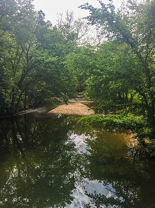
Elm Creek is an 89.5-mile-long (144.0 km) tributary of the Blue Earth River in southern Minnesota. It rises in northeastern Jackson County and flows eastwardly through Martin County into northeastern Faribault County, where it joins the Blue Earth River near the city of Winnebago. Via the Blue Earth and Minnesota rivers, it is part of the Mississippi River watershed.
Temescal Valley in California is a graben rift valley in western Riverside County, California, a part of the Elsinore Trough. The Elsinore Trough is a graben between the Santa Ana Mountain Block to the southwest and the Perris Block on the northeast. It is a complex graben, divided lengthwise into several smaller sections by transverse faults. The Temescal Valley is one of these graben, at the northern end of the trough. The Temescal Valley graben is bounded northeast side by the Lee Lake longitudinal fault and similarly on the southeast by the Glen Ivy Fault.
Plum Creek Township is a township in Kossuth County, Iowa, United States.
Plum Creek is a ghost town in Kossuth County, in the U.S. state of Iowa. A railroad station was once located at Plum Creek.
Coon Creek is a stream in Faribault County, Minnesota, and Kossuth County, Iowa. It is a tributary of the Blue Earth River.
Badger Creek is a stream in Faribault and Martin counties, in the U.S. state of Minnesota. It is a tributary of the Blue Earth River.
Woodbury Creek is a stream in Freeborn and Mower Counties in the U.S. state of Minnesota.
Pike Creek is a stream in Morrison County, in the U.S. state of Minnesota. It is a tributary of the Mississippi River.
Massies Creek is a stream located entirely within Greene County, Ohio. It is a tributary of the Little Miami River.
Charlie Creek is a stream in the U.S. state of South Dakota.
Troublesome Creek is a stream in Knox, Lewis and Marion counties in the northeastern part of the U.S. state of Missouri. It is a tributary of the South Fabius River.
Greasy Creek is a stream in Madison County in the U.S. state of Missouri. It is a tributary of the Castor River.
References
- ↑ U.S. Geological Survey Geographic Names Information System: Center Creek (Minnesota)
- ↑ Upham, Warren (1920). Minnesota Geographic Names: Their Origin and Historic Significance. Minnesota Historical Society. p. 333.
43°44′11″N94°10′35″W / 43.73639°N 94.17639°W
| | This article related to a river or creek in Minnesota is a stub. You can help Wikipedia by expanding it. |