
Forbes is a town in the Central West region of New South Wales, Australia, located on the Newell Highway between Parkes and West Wyalong. At the 2016 census, Forbes had a population of 8,432. Forbes is probably named after Sir Francis Forbes, first Chief Justice of NSW.

The Riverina is an agricultural region of South-Western New South Wales (NSW), Australia. The Riverina is distinguished from other Australian regions by the combination of flat plains, warm to hot climate and an ample supply of water for irrigation. This combination has allowed the Riverina to develop into one of the most productive and agriculturally diverse areas of Australia. Bordered on the south by the state of Victoria and on the east by the Great Dividing Range, the Riverina covers those areas of New South Wales in the Murray and Murrumbidgee drainage zones to their confluence in the west.

West Wyalong is the main town of the Bland Shire in the Central West region of New South Wales, Australia. Located 467 kilometres (290 mi) west of Sydney and 262 m (860 ft) above sea level, it is situated on the crossroads of the Newell Highway between Melbourne and Brisbane, and the Mid-Western Highway between Sydney and Adelaide.
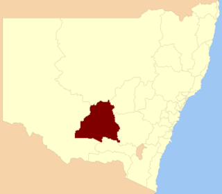
The Division of Bland was an Australian electoral division in New South Wales. The division was proclaimed in 1900, and was one of the original 65 divisions to be contested at the first federal election. It was abolished in 1906. It was named for Dr William Bland, a New South Wales colonial politician. Based in rural southern New South Wales, it included the towns of Narrandera, Young, Wagga Wagga and West Wyalong. Bland was held by Chris Watson, the first Leader of the federal parliamentary Labor Party and Australia's first Labor Prime Minister. When Bland was abolished in 1906, Watson transferred to South Sydney.

Barwon is an electoral district of the Legislative Assembly in the Australian state of New South Wales. It is represented by Roy Butler of the Shooters Fishers and Farmers Party.

Burrinjuck was an electoral district of the Legislative Assembly in the Australian state of New South Wales from 1950 to 2015.
Murrumbidgee is a former electoral district of the Legislative Assembly in the Australian state of New South Wales, named after the Murrumbidgee River.
The South West Slopes is a region predominantly in New South Wales, Australia. It covers the lower inland slopes of the Great Dividing Range extending from north of Cowra through southern NSW into western Victoria. More than 90% of the region is in the state of New South Wales and it occupies about 10% of that state.

Tottenham is a small town in Lachlan Shire in the Central West of New South Wales, Australia. Tottenham is known as “The Soul of the Centre”, a reference to it being the nearest town to the geographical centre of New South Wales. It had a population of 299 at the 2011 census, including 21 indigenous people (6%) and 20 foreign born people (6%).

The lands administrative divisions of New South Wales refers to the 141 counties within the Colony of New South Wales, that later became the Australian state of New South Wales.

Lands administrative divisions of Australia are the cadastral divisions of Australia for the purposes of identification of land to ensure security of land ownership. Most states term these divisions as counties, parishes, hundreds, and other terms. The eastern states of Queensland, New South Wales, Victoria and Tasmania were divided into counties and parishes in the 19th century, although the Tasmanian counties were renamed land districts in the 20th century. Parts of South Australia (south-east) and Western Australia (south-west) were similarly divided into counties, and there were also five counties in a small part of the Northern Territory. However South Australia has subdivisions of hundreds instead of parishes, along with the Northern Territory, which was part of South Australia when the hundreds were proclaimed. There were also formerly hundreds in Tasmania. There have been at least 600 counties, 544 hundreds and at least 15,692 parishes in Australia, but there are none of these units for most of the sparsely inhabited central and western parts of the country.

The Land District of Queanbeyan was one of the around 100 land districts of New South Wales which were introduced with the Crown Lands Act of 1884. It was based around the town of Queanbeyan, and included the area from near Lake George in the north, to Colinton in the south, and west to the Goodradigbee River and beyond it. In 1909, a large part of the district was transferred to the Commonwealth government to become the Australian Capital Territory.
The Lachlan Fold Belt (LFB) or Lachlan Orogen is a geological subdivision of the east part of Australia. It is a zone of folded and faulted rocks of similar age. It dominates New South Wales and Victoria, also extending into Tasmania, the Australian Capital Territory and Queensland. It was formed in the Middle Paleozoic from 450 to 340 Mya. It was earlier known as Lachlan Geosyncline. It covers an area of 200,000 km2.

Murray is an electoral district in the Australian state of New South Wales.

The Grenfell Record and Bland Advertiser is an English language newspaper published in Grenfell, New South Wales, Australia. The newspaper has run continuously under various titles since June 1867 when it began as The Mining Record and Grenfell General Advertiser.

Euabalong is a town in western New South Wales, Australia. The town is in the Cobar Shire local government area and on the Lachlan River, 531 kilometres (330 mi) west of the state capital, Sydney, and 27 kilometres from Lake Cargelligo. At the 2011 census, Euabalong had a population of under 200 people.
Auber George Jones was an Australian politician.


