Related Research Articles

The Annex is a neighbourhood in Downtown Toronto, Ontario, Canada. The traditional boundaries of the neighbourhood are north to Dupont Street, south to Bloor Street, west to Bathurst Street and east to Avenue Road. The City of Toronto recognizes a broader neighbourhood definition that includes the adjacent Seaton Village and Yorkville areas.

Cabbagetown is a neighbourhood in central Toronto, Ontario, Canada. Administratively, it is defined as part of the Cabbagetown-South St. Jamestown neighbourhood. It largely features semi-detached Victorian houses and is recognized as "the largest continuous area of preserved Victorian housing in all of North America", according to the Cabbagetown Preservation Association.

Regent Park is a neighbourhood located in downtown Toronto, Ontario built in the late 1940s as a public housing project managed by Toronto Community Housing. It sits on what used to be a significant part of the Cabbagetown neighbourhood and is bounded by Gerrard Street East to the north, River Street to the east, Shuter Street to the south and Parliament Street to the west. Regent Park's residential dwellings, prior to the ongoing redevelopment, were entirely social housing and covered all of the 69 acres (280,000 m²) which comprise the community. The original neighbourhood was razed in the process of creating Regent Park. The nickname Cabbagetown is now applied to the remaining historical, area north and west of the housing project, which has experienced considerable gentrification since the 1960s and 1970s.
Riverview is a neighbourhood in Ottawa, Ontario, Canada. It is southeast of the downtown adjacent to the Rideau River, its location on which is its namesake. The 2021 Census population of Riverview is 13,113.

Little Italy, sometimes referred to as College Street West, is a district in Toronto, Ontario, Canada. It is known for its Italian Canadian restaurants and businesses. There is also a significant Latin-Canadian and Portuguese-Canadian community in the area. The district is centred on a restaurant/bar/shopping strip along College Street, centred on College Street, imprecisely between Harbord Street and Dundas Street, and spreading out east and west between Bathurst Street and Ossington Avenue. It is contained within the larger city-recognized neighbourhood of Palmerston-Little Italy.

Kensington Market is a distinctive multicultural neighbourhood in Downtown Toronto, Ontario, Canada. The Market is an older neighbourhood and one of the city's most well-known. In November 2006, it was designated a National Historic Site of Canada. Robert Fulford wrote in 1999 that "Kensington today is as much a legend as a district. The (partly) outdoor market has probably been photographed more often than any other site in Toronto."

Parkdale is a neighbourhood and former village in Toronto, Ontario, Canada, west of downtown. The neighbourhood is bounded on the west by Roncesvalles Avenue, on the north by the CP Rail line where it crosses Queen Street and Dundas Street. It is bounded on the east by Dufferin Street from Queen Street south, and on the south by Lake Ontario. The original village incorporated an area north of Queen Street, east of Roncesvalles from Fermanagh east to the main rail lines, today known as part of the Roncesvalles neighbourhood. The village area was roughly one square kilometre in area. The City of Toronto government extends the neighbourhood boundaries to the east, south of the CP Rail lines, east to Atlantic Avenue, as far south as the CN Rail lines north of Exhibition Place, the part south of King Street commonly known as the western half of Liberty Village neighbourhood.
St. James Town is a neighbourhood of Toronto, Ontario, Canada. It lies in the northeast corner of the downtown area. The neighbourhood covers the area bounded by Jarvis Street to the west, Bloor Street East to the north, Parliament Street to the east, and Wellesley Street East to the south.
The 519, formerly known as The 519 Church Street Community Centre, is an agency by the City of Toronto. A Canadian charitable, non-profit organization, it operates a community centre in the Church and Wellesley neighbourhood of Toronto, Ontario, Canada. The 519 serves both its local neighbourhood and the broader lesbian, gay, bisexual and transgender (LGBT) communities in the Toronto area. The 519 defines its local neighbourhood by a catchment area that spans from Bloor Street to the north to Gerrard Street to the south, and from Bay Street in the west to Parliament Street in the east.

Lansing is a neighbourhood in Toronto, Ontario, Canada. It originated as a minor settlement of a store, other services and a post office at the corner of Yonge Street and Sheppard Avenue and later got consolidated with Toronto as sprawling development took place. A larger area was designated as the postal village of Lansing. The City of Toronto labels it as Lansing-Westgate for neighbourhood planning purposes with the boundaries Yonge Street to the east, Highway 401 to the south, Bathurst Street to the west and Burnett Avenue to the north.

Old East York is a district of the city of Toronto, Ontario, Canada. It consists of the southern, urban, portion of the former borough of East York. Old East York is continuous and functionally integrated with the old City of Toronto, bounded by the old municipal boundary between East York and Old Toronto on the south, by the Don River Valley on the west and northwest, by Taylor-Massey Creek on the north, and Victoria Park Avenue in the east.

Clairlea is a safe, quiet, middle to upper-middle income neighbourhood in Toronto, Ontario, Canada that features well treed streets and detached homes with large backyards. The neighbourhood is located in east Toronto just east of Victoria Park Avenue.
Grand Street Settlement is a historic social service institution on the Lower East Side and Brooklyn in New York City, United States. The institute was founded in 1916 in response to the needs of immigrants from Eastern and Southern Europe who were settling in the area. Over 17,500 individuals currently participate in Grand Street Settlement's programs.

Alexandra Park is a neighbourhood located in downtown Toronto, Ontario, Canada. Alexandra Park is bounded by Dundas Street West on the north, Spadina Avenue on the east, Queen Street West on the south, and Bathurst Street on the west. Alexandra Park consists of private and public housing, with at grade retail along Queen Street West and Spadina Avenue, some institutional, and several commercial buildings scattered through the neighborhood. The neighborhood takes its name from Alexandra Park, a municipal park at the south-east corner of Dundas Street West and Bathurst Street. The park is named for Queen Alexandra, whose husband, King Edward VII, was the first future monarch to visit Toronto.
West Neighbourhood House is a multi-service neighbourhood centre serving west downtown Toronto, Ontario, Canada since 1912. The non-profit charitable organization provides a wide range of programs to all age groups in downtown west Toronto. St. Christopher House integrates community development approaches with direct delivery of social services. The community served by St. Christopher House includes the diverse immigrant and mixed income neighbourhoods of Trinity Bellwoods, Niagara, Palmerston/Little Italy, Little Portugal, Dufferin Grove, Parkdale, Liberty-Exhibition and Roncesvalles.

The First Russian Congregation of Rodfei Sholem Anshei Kiev, known as the Kiever Synagogue or Kiever Shul, is a Modern Orthodox Jewish synagogue in Toronto, Ontario, Canada. It was founded by Jewish immigrants from Ukraine in 1912, and formally incorporated in 1914. The congregants were poor working-people, and services were led by members and held in their homes. Two houses were eventually purchased in the Kensington Market area, and in their place construction was completed on the current twin-domed Byzantine Revival building in 1927. The building was once the site of George Taylor Denison's home Bellevue.
Parliament Street is a north–south street in the eastern part of downtown Toronto, Ontario, Canada. The street runs from Bloor Street to Queens Quay and is the first major street west of the Don River.

The Ward was a neighbourhood in central Toronto, Ontario, Canada, in the 19th and early 20th centuries. Many new immigrants first settled in the neighbourhood; it was at the time widely considered a slum.

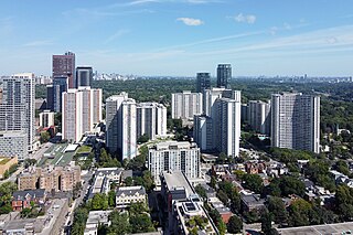
Throughout its history, Toronto has been a city divided into many districts and neighbourhoods. As the city has grown, new neighbourhoods have been created by expansion of the city into the countryside. Over time, the neighbourhoods within existing areas have also been altered and rearranged.

Grange Park is a neighbourhood in downtown Toronto, Ontario, Canada. It is bounded on the west by Spadina Avenue, on the north by College Street, on the east by University Avenue and on the south by Queen Street West. It is within the 'Kensington-Chinatown' planning neighbourhood of the City of Toronto. Its name is derived from the Grange Park public park. The commercial businesses of Chinatown extend within this neighbourhood.
References
- ↑ Central Neighbourhood House - About : History
- ↑ Lorinc, John (May 6, 2013). "Whatever became of Toronto's first priority neighbourhood?". Spacing. Retrieved May 6, 2013.
- ↑ Childcare Services
- ↑ Children and Youth Programs
- ↑ Women's Club
- ↑ Family Support
- ↑ Street Survivors
- ↑ Supportive Housing Initiative
- ↑ Vulnerable Seniors Program