
Quảng Ngãi is a province in the South Central Coast region of Vietnam, on the coast of East Sea. It is located 883 kilometres (549 mi) south of Hanoi and 838 kilometres (521 mi) north of Hồ Chí Minh City.

Hải Dương is a city in Vietnam. It is the capital of Hải Dương, a highly industrialized province in the Hanoi Metropolitan Area and the Red River Delta in Northern Vietnam. Its name is Sino-Vietnamese for "ocean sun" (海陽). The city is at the midpoint between the capital Hà Nội and major port Hải Phòng, and is part of the Northern Key Economic Zone. As of 2016, the city has a population of 403,893.

South Central Coast is one of the regions of Vietnam. It consists of the independent municipality of Đà Nẵng and seven other provinces. The two southern provinces Ninh Thuận and Bình Thuận are sometimes seen as part of the Southeast region.The Paracel Islands, and Spratly Islands, are also part of this region.

Đồng Hới is the capital city of Quảng Bình Province in the north central coast of Vietnam. The city's area is 155.71 km2 (60.12 sq mi). Population as per the 2013 census was 160,000. It is served by National Highway 1A, the Đồng Hới Railway Station, and airport. By road, Đồng Hới is 486 kilometres (302 mi) south of Hanoi, 195 kilometres (121 mi) south of Vinh, 160 kilometres (99 mi) north of Huế and 1,204 kilometres (748 mi) north of Hồ Chí Minh City. It borders Quảng Ninh District on the west and south, the South China Sea on the east, Bố Trạch District on the north.
Nghệ An is a province in the North Central Coast region of Vietnam. It is Vietnam's largest province by area. Nghệ An is located in a central position in North Central Coast. To the east lies the Gulf of Tonkin; to the west the province is bordered by Laos; to the south Hà Tĩnh Province; and to the north is Thanh Hóa Province. It is located on the east–west economic corridor connecting Myanmar, Thailand, Laos and Vietnam along National Route 7 to the port of Cửa Lò.

National Route 1A is the trans-Vietnam highway. The route begins at km 0 at Huu Nghi Quan Border Gate near the China-Vietnam border. The route ends at at Năm Căn township in Cà Mau Province.

Lao Bảo is a small town in Hướng Hóa District of Quảng Trị Province, Vietnam, located in the North Central Coast region, near the border with Laos. Its population is approximately 30,000.

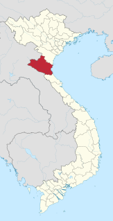
Ba Vi is a district of Ha Noi, Vietnam.
The Beibu Gulf Economic Rim or Beibu Economic Belt also known as Gulf of Tonkin Economic Belt in defines the economic region or rim surrounding around China's southwestern coastal region and cities around the Gulf of Tonkin. The region is part of Chinese government's "Go West" strategy, to boost its less developed western regions. The implementation of the campaign, has resulted in many construction projects in cities on the Beibu Gulf Rim, especially in Guangxi. The Beibu Gulf economic rim has emerged as a new highlight of China-ASEAN cooperation, especially between Vietnam, who is also cooperating in this economic zone. It covers Guangdong, Hainan and Guangxi, and northern and central Vietnam.
Hon La Economic Zone is one of special economic zones in Vietnam. This zone is located by the South China Sea's Hon La Port in Quảng Trạch District, Quảng Bình Province, Bắc Trung Bộ, Vietnam. The economic zone covers 100 square kilometers, including communes: Quảng Đông, Quảng Phú, Quảng Tùng, Cảnh Dương, Quảng Hưng and Quảng Xuân Hon La Economic Zone is situated 60 km north Đồng Hới, around 440 km south of Hanoi, at the foot of Ngang Pass, near the Vung Ang Economic Zone in Hà Tĩnh Province with deep-water Vung Ang Port. The National Route 1A and Vietnamese main railway runs along the zone. The economic zone is accessed by road, railway at Đồng Hới Railway Station or by air at Đồng Hới Airport or Phu Bai International Airport . In order to attract investment here, preferentially reduced taxes, fees, land hire and investment incentives are applied to investors. As of 2009, Petrovietnam is operating a deep-water Hon La Port. Petrovietnam is preparing to build a 2,400 MW coal-fuelled thermal power plant in this economic zone.

Mộc Bài is an international border gate between Vietnam and Cambodia located in Tây Ninh Province, Vietnam. Its counterpart across the border is the Bavet border gate, Svay Rieng Province, Cambodia. As it is located on the main highway between Ho Chi Minh City and Phnom Penh, the border crossing is one of the busiest land entry points into Vietnam.
Below is a list of Vietnamese exonyms for various cities and countries around the world. The list does not include Vietnamese-speaking areas and cities, including Vietnam itself. Cities in bold are the capital cities of their respective country. The Vietnamese exonym is after the name of the city in English. An asterisk [*] indicates a name that is still in common use. For the other countries or cities, Vietnamese people usually use the English names.
Thi Nai Bridge is a bridge in Vietnam, connecting the city of Qui Nhơn to the Phương Mai Peninsula. The bridge was inaugurated in 2006 and was the longest sea bridge in Vietnam with a length of 2477.3 metres, and width of 14.5 metres. The bridge took three years to construct and opened on December 22, 2006. It cut the road distance from Qui Nhơn City to Nhon Hoi Economic Zone from 60 km to only 7 km.
The 4th Military Region of Vietnam People's Army, is directly under the Ministry of Defence of Vietnam, tasked to organise, build, manage and command armed forces defending the North Central Vietnam. The predecessor, 4th War Zone was established by the order of Ho Chi Minh on 15 October 1945, and this day has become the traditional day of the Military Zone. On 3 June 1957, Ho Chi Minh signed the ordinance 17/SL to establish 4th Military Zones on the basis of 4th Joint Zone, simultaneously with other military zones: the North Vietnamese, North West, North East, Left Bank, Right Bank.
Nhon Hoi Economic Zone is new urban center in the east of Qui Nhơn, Vietnam. It includes or is planned to include residential areas, an industrial park, a deep water port, and a resort. It was established in 2005 and has a total area of 120km2, of which 14km2 are reserved for an industrial park.

On the First Tier, Vietnam is divided into 58 provinces and 5 municipalities. Municipalities are the highest-ranked cities in Vietnam. Municipalities are centrally-controlled cities and have special status equal to the Province.
Quang Bình is a rural district of Hà Giang Province in the Northeast region of Vietnam. As of 2003 the district had a population of 53,160. The district covers an area of 774 km². The district capital is Yên Bình.


