Gopalganj is one of the administrative districts in the Indian state of Bihar. The district headquarters is the town of Gopalganj, and the district is part of Saran Division. Major languages spoken are Bhojpuri, and Hindi.
Deoria district is one of the districts of Uttar Pradesh, India. Deoria is the district headquarters. Deoria district is a part of Gorakhpur division. Deoria district came into existence on 16 March 1946 from Gorakhpur district.

Siwan is a city and the district headquarters of the Siwan district in the Indian state of Bihar. It is also block headquarter of Siwan block. It is one out of three municipalities located in Siwan district which is Nagar Parishad, the two other municipalities are Nagar Panchayat. It is located close to Uttar Pradesh. The town is known for its great past especially for First President of Indian Republic who belonged to Ziradei.
Mairwa community development block or Mairwa Block is a notified area in Siwan district in the Indian state of Bihar. It is one out of 13 blocks of Siwan Subdivision.
Warisaliganj is a Town and a Nagar Panchayat in Nawada district, in the Indian state of Bihar.
Khawaspur is a village district, in the Bihar state of India

Kushinagar Airport is a proposed airport situated in Kasia, Kushinagar district and is 52 km east of Gorakhpur, in Kushinagar district in Uttar Pradesh, India. The airstrip spans 97 acres, has a small apron of 145 metres by 46 metres and handles small aircraft.
The Barauni–Gorakhpur, Raxaul and Jainagar lines are a set of three lines connecting Barauni in the Indian state of Bihar with Gorakhpur in Uttar Pradesh. The lines run in an east-west direction between the Ganges and India-Nepal border, covering northern Bihar west of the Kosi river and eastern Uttar Pradesh. The southernmost of the lines connects via Hajipur Junction, Sonpur Junction and Chhapra. The central line connects via Muzaffarpur, Motihari and Sugauli. The northern line connects via Darbhanga, Sitamarhi and Raxaul. The lines have interconnections between them and the northern line has extensions to places near the India-Nepal border.
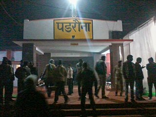
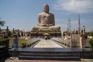
Padrauna railway station is on the Gorakhpur-Thawe line. It is about 77 km from Gorakhpur railway station and is situated towards its north-eastern part. It is situated about 20 km from Kushinagar, an international tourist and religious spot for Buddhists. It serves Padrauna city in the Indian state of Uttar Pradesh.
Hathaura is a village in Siwan district, Bihar state, India.
Tarwara is a village panchayat, and the most developed village located in the Siwan district of Bihar state, India, around 90.6 kilometres (56.3 mi) from Patna, the state capital. The other surrounding state capitals are Ranchi, Lucknow, and Gangtok.
Adapur is a block in East Champaran district of Bihar, India. Adapur railway station is located 40 kilometres (25 mi) north of Motihari, the district headquarters. The state capital Patna is 175 kilometres (109 mi) south. Adapur is located on the India - Nepal border. There are many villagers Near Adapur town peoples come to buy their daily essential things.
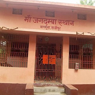
Bagmusha is a village of Hajipur Block and Tirhut Division of Bihar.Bagmusha is very nearest of Hajipur junction and NH 19.
Nalanda railway station, station code NLD, is a railway station and under Danapur railway division of East Central Railway. Nalanda is connected to metropolitan areas of India, by the Delhi-Kolkata Main Line via Mugalsarai-Patna route. Station is located in Nalanda city in Nalanda district in the Indian state of Bihar. Due to its location on the Bakhtiyarpur-tilaiya main line many Patna and other cities via express trains coming from Rajgir and Gaya Junction stops here.
Madhopur is a village in Barharia block of Siwan district in the Indian state of Bihar. It is located 2 kilometers (1.24 mi) north of the Barharia block at Barharia-Gopalganj road, It is located 18 kilometres (11 mi) east of the district headquarters Siwan and 150 kilometres (93 mi) from the state capital Patna. Madhopur is surrounded by Sahpur to the north, Barasra south, Chhatisi east, and Rasulpur to the west. Barharia, Siwan, Gopalganj, Mirganj, Barauli and Thawe are nearby towns.

Thawe Mandir, the Temple of Maa Thawewali is situated in Thawe, in Gopalganj District in the State of Bihar, India. It is only 6 km from Gopalganj town on the Gopalganj-Siwan National Highway.

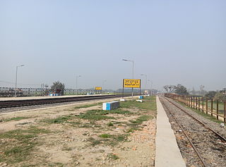
Tamkuhi Road railway station is a small railway station in Kushinagar district, Uttar Pradesh. Its code is TOI. It serves Tamkuhi Raj town. The station consists of two platforms. The platforms are not well sheltered. It lacks many facilities including water and sanitation.
Sani Basantpur is a village council situated in Goriakothi Block in Siwan district of Bihar state, India. It belongs to Saran division. It is located 21 km towards east from district headquarters Siwan and 117 km from the state capital Patna. Sani Basantpur's PIN code is 841439. Mustfabad is sub post office of Sani Basantpur. Nearby cities to Sani Basantpur is Siwan, Maharajganj, Barauli, Gopalganj and Mirganj.
Rajpur is a large village located in Raghunathpur Block in Siwan district in Bihar. It belongs to Saran Division. It is located 28 KM towards South from District head quarters Siwan. 3 KM from RaghunathPur. 114 KM from State capital Patna. Rajpur Pin code is 841504 and postal head office is Raghunathpur (Siwan). As per the administration register, the village code of Rajpur is 232505. The village has 604 homes. This Place is in the border of the Siwan District and Ballia District. Ballia District Maniar is west towards this place. It is near to the Uttar Pradesh State Border.
Darauli is a Community development block and a town in district of Siwan, in Bihar state of India. It is one out of 13 blocks of Siwan Subdivision. The headquarter of the block is at Darauli town.