Look up chala in Wiktionary, the free dictionary.
Contents
Chala may also refer to:
Chala may also refer to:

Kasaragod is a municipal town and administrative headquarters of Kasaragod district in the state of Kerala, India. Established in 1966, Kasaragod was the first municipal town in the district. It is the northernmost district of Kerala and is also known as Sapta Bhasha Sangama Bhumi.
Kannur is one of the 14 districts along the west coast in the state of Kerala, India. The city of Kannur is the district headquarters and gives the district its name. The old name, Cannanore, is the anglicized form of the Malayalam name "Kannur". Kannur district is bounded by Kasaragod District to the north, Kozhikode district to the south, Mahé district to the southwest and Wayanad District to the southeast. To the east, the district is bounded by the Western Ghats, which forms the border with the state of Karnataka. The Arabian Sea lies to the west. Paithalmala is the highest point in Kannur District (1,372m). Enclosed within the southern part of the district is the Mahé district of the Union Territory of Puducherry. The district was established in 1957.
Jesus was a Jewish preacher and religious leader who most Christians believe to be the incarnation of God and Muslims believe was a prophet.

Payyanur, is a municipal town and a taluk, a sub-district administrative unit, in the Kannur district of Kerala, India. Payyanur is the first municipality in Kerala to establish libraries in all its wards. On 10 March 2018, Kerala Chief Minister Pinarayi Vijayan inaugurated Payyanur as the fifth taluk in the district. Payyanur taluk comprises 22 villages including 16 de-linked from the Taliparamba taluk and six from the Kannur taluk. The town is situated on the banks of the Perumba River.
Chirakkal may refer to:

Ezhimala, a hill reaching a height of 286 metres (938 ft), is located near Payyanur, in Kannur district of Kerala, South India. It is a part of a conspicuous and isolated cluster of hills, forming a promontory, 38 km (24 mi) north of Kannur (Cannanore). The Indian Naval Academy at Ezhimala is Asia's largest, and the world's third-largest, naval academy.
Thottada is a census town and suburb of Kannur city situated on NH 66 of about 8 km (5.0 mi) south of Kannur railway station in Kerala State, India.
Pariyaram is a Grama Panchayat consisting of two villages viz. Pariyaram census town and Kuttiyeri village. Pariyaram is a suburb of Taliparamba on National Highway between Taliparamba and Payyanur in Kerala state of India. Mini villages of Thiruvattoor, Koran Peedika, Mukkunnu & Chithappile Poyil are parts of Pariyaram.
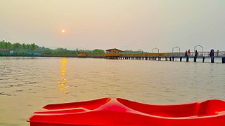
Chala is a census town and Suburb of Kannur city in the state of Kerala, India and is situated 10 km (6.2 mi) south of Kannur and lies on National Highway 66 towards Thalassery.

Kasaragod (Malayalam:[kaːsɐrɡoːɖɨ̆] is one of the 14 districts in the southern Indian state of Kerala. Its northern border Thalappady is located just 9 km south to Ullal, which is the southernmost portion of the major port city Mangalore, on the southwestern Malabar coast of India.
Chail may refer to:

Karivellur is a census town and Gram Panchayat in Kannur district of Kerala state, India.
Manantheri is a census town near Kuthuparamba in Kannur district in the Indian state of Kerala.

Religion in Kerala is diverse. According to 2011 census of India figures, 54.73% of Kerala's population are Hindus, 26.56% are Muslims, 18.38% are Christians, and the remaining 0.33% follow other religions or have no religion. As of 2020, Hindus, Muslims, Christians and others account for 41.5%, 43.9%, 13.9% and 0.7% of the total child births in the state, respectively.
Challa or Chala or Challah may refer to:
Palayam may refer to:

The following outline is provided as an overview of and topical guide to Kerala:

Anthoor is a municipality, in Taliparamba taluk of the Kannur district in Kerala, India. The municipality had a population of 28,218 in the 2011 Indian census.
Kolachery is a census town and Grama Panchayat in Kannur District of Kerala state, India. Kolachery is located 15 kilometres (9.3 mi) north east of Kannur city.
Chalia or Chalía may refer to: