
The Tibet Autonomous Region or Xizang Autonomous Region, often shortened to Tibet or Xizang, is an autonomous region of the People's Republic of China in Southwest China. It was overlayed on the traditional Tibetan regions of Ü-Tsang and Kham.
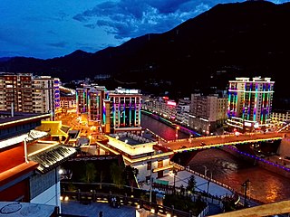
Karub District also known as Kharro or Karuo, is a district in Qamdo, the district is synonymous referred to as Chamdo, Qamdo, or Chengguan in the Tibet Autonomous Region of China, and the seat of government of Qamdo. Karuo has an area of 10,700 km2 and a population of 78,000, of which 90% are Tibetan. The average temperature is 7.6 °C, with average temperatures of −2.3 °C in January and 16.3 °C in July. The average precipitation is 467 mm per year.

Chamdo, officially Qamdo and also known in Chinese as Changdu, is a prefecture-level city in the eastern part of the Tibet Autonomous Region, China. Its seat is the town of Chengguan in Karuo District. Chamdo is Tibet's third largest city after Lhasa and Shigatse.
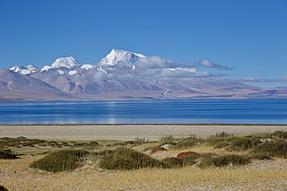
Ngari Prefecture or Ali Prefecture is a prefecture of China's Tibet Autonomous Region covering Western Tibet, whose traditional name is Ngari Khorsum. Its administrative centre and largest settlement is the town of Shiquanhe. It is one of the least densely populated areas in the world, with 0.3 people per kilometer.

Chengguan synonymously referred to as Chamdo or Qamdo is a major town in the historical region of Kham in the eastern Tibet Autonomous Region of China. The seat of Karub District and Chamdo Prefecture, it is Tibet's third largest city after Lhasa and Shigatse with a population of 45,861 in 2010. It is located about 600 km (370 mi) east of Lhasa. By road, the distance is 1,120 km (700 mi) via the southern route or 1,030 km (640 mi) via the northern route. It is at an altitude of 3,230 m (10,600 ft) at the confluence of the rivers Za Qu and Ngom Qu which form the Lancang River (Mekong).

Sog County is a county under the administration of the prefecture-level city of Nagqu of the Tibet Autonomous Region, China.
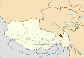
Riwoche is a county under the administration of the prefecture-level city of Chamdo in the Tibet Autonomous Region, China. The county lies in eastern Tibet and borders Qinghai province to the north.

Lhorong County is a county of Chamdo in the Tibet Autonomous Region, China. The county covers an area of 8,108 km2 (3,131 sq mi) and has a population of around 40,000 as of 2003. The word Lhorong means "valley in the south" or "river in the south" in Tibetan.
Baima is a town in Baxoi County, Chamdo Prefecture of the Tibet Autonomous Region of the People's Republic of China. It lies at an altitude of 3,772 metres (12,378 ft). As of 2020, it administers Baima Residential Community and the following eight villages:
Baimai is a Township in Lhorong County, Qamdo Prefecture in the eastern Tibet Autonomous Region of the People's Republic of China. It lies at an altitude of 4,507 metres (14,787 ft) and is located some 48 kilometres (30 mi) west of the village of Gyari.
This is a list of topics related to Tibet.
Cêngdo is a township in Markam County, Chamdo Prefecture, Tibet Autonomous Region of China.
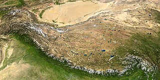
The following outline is provided as an overview of and topical guide to Tibet:

The Battle of Chamdo occurred from 6 to 24 October 1950. It was a military campaign by the People's Republic of China (PRC) to take the Chamdo Region from a de facto independent Tibetan state. The campaign resulted in the capture of Chamdo and the annexation of Tibet by the People's Republic of China.
Coka is a town in Banbar County, Chamdo Prefecture, in the east of the Tibet Autonomous Region, China. It lies just 5 km (3.1 mi) to the southwest of Banbar, and is serviced by Tibet Regional Highway 303 (S303). The administrative division covers an area of 451 km2 (174 sq mi), and as of 2004 had a population of 4,000.
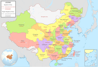
The history of the administrative divisions of China after 1949 refers to the administrative divisions under the People's Republic of China. In 1949, the communist forces initially held scattered fragments of China at the start of the Chinese Civil War. By late 1949, they controlled the majority of mainland China, forcing the Republic of China government to relocate to Taiwan.
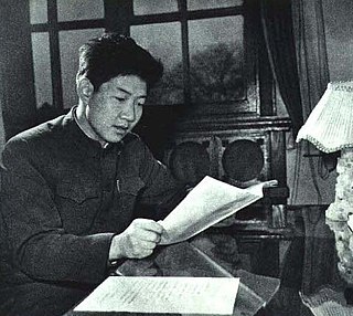
Pagbalha Geleg Namgyai is the 11th Qamdo Pagbalha Hutuktu of Tibetan Buddhism and a politician of the People's Republic of China. He is a Vice Chairman of the Chinese People's Political Consultative Conference (CPPCC), and the Honorary President of the Buddhist Association of China. He also formerly served as a Vice Chairman of the National People's Congress, Vice Chairman of the Tibet Autonomous Region, and Vice President of the Buddhist Association of China. As a Tibetan tulku, he is notable for his willingness to work in the Chinese government, except during the Cultural Revolution.
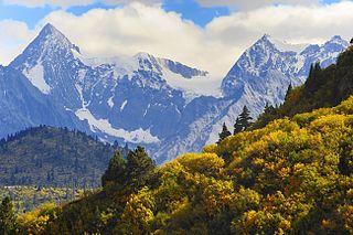
Kangri Karpo, also spelt Gangri Garbo, is a mountain range in eastern Tibet, located primarily in Nyingchi Prefecture as well as a portion of Qamdo Prefecture in the Tibet Autonomous Region, China. The mountain range lies to the east of the Himalayas and to the west of the Hengduan Mountains. The mountains are geographically a southern extension of the eastern Transhimalayas.
Chamdo Region or Qamdo Region (Chinese: 昌都地区; pinyin: Chāngdū Dìqū; Wade–Giles: Chʻang1-tu1 Ti4-chʻü1) was a province-level area of the People's Republic of China comprising most of the western Kham region of traditional Tibet, where the Khampa, a subgroup of the Tibetan people, live. Chamdo split from Xikang Province in 1950 after the Battle of Chamdo. Chamdo was merged into Tibet Autonomous Region in 1965.
Zhu Zhongkui is a former Chinese politician. He surrendered himself to China's top anti-graft agency in October 2021. Previously he served as party secretary of Ngari Prefecture. He was a representative of the 19th National Congress of the Chinese Communist Party.


