CSS Charleston was a casemate ironclad ram built for the Confederate Navy (CSN) at Charleston, South Carolina during the American Civil War. Funded by the State of South Carolina as well as donations by patriotic women's associations in the city, she was turned over to the Confederate Navy and defended the city until advancing Union troops that threatened Charleston caused her to be destroyed in early 1865 lest she be captured. Her wreck was salvaged after the war and the remains have been obliterated by subsequent dredging.

USS Patapsco was a Passaic-class ironclad monitor in the United States Navy during the American Civil War. She was named for the Patapsco River in Maryland.
The First Battle of Fort Wagner was fought on July 10 and 11, 1863, on Morris Island in Charleston harbor during the American Civil War. An attempt by the Union Army to capture Fort Wagner was repulsed. The more famous Second Battle of Fort Wagner, which involved an assault by the 54th Massachusetts, would be fought on July 18.

WWWZ is a commercial radio station in Charleston, South Carolina, owned by Cumulus Media. The station features the Mainstream Urban radio format that plays R&B and hip-hop music. Its studios are located in North Charleston and the transmitter tower is on St. Thomas Island .The station often refers to Charleston by its urban nickname "Chucktown".
John Kresse Arena is a 3,000-seat multi-purpose arena in Charleston, South Carolina. It was the home to the College of Charleston Cougars basketball team from 1982 to 2008. The facility opened as the F. Mitchell Johnson Arena in 1982. In 1994, it was renamed after the school's longtime head basketball coach John Kresse--making Kresse one of the few active collegiate coaches to coach in an arena that is named for him. It hosted the 1997 and 1998 Atlantic Sun Conference men's basketball tournaments. It was replaced by Carolina First Arena, now TD Arena, which opened in October 2008.

The Charleston Open is a WTA Tour affiliated professional tennis tournament for women, held every year since 1973. It is the oldest professional women's tournament with a $750,000 purse. The tournament is played on the green clay courts at the Family Circle Tennis Center on Daniel Island in Charleston, South Carolina, USA. From its inception in 1973 to 2000, the tournament was held at the Sea Pines Plantation on Hilton Head Island with the exception of 1975 and 1976 when it was played on Amelia Island off the coast of Florida. The event moved to Charleston in 2001. From the inaugural edition until 2015 the tournament was named the Family Circle Cup.

The Wando River is a tidewater river in the coastal area of South Carolina. It begins in the town of Awendaw, Charleston County, and has its mouth at the Cooper River shortly before it flows into Charleston Harbor. The Wando's drainage area is 73,061 acres (295.67 km2). Nearby Drum Island is uninhabited. It is spanned by the bridges crossing the Wando River and Towne creek.
College Park is a stadium in Charleston, South Carolina. It was primarily used for baseball and was the home of Charleston RiverDogs. The ballpark has a capacity of 4,000 people and opened in 1940. The grandstand is constructed of metal bleachers and is largely covered by a roof. The first few rows of seats between the dugouts are situated below ground level, giving fans the rare perspective seen from dugout level.

The Charleston Harbor is an inlet of the Atlantic Ocean at Charleston, South Carolina. The inlet is formed by the junction of Ashley and Cooper rivers at 32°49′7.10″N 79°55′40.41″W. Morris and Sullivan's Islands shelter the entrance. Charleston Harbor is part of the Intracoastal Waterway.
USS Peri was one of the ships of the Stone Fleet, sunk in the harbor of Charleston, South Carolina as a blockade during the American Civil War.
USS Stephen Young was one of the ships of the Stone Fleet, sunk in the harbor of Charleston, South Carolina to be used as a blockade during the American Civil War.
WIWF is a commercial radio station located in Charleston, South Carolina, broadcasting to the Lowcountry area on 96.9 MHz. WIWF is currently airing a classic hits format branded as "96.9 The Wolf." Studios are located in North Charleston and the transmitter tower is in Awendaw.

WMGL is a radio station that plays an urban adult contemporary in the Charleston, South Carolina area. It is under ownership of Cumulus Media Inc., through its licensee Radio License Holding CBC, LLC. Its studios are located in North Charleston and the transmitter tower is on St. Thomas Island.
The Battle of Grimball's Landing took place in James Island, South Carolina, on July 16, 1863, during the American Civil War. It was a part of the campaign known as Operations Against the Defenses of Charleston.
WSCI is a noncommercial Classical/News/Talk in Charleston, South Carolina featuring both Classical music as well as news and other programs from NPR. The station is part of the statewide "Classical NPR network" from ETV Radio. There is only one locally produced program on this remotely fed station.

Historic Charleston Foundation (HCF) was founded in 1947 to preserve and protect the integrity of architectural, historical and cultural heritage of Charleston, South Carolina, United States. The Foundation undertakes advocacy, participation in community planning, educational and volunteer programs, the preservation of properties, research, and technical and financial assistance programs. Katharine "Kitty" Robinson has served as president and CEO of the Historic Charleston Foundation since 2000.

North Charleston Air Force Station is a closed United States Air Force General Surveillance Radar station. It is located in the City of North Charleston, South Carolina. It was closed in 1980.
The Battle of James Island was a minor skirmish near the end of the American Civil War. It was known as the "Last fight for Charleston".

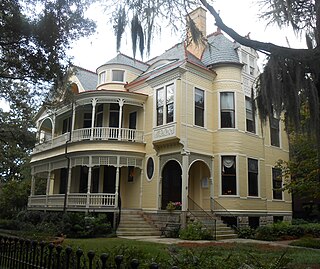
The Albert Sottile House is a Victorian house at 11 College St., Charleston, South Carolina. The house was built by Samuel Wilson in 1890, a prominent merchant and banker. The architect of the house was S.W. Foulk of Richmond, Virginia.

The Richard Brenan House is an early 19th-century house at 207 Calhoun St., Charleston, South Carolina. The house was built for Richard Brenan, a merchant, in 1817 and originally included the adjacent land to the west. The house is a three-story Charleston single house with quoins and fine cornice. The house was a two-story piazza on the west side.


