This article includes a list of references, related reading or external links, but its sources remain unclear because it lacks inline citations .(April 2020) |
Geography | |
---|---|
Coordinates | 50°40′57″S74°21′06″W / 50.682544°S 74.351786°W Coordinates: 50°40′57″S74°21′06″W / 50.682544°S 74.351786°W |
Adjacent bodies of water | Pacific Ocean |
Area | 696 km2 (269 sq mi) |
Coastline | 355.0 km (220.59 mi) |
Administration | |
Region | Magallanes |
Additional information | |
NGA UFI=-876684 |
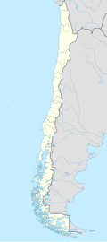
Chatham Island (Spanish: Isla Chatham) is an island in the Magallanes Region, Chile.
Cape Charles is the southwest point of Chatham Island, and is the most prominent of the many headlands in that vicinity. The cape is high, rugged, and barren.
Harwich is a New England town on Cape Cod, in Barnstable County in the state of Massachusetts in the United States. At the 2020 census it had a population of 13,440. Harwich experiences a seasonal increase to roughly 37,000. The town is a popular vacation spot, located near the Cape Cod National Seashore. Harwich's beaches are on the Nantucket Sound side of Cape Cod. Harwich has three active harbors. Saquatucket, Wychmere and Allen Harbors are all in Harwich Port. The town of Harwich includes the villages of Pleasant Lake, West Harwich, East Harwich, Harwich Port, Harwich Center, North Harwich and South Harwich.
Cape Cod is a geographic cape extending into the Atlantic Ocean from the southeastern corner of mainland Massachusetts, in the northeastern United States. Its historic, maritime character and ample beaches attract heavy tourism during the summer months. The name Cape Cod, coined in 1602 by Bartholomew Gosnold, is the ninth oldest English place-name in the U.S.
The geography of Chile is extremely diverse as the country extends from a latitude of 17° South to Cape Horn at 56° and from the ocean on the west to Andes on the east. Chile is situated in southern South America, bordering the South Pacific Ocean and a small part of the South Atlantic Ocean. Chile's territorial shape is among the world's most unusual. From north to south, Chile extends 4,270 km (2,653 mi), and yet it only averages 177 km (110 mi) east to west. Chile reaches from the middle of South America's west coast straight down to the southern tip of the continent, where it curves slightly eastward. Diego Ramírez Islands and Cape Horn, the southernmost points in the Americas, where the Pacific and Atlantic oceans meet, are Chilean territory. Chile's northern neighbors are Peru and Bolivia, and its border with Argentina to the east, at 5,150 km (3,200 mi), is the world's third-longest. The total land size is 756,102 km2 (291,933 sq mi). The very long coastline of 6,435 km (3,999 mi) gives it the 11th largest exclusive economic zone of 3,648,532 km2 (1,408,706 sq mi).
Barnstable County is a county located in the U.S. state of Massachusetts. At the 2020 census, the population was 228,996. Its shire town is Barnstable. The county consists of Cape Cod and associated islands.
In geography and geology, a cliff is an area of rock which has a general angle defined by the vertical, or nearly vertical. Cliffs are formed by the processes of weathering and erosion, with the effect of gravity. Cliffs are common on coasts, in mountainous areas, escarpments and along rivers. Cliffs are usually composed of rock that is resistant to weathering and erosion. The sedimentary rocks that are most likely to form cliffs include sandstone, limestone, chalk, and dolomite. Igneous rocks such as granite and basalt also often form cliffs.
Chatham is a town in Barnstable County, Massachusetts, United States. Chatham is located at the southeast tip of Cape Cod, and has historically been a fishing community. First settled by the English in 1664, the township was originally called Monomoit based on the indigenous population's term for the region. Chatham was incorporated as a town on June 11, 1712, and has become a summer resort area. The population was 6,594 at the 2020 census, and can swell to 25,000 during the summer months. There are four villages that comprise the town, those being Chatham (CDC), South Chatham, North Chatham, and West Chatham. Chatham is home to the Monomoy National Wildlife Refuge, and the decommissioned Monomoy Point Light both located on Monomoy Island. A popular attraction is the Chatham Light, which is an operational lighthouse that is operated by the United States Coast Guard.
Chatham may refer to:
Mainland is defined as "relating to or forming the main part of a country or continent, not including the islands around it [regardless of status under territorial jurisdiction by an entity]." The term is often politically, economically and/or demographically more significant than politically associated remote territories, such as exclaves or oceanic islands situated outside the continental shelf.
Cape Horn is the southernmost headland of the Tierra del Fuego archipelago of southern Chile, and is located on the small Hornos Island. Although not the most southerly point of South America, Cape Horn marks the northern boundary of the Drake Passage and marks where the Atlantic and Pacific Oceans meet.
The Chilean Antarctic Territory or Chilean Antarctica is the territory in Antarctica claimed by Chile. The Chilean Antarctic Territory ranges from 53° West to 90° West and from the South Pole to the 60° South parallel, partially overlapping the Argentine and British Antarctic claims. It is administered by the Cabo de Hornos municipality in the South American mainland.
Desolación Island is an island at the western end of the Strait of Magellan in the Magallanes y la Antártica Chilena Region, Chile.
Hanover Island is an island in the Magallanes Region. It is separated from the Chatham Island by the Esteban Channel, Guías Narrows and Inocentes Channel.
The Antarctic Floristic Kingdom, also the Holantarctic Kingdom, is a floristic kingdom that includes most areas of the world south of 40°S latitude. It was first identified by botanist Ronald Good, and later by Armen Takhtajan. The Antarctic Floristic Kingdom is a classification in phytogeography, different from the Antarctic realm classification in biogeography, and from Antarctic flora genera/species classifications in botany.
Ramirez Island is an island in the Queen Adelaide Archipelago, located west of Vidal Gormaz Islands and Rennell Islands and south of Nelson Strait.
Acuy is a small island southeast of the town of Queilén. It is about 2 km long and 500 m wide at its largest points, and therefore has only a small population.
Monomoy Regional High School is a regional secondary school located in Harwich, Massachusetts, United States, within Barnstable County. Monomoy Regional High School serves approximately 625 students in grades 8-12 from the towns of Chatham and Harwich.
The Guía Narrows are located between Chile's Hanover and Chatham Islands. Guia Narrows connects Sarmiento and Inocentes Channels. The narrows are 6 miles long and are 1 to 1.5 miles wide, except at the north end, between Porpoise Point, low and sharp, on the west side, and Guard Island on the east, where the breadth is about 400 yards, but generally, there is no danger; the shores being steep-to on either side. Sometimes, the tide sweeps strongly around the point; therefore, it would be advisable to keep closer to Guard Island while passing through.