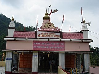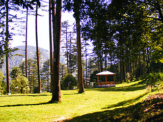
The Pulwama district is a district in the Indian Union territory of Jammu and Kashmir, located in the south of Srinagar. The district headquarters of Pulwama district are located in Pulwama city.

Chamoli district is a district of the Uttarakhand state of India. It is bounded by the Tibet region to the north, and by the Uttarakhand districts of Pithoragarh and Bageshwar to the east, Almora to the south, Pauri Garhwal to the southwest, Rudraprayag to the west, and Uttarkashi to the northwest. The administrative headquarters of Chamoli district is in Gopeshwar.

Milam Glacier is a major glacier of the Kumaon Himalaya.

Pauri Garhwal is a district in the Indian state of Uttarakhand. Its headquarters is in the town of Pauri. It is sometimes referred to simply as Garhwal district, though it should not be confused with the larger Garhwal region of which it is only a part.

Tehri Garhwal is a district in the hill state of Uttarakhand, India. Its administrative headquarters is at New Tehri. The district has a population of 618, 931, a 2.35% increase over the previous decade. It is surrounded by Rudraprayag District in the east, Dehradun District in the west, Uttarkashi District in the north, and Pauri Garhwal District in the south. Tehri Garhwal is a part of the Himalayas

Rudraprayag is a district of the state of Uttarakhand of northern India. The district occupies an area of 1984 km2. The town of Rudraprayag is the administrative headquarters of the district. The district is bounded by Uttarkashi District on the north, Chamoli District on the east, Pauri Garhwal District on the south, and Tehri Garhwal District on the west.

Kotdwar is a city, a municipal corporation and a tehsil in the Pauri Garhwal district of Uttarakhand, India. It's just 101 km from Pauri town, the district headquarter. It is the eighth-largest city in Uttrakhand. Its old name was "Khohdwar", which means the gateway of the river Khoh since it is located on the bank of river Khoh. It is situated in the southwestern part of the state and is one of the main entrance points in the state of Uttarakhand.
Ramganga is a tributary of the river Ganges, originating in Uttarakhand state, India.

Dhanaulti is a hill station situated in the foothills of the Garhwal Himalayan range located 115 km (71 mi) from New Tehri, the district headquarter, 60 km from the hill station of Mussoorie. Dhanaulti is a tehsil in Tehri Garhwal district, Uttarakhand, India.

Kanwari, also spelled Kunwari, or Kwari, is a village of 7,000 population, in Hansi-I Tehsil, Hisar-1 Rural Development Block, Hansi and Hisar of Hisar District of Hisar Division in the Haryana state of India. It is part of the saat bas bhaichara grouping of 7 villages. The village has 4 panna/patti (subdivisions), named as Nangalia Panna , upparla Panna , parla Panna , etc. with a total revenue land area of 43903 kanal or 5487 acre as per HALRIS records.

Satpuli is a town on the Meerut-Pauri highway, located approximately 50 kilometers from Kotdwar and 50 kilometers from Pauri, in Pauri Garhwal district of Uttarakhand.
Ghansali is located in Ghansali Tehsil of Tehri Garhwal district in Uttarakhand, India. Ghansali town offers a splendid beauty of Bhilangana river on one side and dense forest at other. According to the 2011 census it has a population of 392 living in 82 households. Its main agriculture product is paddy growing.
Rongpo or Rangpo is a West Himalayish language spoken in Uttarakhand, India.

Rathsun or Rathsoon is a village and block located in the Jammu and Kashmir's Budgam district. It is situated at the base of the Pir Panjal Range of the Himalayas. It falls under the administrative division of tehsil Beerwah one of the nine tehsils of district Budgam. It is about 23.7 km via Beerwah-Budgam Road from district headquarters Budgam, 7 km (4.3 mi) from sub-district headquarters Beerwah, known as the Gateway of Doodhpathri and Gateway of Tosamaidan, and 29 km away from Srinagar, the summer capital of Jammu and Kashmir. Magam, known as the Business Hub of Budgam district and the Gateway of Gulmarg, is nearest town to Rathsun which is approximately 4 kilometres (2.5 mi) away.

Thalisain is a town and tehsil of Pauri Garhwal district in the North Indian state of Uttarakhand. At an altitude of 1690 metres from sea level, it is situated on a gentle slope above the right bank of Nayaar (East) river. It is in the southwestern foothills of Dudhatoli Range and at a distance of 83 kilometers from Pauri town and 95 kilometers from Gairsain, the future capital of Uttarakhand.

Mehalchauri is a village in Gairsain Tehsil located in Chamoli district in the Indian state of Uttarakhand. It is situated in Garhwal mandal nearby the center of the Garhwal and Kumaon mandal.

Mendhar is a tehsil in the Poonch district of the Indian union territory of Jammu and Kashmir. It is located in the foothills of Pir Panjal range within the Himalayas. The Mendhar Tehsil headquarters is in Mendhar town. It is located 60 km (37 mi) south of the Poonch district headquarters and 210 km (130 mi) from the state winter capital Jammu.
Chaubttakhal Uttarakhand Legislative Assembly constituency is one of the 70 constituencies in the Uttarakhand Legislative Assembly of Uttarakhand state of India. Chaubattakhal is also part of Garhwal Lok Sabha constituency.

Narbal is a tehsil in central Kashmir's Beerwah sub-district. It is also a block in Budgam district in the Indian administered union territory of Jammu and Kashmir. It is 18 km (11 mi) away from sub-district headquarter Beerwah and 13 km (8.1 mi) away from Srinagar, the summer capital of Jammu and Kashmir.

Ekeshwar is a block in Pauri Garhwal district of Uttarakhand. It is 59 km (37 mi) from district headquarter Pauri, at an altitude of 1,820 metres (5,970 ft) in a rural region and surrounded by forest. Ekeshwar falls is in Chaubattakhal. There are 283 villages in Ekeshwar.


