
The Royal Borough of Kensington and Chelsea is an Inner London borough with royal status. It is the smallest borough in London and the second smallest district in England; it is one of the most densely populated administrative regions in the United Kingdom. It includes affluent areas such as Notting Hill, Kensington, South Kensington, Chelsea, and Knightsbridge.

Notting Hill is a district of West London, England, in the Royal Borough of Kensington and Chelsea. Notting Hill is known for being a cosmopolitan and multicultural neighbourhood, hosting the annual Notting Hill Carnival and the Portobello Road Market. From around 1870, Notting Hill had an association with artists.

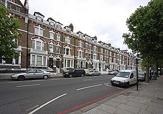
Chelsea is an affluent area in West London, England, due south-west of Charing Cross by approximately 2.5 miles. It lies on the north bank of the River Thames and for postal purposes is part of the south-western postal area.

Sloane Square is a London Underground station in Chelsea, serving Sloane Square. It is served by the District and Circle lines, between South Kensington and Victoria stations and is in Travelcard Zone 1.

The Metropolitan Borough of Chelsea was a metropolitan borough of the County of London between 1900 and 1965. It was created by the London Government Act 1899 from most of the ancient parish of Chelsea. Following the London Government Act 1963, it was amalgamated with the Royal Borough of Kensington in 1965 to form the Royal Borough of Kensington and Chelsea.
King's Road or Kings Road is a major street stretching through Chelsea and Fulham, both in west London, England. It is associated with 1960s style and with fashion figures such as Mary Quant and Vivienne Westwood. Sir Oswald Mosley's Blackshirt movement had a barracks on the street in the 1930s.
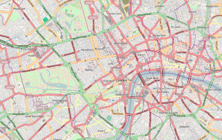
Central London is the innermost part of London, in England, spanning the City of London and several boroughs. Over time, a number of definitions have been used to define the scope of Central London for statistics, urban planning and local government. Its characteristics are understood to include a high-density built environment, high land values, an elevated daytime population and a concentration of regionally, nationally and internationally significant organisations and facilities.

Ladbroke Grove is an area and a road in North Kensington in the Royal Borough of Kensington and Chelsea, passing through Kensal Green and Notting Hill, running north–south between Harrow Road and Holland Park Avenue.

Bayswater Road is the main road running along the northern edge of Hyde Park in London. Originally part of the A40 road, it is now designated part of the A402 road.
Holland Road is a road in Kensington, London, which connects Kensington High Street with the Holland Park roundabout. The southernmost section is one-way and forms part of the Kensington/Earl's Court one-way system.

Chelsea Embankment is part of the Thames Embankment, a road and walkway along the north bank of the River Thames in central London, England.

Brompton Road is a street located in the southern part from Knightsbridge and in the eastern part from Brompton in the Royal Borough of Kensington and Chelsea and partly the City of Westminster in London.

North Kensington is an area of west and northwest London. It is north of Notting Hill and south of Kensal Green predominately in the Royal Borough of Kensington and Chelsea and partly in the London Borough of Brent and City of Westminster. The names North Kensington and Ladbroke Grove describe the same area.

Fulham Road is a street in London, England, which comprises the A304 and part of the A308.

Cremorne Gardens were popular pleasure gardens by the side of the River Thames in Chelsea, London. They lay between Chelsea Harbour and the end of the King's Road and flourished between 1845 and 1877; today only a vestige survives, on the river at the southern end of Cheyne Walk.

Chelsea and Fulham is a constituency in Greater London represented in the House of Commons of the UK Parliament by Ben Coleman of the Labour Party.

Crossrail 2 is a suspended proposal for a hybrid commuter rail and rapid transit route in South East England, running from nine stations in Surrey to three in Hertfordshire, providing a new North–South rail link across Greater London. It would connect the South West Main Line to the West Anglia Main Line, via Victoria and King's Cross St Pancras. The intent was to alleviate severe overcrowding that would otherwise occur on commuter rail routes into Central London. When first proposed, the hope was for construction to start around 2023, with the new line opening from the early 2030s. The project's cost has been estimated at £31.2 billion.

King's Road Chelsea railway station is a proposed station on Crossrail 2, a planned underground railway line through London in the United Kingdom. If constructed, the station would serve the King's Road area of Chelsea.
Ladbroke Grove is a proposed railway station in London, England on the Crossrail Route between Old Oak Common and Paddington. This is not part of the internal route and would be added at a later stage. Locals want the station to be called Portobello Central to serve the nearby Portobello Market. It was originally called Kensal.

Dovehouse Street is a street in Chelsea, London. It runs roughly north to south from Fulham Road to King's Road, having junctions with Cale Street and Britten Street, among others.
