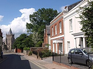
Ottery St Mary, known as "Ottery", is a town and civil parish in the East Devon district of Devon, England, on the River Otter, about 10 miles (16 km) east of Exeter on the B3174. At the 2001 census, the parish, which includes the villages of Metcombe, Fairmile, Alfington, Tipton St John, Wiggaton, and West Hill, had a population of 7,692. The population of the urban area alone at the 2011 census was 4,898. In 2021 the parish had a population of 7,986.

Lytchett Matravers is a large village and civil parish in Dorset, England. The 2011 census recorded the parish as having 1,439 households and a population of 3,424.

Silverton is a large village and civil parish, about 8 miles (13 km) north of Exeter, in the English county of Devon. It is one of the oldest villages in Devon and dates from the first years of the Saxon occupation.

Broadhempston is a village, parish and former manor in Devon, England, situated about 4 miles north of Totnes. It is now administered by Teignbridge District Council. According to the 2001 census the parish contained 257 houses with a population of 641.

Whimple is a village and civil parish in East Devon in the English county of Devon, approximately 9 miles (14 km) due east of the city of Exeter, and 3 miles (4.8 km) from the nearest small town, Ottery St Mary. The parish has a population of 1,983, recounted to 1,120 for the built up area in the United Kingdom Census 2021. The electoral ward with the same name had a population of 2,380 at the above census.

Cheriton Fitzpaine is a village in Devon, England, located 4 miles (7 km) north-east of Crediton. The population of the parish in the 2011 Census was 556.

Landkey is a village and civil parish in the North Devon district, in the county of Devon, England. The parish has a population of 2,302 according to the 2021 census. It is situated 3 miles (4.8 km) from the nearest town of Barnstaple. The village is a major part of the electoral ward called Landkey, Swimbridge and Taw.

West Meon is a village and civil parish in Hampshire, England, with a population of 749 people at the 2011 census.

Tedburn St Mary is a village and civil parish in the Teignbridge district of Devon, England, approximately 8 miles west of Exeter. According to the 2021 census, it had a population of 1,550, which was slightly more than the 1,472 recorded at the 2011 census. The village is the principal population centre of the electoral ward called Teignbridge North. The population of the ward at the 2011 census is 2,715.

St Anthony-in-Meneage is a coastal civil parish and village in Cornwall, England, United Kingdom. The parish is in the Meneage district of the Lizard peninsula. In the 2001 census the parish had a population of 171, decreasing to 168 at the 2011 census.

Brampford Speke is a small village in Devon, 4 miles (6 km) to the north of Exeter. The population is 419. It is located on red sandstone cliffs overlooking the river Exe. Its sister village of Upton Pyne lies to its southwest, and Stoke Canon is across the river, to the east. To the south is the hamlet of Cowley with its chapel of ease, which was formerly part of the ecclesiastical parish of Brampford Speke.

Burrington is a village and civil parish in North Devon in England. In 2001 the population was 538.

Mabe is a village and civil parish in Cornwall, England, United Kingdom. The village is situated one mile (1.6 km) west of Penryn.

Meavy is a small village, civil parish and former manor in the English county of Devon. Meavy forms part of the district of West Devon. It lies a mile or so east of Yelverton. The River Meavy runs near the village. For administrative purposes the parish is grouped with the parishes of Sheepstor and Walkhampton to form Burrator Parish Council, and for electoral purposes it is grouped with the same two parishes to form Burrator Ward.

Thorverton is a civil parish and village in Devon, England, about a mile west of the River Exe and 8 miles (13 km) north of Exeter. It is almost centrally located between Exeter and the towns of Tiverton, Cullompton and Crediton, and contains the hamlets of Yellowford and Raddon. The parish is surrounded, clockwise from the north, by the parishes of Bickleigh, Rewe, Nether Exe, Brampford Speke, Upton Pyne, Shobrooke, Stockleigh Pomeroy and Cadbury. Most of the eastern boundary of the parish is formed by the River Exe and the land rises westwards to 800 feet (240 m) at the border with Cadbury.

Bramdean is a village and former civil parish, now in the parish of Bramdean and Hinton Ampner, in the Winchester district, in the county of Hampshire, England. It is a linear settlement located along the busy A272 trunk road which was widened by the American troops in 1943 in preparation for D-Day.
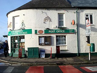
Stoke Canon is a small village and civil parish near the confluence of the rivers Exe and Culm on the main A396 between Exeter and Tiverton in the English county of Devon, and the district of East Devon. At the 2001 census, it had a population of 660. The population was unchanged in 2011 but the village forms the major part of the Exe Valley electoral ward. The population of this ward was 2,041 at the 2011 Census.

Kelly is a small village in west Devon, England.

Shirwell is a village, civil parish and former manor in the local government district of North Devon, in the county of Devon, England. It was also formerly the name of a hundred of Devon. The village lies about 3.5 miles north-east of the town of Barnstaple, to the east of the A39 road to Lynton. The parish is surrounded clockwise from the north by the parishes of East Down, Arlington, Loxhore, Bratton Fleming, Goodleigh, Barnstaple, West Pilton and Marwood. In 2001 its population was 333, little changed from the 1901 figure of 338.

Ringmore is a village and civil parish in the South Hams district, on the coast of Devon, England. The population taken at the 2011 census was 208.
