
Bethnal Green is an area in London, England and is located in the London Borough of Tower Hamlets. It is in east London and part of the East End. The area emerged from the small settlement which developed around the Green, much of which survives today as Bethnal Green Gardens, beside Cambridge Heath Road. By the 16th century the term applied to a wider rural area, the Hamlet of Bethnal Green, which subsequently became a Parish, then a Metropolitan Borough before merging with neighbouring areas to become the north-western part of the new Tower Hamlets.

Whitechapel is an area in London, England, and is located in the London Borough of Tower Hamlets. It is in east London and part of the East End. It is the location of Tower Hamlets Town Hall and therefore the borough town centre. Whitechapel is located 3.4 miles (5.5 km) east of Charing Cross.

The London Borough of Tower Hamlets is a borough of London, England. Situated on the north bank of the River Thames and immediately east of the City of London, the borough spans much of the traditional East End of London and includes much of the regenerated London Docklands area. The 2019 mid-year population for the borough is estimated at 324,745.

Ronald "Ronnie" Kray and Reginald "Reggie" Kray were English gangsters or organised crime figures and identical twin brothers from Haggerston who were prominent from the late 1950s until their arrest in 1968. Their gang, known as the Firm, was based in Bethnal Green, where the Kray twins lived. They were involved in murder, armed robbery, arson, protection rackets, gambling and assaults. At their peak in the 1960s, they gained a certain measure of celebrity status by mixing with prominent members of London society, being photographed by David Bailey and interviewed on television.

Aldgate was a gate in the former defensive wall around the City of London.

Ludgate Hill is a street and surrounding area, on a small hill in the City of London, England. The street passes through the former site of Ludgate, a city gate that was demolished – along with a gaol attached to it – in 1760.

Spitalfields is an area in London, England and is located in the London Borough of Tower Hamlets. It is in East London and situated in the East End. Spitalfields is formed around Commercial Street and Brick Lane. It has several markets, including Spitalfields Market, the historic Old Spitalfields Market, Brick Lane Market and Petticoat Lane Market. The area has a long attracted migrants from overseas, including many Jews, whose presence gained the area the 19th century nickname of Little Jerusalem.

Bethnal Green was a civil parish and a metropolitan borough of the County of London between 1899 and 1965, when it was merged with the Metropolitan Borough of Stepney and the Metropolitan Borough of Poplar to form the London Borough of Tower Hamlets.

Brick Lane is a famous street in the East End of London, in the borough of Tower Hamlets. It runs from Swanfield Street in Bethnal Green in the north, crosses the Bethnal Green Road before reaching the busiest, most commercially active part which runs through Spitalfields, or along its eastern edge. Brick Lane's southern end is connected to Whitechapel High Street by a short extension called Osborn Street.
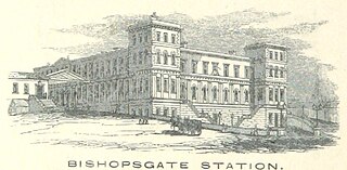
Bishopsgate was a railway station located on the eastern side of Shoreditch High Street in the parish of Bethnal Green on the western edge of the East End of London and just outside the City of London.
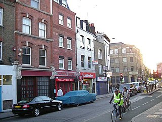
Cable Street is a road in the East End of London, England, with several historic landmarks nearby. It was made famous by the Battle of Cable Street in 1936.

Shoreditch High Street is a London Overground station located on Bethnal Green Road in Shoreditch in East London. It is served by the East London Line between Whitechapel and Hoxton with services running either to Dalston Junction, Highbury & Islington or New Cross, New Cross Gate, West Croydon, Crystal Palace, and is in Travelcard Zone 1.

Hauser & Wirth is a Swiss contemporary and modern art gallery.
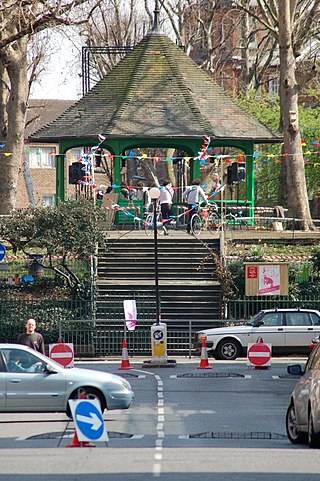
The Boundary Estate is a housing development in the London Borough of Tower Hamlets, in the East End of London.
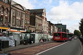
Whitechapel Road is a major arterial road in Whitechapel, Tower Hamlets, in the East End of London. It is named after a small chapel of ease dedicated to St Mary and connects Whitechapel High Street to the west with Mile End Road to the east in Stepney. The road is part of the historic Roman road from London to Colchester, now the A11.
Gregor Muir is Director of Collection, International Art, at Tate, having previously been the Executive Director of the Institute of Contemporary Arts in London from 2011 to 2016. He was the director of Hauser & Wirth, London, at 196a Piccadilly, from 2004 to 2011. He is also the author of a 2009 memoir in which he recounts his direct experience of the YBA art scene in 1990s London.

Columbia Road Flower Market is a street market in Bethnal Green in London, England. Columbia Road is a road of Victorian shops situated off Hackney Road in the London Borough of Tower Hamlets. The market is open on Sundays only.

Brady Street is a road located in Whitechapel, East London. It runs from Whitechapel Road in the south to Three Colts Lane, near Bethnal Green railway station, in the north. It was formerly known as North Street.
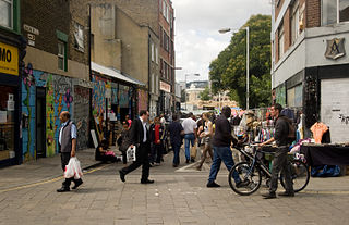
Brick Lane Market is the collective name for a number of London markets centred on Brick Lane, in Tower Hamlets in east London. The original market was located at the northern end of Brick Lane and in the heart of what is now east London's Bangladeshi community but now commonly refers to the various markets that are housed along the famous London street. The various markets that stretch the length of Brick Lane operate both weekdays but most historically weekends: Saturday from 11 a.m. to 6 p.m. and Sunday from 10 a.m. to 6 p.m.
Repton Boxing Club is a boxing club in Bethnal Green, east London, England. The club grew out of Repton Boys Club, which was founded by Repton School, a public school in Derbyshire. Repton Boys Club was set up by the school to help underprivileged young men in east London.


