Beverly Hills is a city in Los Angeles County, California. Located within 5.71 square miles (14.8 km2), and surrounded by the cities of Los Angeles and West Hollywood, it has a population of 32,701 according to the 2020 census.
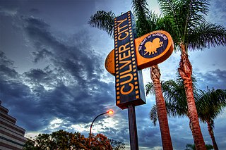
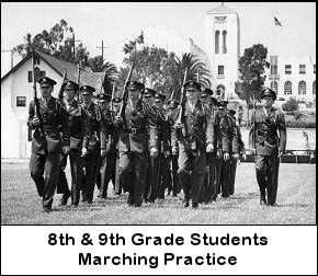
Culver City is a city in Los Angeles County, California. As of the 2020 census, the population was 40,779. Founded in 1917 as a "whites only" Sundown Town, it is now a multicultural city with what was called the “third-most diverse school district in California” in 2020.
Palms is a community in the Westside region of Los Angeles, California, founded in 1886 and the oldest neighborhood annexed to the city, in 1915. The 1886 tract was marketed as an agricultural and vacation community. Today it is a primarily residential area, with many apartment buildings, ribbons of commercial zoning and a single-family residential area in its northwest corner. As of the 2000 census the population of Palms was 42,545.
The Los Angeles Westside is an urban region in western Los Angeles County, California. It has no official definition, but sources like LA Weekly and the Mapping L.A. survey of the Los Angeles Times place the region on the western side of the Los Angeles Basin south of the Santa Monica Mountains.
Beverlywood is a neighborhood in the Westside of the city of Los Angeles, California.
West Los Angeles is an area within the city of Los Angeles, California. The residential and commercial neighborhood is divided by the Interstate 405 freeway, and each side is sometimes treated as a distinct neighborhood, mapped differently by different sources. Each lies within the larger Westside region of Los Angeles County.

Beverly Hills Post Office (BHPO) is the name given to a section of Los Angeles, California, that lies within the 90210 ZIP code, assigned to the Beverly Hills Post Office. Los Angeles mailing addresses with the ZIP code 90210 may be written as "Beverly Hills, CA 90210", though the properties themselves lie outside of the Beverly Hills city limits.

Wilshire Boulevard is a prominent 15.83 mi (25.48 km) boulevard in the Los Angeles area of Southern California, extending from Ocean Avenue in the city of Santa Monica east to Grand Avenue in the Financial District of downtown Los Angeles. One of the principal east-west arterial roads of Los Angeles, it is also one of the major city streets through the city of Beverly Hills. Wilshire Boulevard runs roughly parallel with Santa Monica Boulevard from Santa Monica to the west boundary of Beverly Hills. From the east boundary it runs a block south of Sixth Street to its terminus.

Chaminade College Preparatory is a private Catholic preparatory school with two campuses in San Fernando Valley, Los Angeles County, California.

South Robertson is a neighborhood in the Westside of the city of Los Angeles, California. It is notable for its diversity and being a center for the Jewish community.

Robertson Boulevard is a street in Los Angeles, in the U.S. state of California, that also passes through the incorporated cities of West Hollywood, Beverly Hills, and Culver City.
Claud W. Beelman, sometimes known as Claude Beelman, was an American architect who designed many examples of Beaux-Arts, Art Deco, and Streamline Moderne style buildings. Many of his buildings are listed on the National Register of Historic Places.

Pico-Robertson is a relatively densely-populated neighborhood in the Westside of Los Angeles, California, flanked on the north, northeast, and west by Beverly Hills, on the east by Carthay and Mid-City, on the south by Mid-City, Beverlywood and Cheviot Hills. It is notable for its large Jewish population.
Cheviot Hills is a neighborhood on the Westside of the city of Los Angeles, California.
The Baldwin Hills are a low mountain range surrounded by and rising above the Los Angeles Basin plain in central Los Angeles County, California. The Pacific Ocean is to the west, the Santa Monica Mountains to the north, Downtown Los Angeles to the northeast, and the Palos Verdes Hills to the south - with all easily viewed from the Baldwin Hills.

The Beverly Hills Oil Field is a large and currently active oil field underneath part of the US cities of Beverly Hills, California, and portions of the adjacent city of Los Angeles. Discovered in 1900, and with a cumulative production of over 150 million barrels of oil, it ranks 39th by size among California's oil fields, and is unusual for being a large, continuously productive field in an entirely urban setting. All drilling, pumping, and processing operations for the 97 currently active wells are done from within four large "drilling islands", visible on Pico and Olympic boulevards as large windowless buildings, from which wells slant diagonally into different parts of the producing formations, directly underneath the multimillion-dollar residences and commercial structures of one of the wealthiest cities in the United States. Annual production from the field was 1.09 million barrels in 2006, 966,000 barrels in 2007, and 874,000 in 2008, and the field retains approximately 11 million barrels of oil in reserve, as estimated by the California Department of Conservation. The largest operators as of 2009 were independent oil companies Plains Exploration & Production and BreitBurn Energy.
George Konheim (1917–2001) was an American real estate developer and philanthropist.

Castle Heights is a neighborhood on the Westside of the city of Los Angeles, California.

The old Beverly Hills Main Post Office is a Renaissance Revival building at the Beverly Hills Civic Center in Beverly Hills, California. The building has carried the addresses 469 North Crescent Drive and 470 North Canon Drive. It was built as the main post office in the 1930s, remaining a post office until the 1990s, and in the 2010s became the Paula Kent Meehan Historic Building of the Wallis Annenberg Center for the Performing Arts.
Maynard Lyndon was an American architect. He designed over 40 school buildings in Michigan and California, including the Northville School, known as "the first modern public school in North America". He also designed Bunche Hall on the UCLA campus.