Related Research Articles

Punjab, also known as the Land of the Five Rivers, is a geopolitical, cultural, and historical region in South Asia. It is located in the northwestern part of the Indian subcontinent, comprising areas of modern-day eastern-Pakistan and northwestern-India. Punjab's major cities are Lahore, Faisalabad, Rawalpindi, Gujranwala, Multan, Ludhiana, Amritsar, Sialkot, Chandigarh, Shimla, Jalandhar, Patiala, Gurugram, and Bahawalpur.

Punjab is a province of Pakistan. With a population of over 127 million, it is the most populous province in Pakistan and second most populous subnational polity in the world. Located in the central-eastern region of the country, it has the largest economy, contributing the most to national GDP, in Pakistan. Lahore is the capital and largest city. Other major cities include Faisalabad, Rawalpindi, Gujranwala and Multan.

Mandi district is one of the central districts of Himachal Pradesh state in northern India. The town of Mandi is the headquarters of the district.

Salcete or Salcette is a subdivision of the district of South Goa, in the state of Goa, situated by the west coast of India. The Sal River and its backwaters dominate the landscape of Salcete. Historically, the sixty-six settlements south of the Zuari River formed the original Salcette territory. Salcete forms a part of the bigger Konkan region that stretches along the western shoreline of peninsular India.

Hoshiarpur district is a district of Punjab state in northern India. Hoshiarpur, one of the oldest districts of Punjab, is located in the North-east part of the Punjab state and shares common boundaries with Gurdaspur district in the north-west, Jalandhar district and Kapurthala district in south-west, Kangra district and Una district of Himachal Pradesh in the north-east. Hoshiarpur district comprises 4 sub-divisions, 10 community development blocks, 9 urban local bodies and 1417 villages. The district has an area of 3365 km2. and a population of 1,586,625 persons as per census 2011.

Jhang is the capital city of Jhang District in central Punjab, Pakistan. Situated on the east bank of the Chenab river, it is the 13th most populous city of Pakistan.

The Punjab Province was a province of British India. Most of the Punjab region was annexed by the British East India Company on 29 March 1849; it was one of the last areas of the Indian subcontinent to fall under British control.

Patiala district is one of the twenty three districts in the state of Punjab in north-west India.

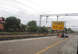
Palwal is a city and a municipal council. It is the headquarters of Palwal district, the 21st district of Haryana state in northern India. It is a centre of the cotton trade in the area. It is part of Braj region. It is also a part of National Capital Region.

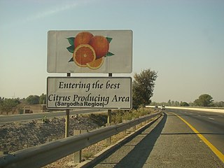
Sargodha District, is a district of Punjab, Pakistan. The capital of the district is Sargodha. It is an agricultural district with wheat, rice, sugarcane and kinnow being its main crops. The Sargodha district and region is also famous for citrus fruit including Kinnow, orange and lemon. The district has an area of 5,864 km2.

Jalandhar district is a district in Doaba region of the state of Punjab, India. The district headquarters is the city of Jalandhar.
A sarpanch, gram pradhan, mukhiya, or president is a decision-maker, elected by the village-level constitutional body of local self-government called the gram sabha in India. The sarpanch, together with other elected panchayat members, constitute gram panchayats and zilla panchayats. The sarpanch is the focal point of contact between government officers and the village community and retains power for five years. the term used to refer to the sarpanch can vary across different states of India. Here are some of the commonly used terms for sarpanch in various states: panchayat president, gram pramukh, gram pradhan, gram adhyaksha, gaon panchayat president, gram panchayat president, etc.
Curtorim is a town in the Salcette taluka of South Goa district in Goa, India.It comes under Margao metropolitan region. Curtorim, a verdant agrarian village, known as the "granary of Salcete", is said to have got its name from either kuddtari or kuddtoddi since the agricultural village had kudds (rooms) built on the river bank to store kharif and rabi crops.

Palwal district was created on 15 August 2008. It is the 21st district of Haryana state in Delhi NCR region of northern India. Palwal City is the headquarters of the district. It is part of the Braj region.

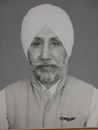
Jagbir Singh Chhina (1920-2012) was a freedom fighter who worked during the freedom movement with Comrade Achhar Singh Chhina, Pratap Singh Kairon, Sohan Singh Josh, Mohan Singh Batth, Gurdial Singh Dhillon and Harkishan Singh Surjeet against the British empire. He has served the community since 1938 as an active member of society.

The Taoni is a Rajput ethnic group who, dominated a region in Ambala district then a part of the Punjab until the period of the British India. They are an offshoot of Bhati Rajputs of the Kingdom of Jaisalmer. The Taoni (Bhatis) also ruled over Punjab Hill states such as in Sirmur State until 1948. Before the Partition of India, In areas surrounding Rajpura and Patiala, the Taons or Taoni had 14 Chhats and 24 makans, the chhats – being Banur, Shamdo, Kauli, Ghanaur, Patton, Khera Gujju, Suhron, Ajrawar, Chamaru, Manakpur, Jausla, Kharar, Khanpur and Morinda. According to the tradition of the tribe, their eponymous ancestor Raja Tan was a grandson of Rawal Shalivahan Singh II, the King of Jaisalmer (1168–1200). The said Raja Tan left Jaisalmer and came to Jalandhar, Punjab. Later, His descendent Raja Amba founded the city of Ambala and made it the capital of his kingdom.
General elections were held in British India in November 1923 for both the Central Legislative Assembly and Provincial Assemblies. The Central Legislative Assembly had 145 seats, of which 105 were elected by the public.
The Warya is a Rajput and Jat clan found predominantly in the Punjab and Sindh provinces of Pakistan and in the state of Gujarat in India.

Singhpuria Misl, also known as the Faizulpuria Misl, was founded by the Sikh warrior Nawab Kapur Singh, who was born in 1697 and later became a prominent Dal Khalsa leader. The misl took its original name from a village Faizullapur in Amritsar and then changed the name of the village to Singhpura, with the misl eventually following.

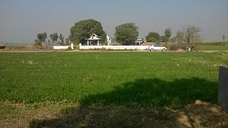
Sowaddi Kalan or Swaddi Khas is a village in Ludhiana district in the Indian state of Punjab. Kalan is Persian language word which means Big. It is one of the most educated villages in the area. Swaddi Kalan is a large village in Jagraon of Ludhiana district with a total of 954 families and 4,804 residents in 2011.
References
- ↑ Gait, Edward (1902). Census of India, 1901: Punjab and North West Frontier Province (2 v.). Office of the Superintendent of Government Printing, India. p. 323.
- 1 2 Punjab District Gazetteers Hoshiarpur District. Punjab Government Press. 1905. p. 46.