This article needs additional citations for verification .(January 2017) (Learn how and when to remove this template message) |
This article needs additional citations for verification .(January 2017) (Learn how and when to remove this template message) |
Chichica is located in the Comarca (indigenous reservation) Ngäbe-Buglé in the Republic of Panama [1] . Before the formation of the Comarca in 1997, Chichica was in the province of Chiriquí in the Republic of Panama. The Comarca is divided into three regions: Ňö Kribo, Nedrini, and Kadri. Each of these is divided into districts, and the districts are divided into corregimientos, or townships per the Panamanian system. Chichica is located in the region Kadri, District Münä, and corregimiento of Chichica.

Chiriquí is a province of Panama located on the western coast; it is the second most-developed province in the country, after the Panamá Province. Its capital is the city of David. It has a total area of 6,490.9 km², with a population of 416,873 as of the year 2010. The province of Chiriquí is bordered to the north by the provinces Bocas del Toro and Ngobe-Buglé, to the west by Costa Rica, to the east by the province of Veraguas, and to the south by the Pacific Ocean, specifically the Gulf of Chiriquí.
The Comarca Ngäbe-Buglé is characterized by mountainous terrain, steep slopes, and generally nutrient poor soil with high rock content, all characteristics that make farming difficult. This is interesting because agriculture and subsistence farming are the main forms of work in the Comarca. On the Caribbean slope there is no dry season and tropical forest dominates the landscape; on the Pacific slope there is a windy dry season (December to April) and a wet season. As a result of increased seasonal variation, there are more localized geographies on the Pacific slope and vegetation consists of grasses mixed with tropical forest cover. Small perennial streams and larger rivers run on both sides of the continental divide and are used for bathing, laundry, and drinking. In the region most travel is done on foot or horseback, however in the community of Chichica year-round road access is available.

The Caribbean is a region of The Americas that consists of the Caribbean Sea, its islands and the surrounding coasts. The region is southeast of the Gulf of Mexico and the North American mainland, east of Central America, and north of South America.
The topography of Chichica is dominated by ridges and valleys, where the concentration of population is along the ridges extending into the valleys. The main town of Chichica is more contiguous as neighborhoods expand or as older neighborhoods grow from water sources in the valleys toward the main ridge. To the North is the Cordillera, or central spine of mountains, that split Panama in North and South halves. To the South are the Pacific Ocean and the coastal plain – making Chichica in the Pacific slope climate. Chichica and its corregimiento does not touch the Cordillera or the Pacific Ocean, however these two topographical/geological formations play heavily into the climate, transportation, diet, and daily lives of the people of Chichica.

Topography is the study of the shape and features of land surfaces. The topography of an area could refer to the surface shapes and features themselves, or a description.
The city of Chichica is located 8.4 miles (13.5 kilometers) North of Tolé in direct line of travel. On roads, Chichica is 15.7 miles (25.2 kilometers) North of Tolé. Using public transportation, which can be picked up at the piquera, or bus stop, in Tolé, it takes between 45 minutes and 1 hour to reach Chichica. Using private transportation, which 4x4 is necessary, the time can be cut in half. Its primary road is oriented in a Southwesterly to Northeasterly direction on top of a ridge. The initial rise into Chichica from the river – Río Culebra – and stream – Quebrada Otoe – is Northwest to Southeast. Lastly, in the neighborhood of Cuatro Pinos, the road changes to a direct North/South orientation.
As you drive into Chichica from Tolé, the first neighborhood is El Retiero – which is located on the initial incline into Chichica, until the road changes to its SW/NE direction. At this point, an there is a trail on your right that leads to the neighborhood of Cerro Plata – a 45 minute walk from the Chichica schools. As you continue forward into Chichica, the neighborhood of La Loma will be to your left, before you reach the store “La Tiendita.” La Loma continues down the hill and wraps behind the school where it meets up with the neighborhood of Las Naranjas. The main part of town that runs from “La Tiendita” to the Health Center is called Chichica Centro or just Chichica. Within that space, there is a small path that runs off to the right, in front of the Evangelical Church, to the neighborhood of La Jujuca. This neighborhood runs past the stream all the way to the large rock outcrop that looks over La Tinta Valley. This trail is also the primary trail to Las Tijeras.
Just after the Health Center, there is a nondescript trail on the left to the neighborhood of La Pita – previously called Los Mangos. When the road diverges for the first time, you have reached the neighborhood of Cuatro Pinos. This neighborhood continues on both roads and stops at the large hill that descends toward Cerro Grito and Peña Blanca. The center of Cuatro Pinos, where a piquera used to exist, is at the triangle of land that divides the road the second time. This division routes the road toward Peña Blanca or toward Cerro Algadón. Lastly, if you follow the road that diverges toward Cerro Algadón, you will descend into the town of Las Lajitas. There is some disagreement about Las Lajitas being its own city or a neighborhood of Chichica; however, the consensus that has been discovered is that Las Lajitas is not part of Chichica due to gathered census data from the Panamanian Government. The main disagreement is between the age groups – older people dividing the two towns and younger people grouping Las Lajitas as a neighborhood of Chichica. There is a confusion of boundaries as well because of the conjoined aqueduct system and a cultural center of Chichica that is located in Las Lajitas.

Panama, officially the Republic of Panama, is a country in Central America, bordered by Costa Rica to the west, Colombia to the southeast, the Caribbean Sea to the north, and the Pacific Ocean to the south. The capital and largest city is Panama City, whose metropolitan area is home to nearly half the country's 4 million people.

Panama is a country located in Central America, bordering both the Caribbean Sea and the Pacific Ocean, between Colombia and Costa Rica. Panama is located on the narrow and low Isthmus of Panama.
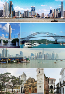
Panama City is the capital and largest city of Panama. It has an urban population of 880,691, with over 1.5 million in its metropolitan area. The city is located at the Pacific entrance of the Panama Canal, in the province of Panama. The city is the political and administrative center of the country, as well as a hub for banking and commerce.

Bocas del Toro (Spanish pronunciation: [ˈbokaz ðel ˈtoɾo]; meaning "Bull’s river mouths") is a province of Panama. Its area is 4,643.9 square kilometers, comprising the mainland and nine main islands. The province consists of the Bocas del Toro Archipelago, Bahía Almirante, Chiriquí Lagoon, and adjacent mainland. The capital is the city of Bocas del Toro on Isla Colón. Other major cities or towns include Almirante and Changuinola. The province has a population of 125,461 as of 2010.

Los Santos is a province of Panama, reaching from the La Villa river in the North to the Pacific Ocean in the south and east. It is part of Azuero Peninsula, bounded by province of Herrera to the north and northeast and Mariato district in Veraguas to the West. The City of Las Tablas is the capital and most populous city; seven other districts of Los Santos, Guararé, Las Tablas, Macaracas, Pedasi, Pocrí and Tonosí are under the jurisdiction of Los Santos Province Governorate. Los Santos' area is 3 809.4 km ², and its population is about 89,592 inhabitants.

David, officially San José de David, is a city and corregimiento in the west of Panama. It is the capital of the province of Chiriquí and has an estimated population of 144,858 inhabitants as confirmed in 2013. It is a relatively affluent city with a firmly established, dominant middle class and a very low unemployment and poverty index. The Pan-American Highway is a popular route to David. It is named after King David from the Bible.
Ngäbe-Buglé is the largest and most populous of Panama's three comarcas indígenas. It was created in 1997 from lands formerly belonging to the provinces of Bocas del Toro, Chiriquí, and Veraguas. The capital is known as Buäbti in Ngäbere and Llano Tugrí in Spanish.

The Ngäbe are an indigenous people within the territories of present-day Panama and Costa Rica in Central America. The Ngäbe mostly live within the Ngäbe-Buglé comarca in the Western Panamanian provinces of Veraguas, Chiriquí and Bocas del Toro. They also have five indigenous territories in southwestern Costa Rica, encompassing 23,600 hectares: Coto Brus, Abrojos Montezuma, Conte Burica, Altos de San Antonio and Guaymi de Osa. In the early 21st century, there are approximately 200,000-250,000 speakers of the Ngäbere language.

Mount Pinos is a mountain located in the Los Padres National Forest on the boundary between Ventura and Kern counties in California. The summit, at 8,847 feet (2,697 m), is the highest point in Ventura County. The mountain is the highest point of the Transverse Ranges west of Tejon Pass, as well as the southernmost point of the Salinian Block.

Cerro Punta is a city and corregimiento in Tierras Altas District, Chiriquí Province, Panama. Cerro Punta is located in Panama's western highlands at an altitude is 6,500 feet, just south of the Continental Divide. Many of the inhabitants of the village and the surrounding areas are indigenous Native Americans. The climate, like the rest of Panama, is tropical with a short dry season and rainy season that extends about 9 – 10 months of the year. Night time temperatures are often cool due to Cerro Punta's relatively high elevation. During the 1970s much of the land was used for cultivating strawberries; households also maintained small mixed-vegetable gardens. The village can be reached by traveling north from the Pan-American highway.
Santa Fe is the name of the capital of the Santa Fe District in the province of Veraguas in Panama. It has a population of 3200 and lies at an altitude of about 430m. Santa Fe lies close to the continental divide and just 60 km from the Mosquito Coast at the Caribbean Sea, but is only connected to the Pacific coast with a paved road to the Pan-American Highway and the city of Santiago de Veraguas.

U.S. Route 221 is a part of the U.S. Highway System that runs from Perry, Florida to Lynchburg, Virginia. In Virginia, the U.S. Highway runs 149.61 miles (240.77 km) from the North Carolina state line near Independence north to its northern terminus at US 29 Business, US 460 Business, and US 501 Business in Lynchburg. US 221 connects Independence, Galax, and Hillsville in Southwest Virginia while running concurrently with US 58. The U.S. Highway connects those communities with Roanoke via Floyd County, within which US 221 is the main east–west highway. The U.S. Highway also runs concurrently with US 460 from Roanoke to Bedford and parallels that U.S. Highway from Bedford to Lynchburg.
Guaymí, or Ngäbere, also known as Movere, Chiriquí, and Valiente, is spoken by the indigenous Ngäbe people in Panama and Costa Rica. The people refer to themselves as Ngäbe and to their language as Ngäbere. The Ngäbes are the most populous of Panama’s several indigenous peoples. The language is centered in Panama within the semi-autonomous indigenous reservation known as the Comarca Ngäbe-Buglé. Beginning in the 1950s, Costa Rica began to receive Ngäbe immigrants, where they are found in several indigenous reservations: Abrojos Montezuma, Conteburica, Coto Brus, Guaymí de Alto Laguna de Osa, and Altos de San Antonio.
Volcán is a town and corregimiento in Tierras Altas District, Chiriquí Province, Panama. It has a land area of 233.7 square kilometres (90.2 sq mi) and had a population of 12,717 as of 2010, giving it a population density of 54.4 inhabitants per square kilometre (141/sq mi). Its population as of 1990 was 7,146; its population as of 2000 was 10,188.

The provinces of Panama and some of the comarcas are divided into districts (distrito). The district are further divided into corregimientos of Panama

The Treaty of Peace and Friendship of 1904 between Chile and Bolivia was signed in Santiago de Chile on October 20, 1904 to delineate the boundary through 96 specified points between Cerro Zapaleri and Cerro Chipe and to regulate the relations between the two countries 20 years after the end of the War of the Pacific.
Archaeology of Bocas del Toro, Panama: The province of Bocas del Toro in Panama has a rich history, beginning with the first European visitors: Christopher Columbus and his son Fernando in 1502 on Columbus’ fourth voyage to the New World. The area was visited frequently from the middle of the 17th century to the middle of the 18th century by privateers and buccaneers marauding Spanish colonial towns and the ships carrying gold to Europe. However little is known of the inhabitants of the region before the time of European contact. Archaeological research conducted since the middle of the 20th century has begun to illuminate the cultural history as well as development of societies in the region prior to Columbus arriving.

Dapa is a small village and area of weekend homes in the Valle del Cauca Department of west central Colombia. It is located in the mountains about 15 kilometers northwest of the city of Cali. It is a township within the Municipality of Yumbo.

Barro Blanco is a gravity dam currently under construction on the Tabasara River in the Chiriqui Province of Panama. As of 2015, the project is under construction and is 95 percent completed. Although the government had authorized the dam, it suspended construction in February 2015 after protests. The President of the Republic authorized the partial restart of construction in August 2015, but prohibited the filling of the reservoir pending a final agreement. Important issues concerning the dam are controversial, such as the question whether the indigenous communities in the area initially had expressed their support or their opposition to the dam's construction and how well they had been informed about the project and its impacts prior to expressing their views.
Coordinates: 8°21′50″N81°40′06″W / 8.36389°N 81.66833°W

A geographic coordinate system is a coordinate system that enables every location on Earth to be specified by a set of numbers, letters or symbols. The coordinates are often chosen such that one of the numbers represents a vertical position and two or three of the numbers represent a horizontal position; alternatively, a geographic position may be expressed in a combined three-dimensional Cartesian vector. A common choice of coordinates is latitude, longitude and elevation. To specify a location on a plane requires a map projection.