
California is a state in the Western United States, lying on the American Pacific Coast. It borders Oregon to the north, Nevada and Arizona to the east, and the Mexican state of Baja California to the south. With 39 million residents across an area of 163,696 square miles (423,970 km2), it is the most populous U.S. state, the third-largest by area, and most populated subnational entity in North America. The Greater Los Angeles and San Francisco Bay areas are the nation's second- and fifth-most populous urban regions, with 19 million and 10 million residents respectively. Los Angeles is the state's most populous city and the nation's second-most, after New York. California's capital, Sacramento, is located in the Central Valley.

The Central Pacific Railroad (CPRR) was a rail company chartered by U.S. Congress in 1862 to build a railroad eastwards from Sacramento, California, to complete most of the western part of the "First transcontinental railroad" in North America. Incorporated in 1861, CPRR ceased independent operations in 1875 when the railroad was leased to the Southern Pacific Railroad. Its assets were formally merged into Southern Pacific in 1959.

Sacramento is the capital city of the U.S. state of California and the seat of government of Sacramento County. Located at the confluence of the Sacramento and American Rivers in Northern California's Sacramento Valley, Sacramento's 2020 population of 524,943 makes it the fourth-most populous city in Northern California, sixth-most populous city in the state, and the ninth-most populous state capital in the United States. Sacramento is the seat of the California Legislature and the Governor of California.

The Sacramento River is the principal river of Northern California in the United States and is the largest river in California. Rising in the Klamath Mountains, the river flows south for 400 miles (640 km) before reaching the Sacramento–San Joaquin River Delta and San Francisco Bay. The river drains about 26,500 square miles (69,000 km2) in 19 California counties, mostly within the fertile agricultural region bounded by the Coast Ranges and Sierra Nevada known as the Sacramento Valley, but also extending as far as the volcanic plateaus of Northeastern California. Historically, its watershed has reached as far north as south-central Oregon where the now, primarily, endorheic (closed) Goose Lake rarely experiences southerly outflow into the Pit River, the most northerly tributary of the Sacramento.

Gridley is a city in Butte County, California, United States, 29 miles south of Chico, California, and 56 miles north of Sacramento, California. The population as of April 1, 2020, is 7,421. California State Route 99 runs through Gridley and Interstate 5 and California State Route 70 are both nearby.

Oroville is the county seat of Butte County, California, United States. Its population was 15,506 at the 2010 census, up from 13,004 in the 2000 census. After the 2018 Camp Fire that destroyed much of the town of Paradise, Oroville's population increased as many people who lost their homes moved there. The 2020 census recorded Oroville's population as 20,042.
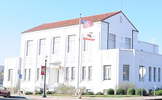
Marysville is a city and the county seat of Yuba County, California, located in the Gold Country region of Northern California. As of the 2010 United States Census, the population was 12,072, reflecting a decrease of 196 from the 12,268 counted in the 2000 Census. It is part of the Yuba-Sutter area of Greater Sacramento.

Northern California is a geographic and cultural region that generally comprises the northern portion of the U.S. state of California, spanning the northernmost 48 of the state's 58 counties. Its main population centers include the San Francisco Bay Area, the Greater Sacramento area, the Redding, California, area south of the Cascade Range, and the Metropolitan Fresno area. Northern California also contains redwood forests, along with most of the Sierra Nevada, including Yosemite Valley and part of Lake Tahoe, Mount Shasta, and most of the Central Valley, one of the world's most productive agricultural regions. Northern California is also home to Silicon Valley, the global headquarters for some of the most powerful tech and Internet-related companies in the world, including Meta, Apple, Google, and Nvidia.
Shasta or Shastan may refer to:
Willow Creek may refer to:
Long Island is a densely populated island in the southeastern geographical area of the State of New York.

John Bigler was an American lawyer, politician and diplomat. A Democrat, he served as the third governor of California from 1852 to 1856 and was the first California governor to complete an entire term in office, as well as the first to win re-election. His younger brother, William Bigler, was elected governor of Pennsylvania during the same period. Bigler was also appointed by President James Buchanan as the U.S. Minister to Chile from 1857 to 1861.
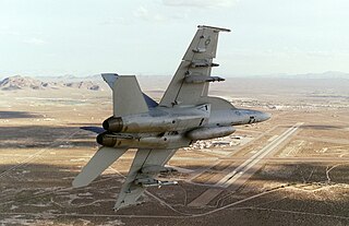
Naval Air Weapons Station (NAWS) China Lake is a large military installation in California that supports the research, testing and evaluation programs of the United States Navy. It is part of Navy Region Southwest under Commander, Navy Installations Command, and was originally known as Naval Ordnance Test Station (NOTS).

McClellan Air Force Base (1935–2001) is a former United States Air Force base located in the North Highlands area of Sacramento County, 7 miles (11 km) northeast of Sacramento, California.

Folsom Lake is a reservoir on the American River in the Sierra Nevada foothills of California, United States. Folsom Lake with its surrounding Folsom Lake State Recreation Area is one of the most visited parks in the California park system.
California's 3rd congressional district is a U.S. congressional district in California. It includes the northern Sierra Nevada and northeastern suburbs of Sacramento, stretching south to Death Valley. It encompasses Alpine, Inyo, Mono, Nevada, Placer, Plumas, and Sierra counties, as well as parts of El Dorado, Sacramento, and Yuba counties. It includes the Sacramento suburbs of Roseville, Folsom, Orangevale, Rocklin, and Lincoln, and the mountain towns of Quincy, South Lake Tahoe, Truckee, Mammoth Lakes, and Bishop. The district is represented by Republican Kevin Kiley.
Yolo or YOLO may refer to:

The American River is a 30-mile-long (50 km) river in California that runs from the Sierra Nevada mountain range to its confluence with the Sacramento River in downtown Sacramento. Via the Sacramento River, it is part of the San Francisco Bay watershed. This river is fed by the melting snowpack of the Sierra Nevada and its many headwaters and tributaries, including its North, Middle, and South Forks.

Camp Kohler was located in the northeast corner of unincorporated Sacramento County, California, United States, until it was destroyed by a fire in 1947. Initially a camp for migrant farm workers, it became the Sacramento Assembly Center a temporary detention center for interned Japanese Americans in 1942. The site is one of 12 California assembly centers that share designation as California Historical Landmark No. 934. From 1943 to 1945 the camp was a training center for US World War II forces.