
Wayanad is a district in the north-east of the Indian state of Kerala, with administrative headquarters at the municipality of Kalpetta. It is the only plateau in Kerala. The Wayanad Plateau forms a continuation of the Mysore Plateau, the southern portion of Deccan Plateau which links the Western Ghats with the Eastern Ghats. It is set high in the Western Ghats with altitudes ranging from 700 to 2,100 meters. Vellari Mala, a 2,240 m (7,349 ft) high peak situated on the trijunction of Wayanad, Malappuram, and Kozhikode districts, is the highest point in Wayanad district. The district was formed on 1 November 1980 as the 12th district in Kerala, by carving out areas from Kozhikode and Kannur districts. An area of 885.92 km2 in the district is forested. Wayanad has three municipal towns—Kalpetta, Mananthavady and Sulthan Bathery. There are many indigenous tribes in this area. The Kabini River, a tributary of Kaveri River, originates at Wayanad. Wayanad district, along with the Chaliyar valley in the neighbouring Nilambur in Malappuram district, is known for natural gold fields, which are also seen in other parts of the Nilgiri Biosphere Reserve. Chaliyar river, which is the fourth longest river of Kerala, originates on the Wayanad plateau. The historically important Edakkal Caves are located in Wayanad district.
The Ulhas River is a river in Maharashtra, India. It is in the Thane, Raigad, and Pune districts of that state. It flows north and west from it source to where it splits into Vasai Creek and Thane Creek, near Thane. The Ulhas divides Salsette Island from the mainland, and is important for the water supply of Mumbai.

Purnia District is one of the thirty-eight districts of the Indian state of Bihar. The city of Purnia is the administrative headquarters of this district. The city of Purnia has continued its tradition of hoisting the national flag at 12:07 am on every Independence Day since 1947. Purnia district is a part of Purnia Division. The district extends northwards from the Ganges river.

Srikakulam district is one of the twenty-six districts of the Indian state of Andhra Pradesh, located in the Uttarandhra region of the state, with its headquarters located at Srikakulam. It is one of the six districts, located in the extreme northeastern direction of the state. It was formerly known as Chicacole, and was under Ganjam district till 1936 April 1, then merged under Vizagapatam district. Srikakulam district forms the core area of Kalinga where most of its historical capitals like Kalinganagari, pithunda, Dantapuram are located.

Patiala district is one of the twenty three districts in the state of Punjab in north-west India.
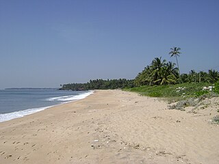
Thottada is a census town and suburb of Kannur city situated on NH 66 of about 8 km (5.0 mi) south of Kannur railway station in Kerala State, India.

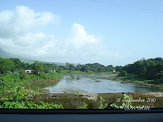
Matool is a village in Kannur district of Kerala State, India. Mattool is located 19 kilometres (12 mi) north of Kannur city. The Valapattanam River and Kuppam River meet the Arabian Sea at Mattool. Mattool can be reached from Kannur via Azheekal crossing the Mattool - Azheekal ferry. And via Madakkara-Matool Bridge From Irinavu Road.
Khanapur known as Khanapura is a panchayat town in Belagavi district, Karnataka, India. It is about 26 km from Belagavi. The Khanapur Municipal Council governs the town. Khanapur is the headquarters for Khanapur taluk. The town is on the Belgaum-Panaji National Highway, NH 4A. Khanapur is well connected by train and road to important cities in Karnataka, Goa, and Maharashtra. Kannada is the official language.

Purathur is a sandy coastal village and a Grama Panchayat in Tirur Taluk, Malappuram district in the state of Kerala, India. Bharathappuzha river and Tirur River merges together in Purathur and join with the Arabian Sea at Padinjarekara Azhimukham, which is also the southernmost tip of Purathur Gram panchayat. Opposite to Padinjarekara Azhimukham is Ponnani port. The village is located at the southernmost tip of Tirur Taluk and is bordered by historically important Ponnani port in Ponnani Municipality of Ponnani taluk to south.
Dhavaleshwar is a village in the southern state of Karnataka, India. It is located in the Mahalingpur taluk of Bagalkot district in Karnataka. Dhavaleshwar is located on the bank of Ghataprabha river. The river bifurcates the Belgaum and Bagalkot districts. Just on the other side of the river, there is one more village which, is also known as Dhavaleshwar. This Dhavaleshwar belongs to Gokak Taluk of Belgaum district. Many politicians promised to build a bridge between both villages, but no one has initiated. The villagers grow sugar cane, which is the source of their income.
Nagaral(ನಾಗರಾಳ) is a village in the southern state of Karnataka, India. It is located in the Bilagi taluk of Bagalkot district in Karnataka. It is about 35 kilometres (22 mi) from the district headquarters of Bagalkot town and is about 5 kilometres (3.1 mi) from taluka headquarters of Bilagi and on the left bank of the Krishna River. It is famous for the Digamabareshwara temple and well educated persons.
Benadi is a village in the North-Western region of Karnataka state near Maharashtra Border in India. It is located in the Chikodi taluka of Belgaum district in Karnataka. Before it was a part of Bombay State and Princely state of Kolhapur. It is a part of Twin Village Aadi-Benadi. People who has origin from this village are known as Benadikar.
Darur is a village in the southern state of Karnataka, India. It is located in the Athani Taluk of Belagavi district in Karnataka.
Hulagabali is a village in the southern state of Karnataka, India. It is located in the Athani taluk toward north-east of Belgaum district. The basic occupation in Hulagabali is agriculture and there are also many landlords in the village who are famous in agriculture. Sugarcane is the highest percentage of agriculture as per the survey. There are quite a few temples in the village. The Birappa temple located in this village is well known in surrounding villages. Birappa temple has a large fair and festivities twice a year that draws huge crowd in the region. Sri Sangameshwara temple stands at the juncture of River Krishna and River Agrani. The famous landlords are Patil and Gaddekars.
Jugul is a village in the southern state of Karnataka, India. It is located in Athani taluk of Belagavi district in Karnataka.
Kunnur is a village in the southern state of Karnataka, India. It is located in the Chikodi taluk of Belgaum district in Karnataka.
Saptasagar is a village in the southern state On River Bank of Krishna Karnataka, State India. It is located in the Athani taluk of Belgaum district in Karnataka.
Soundatti is a village in the southern state of Karnataka, India. It is located in the Raybag taluk of Belgaum district in Karnataka.
Hemmadaga is a village in Belgaum district in the southern state of Karnataka, India. A steam near the village feeds the Mandovi River.
Krishna-kittur is a village in the southern state of Karnataka, India. It is located in the Athani taluka of Belgaum district in Karnataka.

