The topic of this article may not meet Wikipedia's general notability guideline .(May 2016) |
Chop Point School is a school located in the city of Woolwich, Maine. [1]
The topic of this article may not meet Wikipedia's general notability guideline .(May 2016) |
Chop Point School is a school located in the city of Woolwich, Maine. [1]
The school site was originally inhabited by Native Americans sometime in the early 1500s to 1600s. At some point there was likely at least a small farm here and even a small fort possibly. Many archeological artifacts have been found on campus ranging from colonial pipes to Indian arrow heads and fishing weights. During the revolutionary war it is possible that Benedict Arnold may have stopped here or at least passed by on his way to Canada up the Kennebec River. In the late 1800s to early 1900s an all girls camp was established at Chop Point, the camp was called the Merrymeeting Camp at this time. Then in the 1950s the camp changed hands again as it was purchased by Franklin Hayward and Peter Willard. With this new land they planned to start a Christian summer camp. However, they were forced to postpone any and all building due to the nearby Kennebec River being heavily polluted by upriver waste. [2]
This put the plans for a camp on hold until the river was no longer a hazard and once they were later able to receive accreditation from the American Camping Association in 1967. With that, Franklin Hayward and Peter Willard were able to start the Christian summer camp Chop Point. Three decades later, in 1987, Hayward and Willard added Chop Point School, a Christian school, to along with their camp.
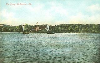
The school is located on Chops Point, a peninsula that juts into the Kennebec River. The campus looks out into Merrymeeting Bay and The Chops. The campus has hills, multiple buildings, camp cabins and a barn. Other facilities include tennis courts, a playground, a large gymnasium, a system of trails along the bay and a soccer field called Bridge Field.
The school's total enrollment is 88 students of ages ranging from kindergarten to the 12th grade. There are exchange students that come every year from all over the world; they typically live at the school during the year. The teacher-student ratio is one to six. [3]
Chop Point School offers a variety of sports. The soccer team is class D in the Maine Principals Association. The 2015 soccer team went 2–8, with wins against High-View Christian Academy and Temple Academy. The school also hosts a running club and the basketball team competes in the MCSSL. [4]

Augusta is the capital of the U.S. state of Maine and the county seat of and most populous city in Kennebec County. Augusta is included in the Lewiston-Auburn, Maine metropolitan New England city and town area. The city's population was 18,899 at the 2020 census, making it the 12th most populous city in Maine, and 3rd least populous state capital in the United States after Montpelier, Vermont, and Pierre, South Dakota.

Somerset County is a county in the state of Maine, United States. As of the 2020 census, the population was 50,477. Its county seat is Skowhegan.

Kennebec County is a county located in the South-central portion of the U.S. state of Maine. At the 2020 census, the population was 123,642. Its county seat is Augusta, the state capital. The county was established on February 20, 1799, from portions of Cumberland and Lincoln Counties. The name Kennebec comes from the Eastern Abenaki /kínipekʷ/, meaning "large body of still water, large bay."

Arrowsic is a town in Sagadahoc County, Maine, United States. The population is 477 as of the 2020 United States Census. It is part of the Portland–South Portland–Biddeford, Maine metropolitan statistical area. During the French and Indian Wars, Arrowsic was site of a succession of important and embattled colonial settlements. It is a favorite with artists and birdwatchers.

Bowdoinham is a town in Sagadahoc County, Maine, United States. Bowdoinham was included in the Lewiston-Auburn, Maine metropolitan New England city and town area. The population was 3,047 at the 2020 census. It is part of the Portland–South Portland–Biddeford, Maine metropolitan statistical area. The town is located on the west side of Merrymeeting Bay.

Woolwich is a town in Sagadahoc County, Maine, United States. The population was 3,068 at the 2020 census. It is part of the Portland–South Portland–Biddeford, Maine metropolitan statistical area. Woolwich is a suburb of the city of Bath located on the opposite shore of Merrymeeting Bay.
Perkins Township is an unorganized territory in Sagadahoc County, Maine, United States. Originally incorporated as the town of Perkins, it was later abandoned, and has been uninhabited since the 1940s. The township comprises Swan Island, Little Swan Island and some tidal flats—all within the Kennebec River between the towns of Richmond and Dresden. The Swan Island Historic District comprises most of the township, with eight buildings, five structures and 1,500 acres (610 ha). Some of the buildings date to the 1750s. The district was added to the National Register of Historic Places in 1995. The entire township is now protected as the Steve Powell Wildlife Management Area, and is under the jurisdiction of the Maine Department of Inland Fisheries and Wildlife. Camping, hunting, fishing, and wildlife viewing are permitted between May and October; reservations are required.

The Kennebec River is a 170-mile-long (270 km) river within the U.S. state of Maine. It rises in Moosehead Lake in west-central Maine. The East and West Outlets join at Indian Pond and the river flows southward. Harris Station Dam, the largest hydroelectric dam in the state, was constructed near that confluence. The river is joined at The Forks by its tributary the Dead River, also called the West Branch.

Lincoln Academy is a private boarding and day school and town academy located in Newcastle, Maine, serving students in Lincoln County, the United States, and other nations around the world. Lincoln Academy is the fourth oldest secondary school in Maine. The majority of Lincoln Academy students live in local sending towns, including Newcastle, Damariscotta, Bristol, Jefferson, Nobleboro, and South Bristol. Similar to other town academies, the sending towns pay tuition for local students.

Merrymeeting Bayis a large freshwater tidal bay located in the U.S. state of Maine. Merrymeeting Bay's unusual geography defies common landform terms. It is not what is usually meant by the word bay. It is somewhat like an estuary but it has fresh water with very little salt. Geologically it is described as an "inland delta" and biologically as "tidal riverine."
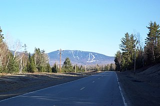
Saddleback Mountain is a mountain located in Sandy River Plantation, Franklin County, Maine, near the resort town of Rangeley. Saddleback is one of the highest mountains in the State of Maine, and one of the fourteen with more than 2,000 ft (610 m) of topographic prominence. The mountain is the site of Saddleback ski resort.
Unity Environmental University is a private university based in New Gloucester, Maine, with an additional campus in Unity and facilities in Moose River and Thorndike. It offers undergraduate and graduate education based on sustainability science that emphasizes study of the environment and natural resources. Initially founded as a residential school in Unity, Maine, the university expanded into online education in 2016 which grew both its enrollment and number of academic programs. The university moved its online program to the historic Pineland Farms campus in New Gloucester in 2019 and later relocated their administrative headquarters there. Unity Environmental University operates both an online-only program and a hybrid program with on-campus courses in New Gloucester and Unity. It also operates a farm and indoor growing facility in Thorndike and an outdoor center in Moose River.
The New Meadows River is a 12-mile-long (19 km) tidal embayment in Maine at the northern end of Casco Bay. It serves as the boundary between Cumberland and Sagadahoc counties for its entire length.

The Sheepscot River is a 66-mile-long (106 km) river in the U.S. state of Maine. Its lower portion is a complex island estuary with connections to the Kennebec River downstream of Merrymeeting Bay.
Morse High School is a public high school in Bath, Maine, serving the towns of Bath, Phippsburg, Woolwich, Georgetown, and Arrowsic. The student/adult ratio at Morse is 15:1. The school colors are blue and white. Class elections take place every year. The enrollment is 623 students.

The Sasanoa River is an 8.6-mile-long (13.8 km) tidal channel in the Midcoast region of Maine, connecting the Kennebec River with the Sheepscot River.

Muscongus Bay is a bay on the coast of Maine, United States, between Penobscot Bay and John's Bay. Muscongus was the name of an Abenaki village meaning "fishing place" or "many [or large] rock ledges." John Smith recorded the river in 1616 as Nusconcus and was also spelled Nuscongus. The two main tributaries are the Saint George River at its eastern end and the Medomak River, which flows into the bay at Waldoboro. Historically, the Medomak River and Muscongus Bay were the dividing line between the Waldo Patent and Pemaquid Patent and Waldoboro was a customs point of entry. Muscongus Bay has many islands including Hog which is home to a National Audubon Society camp, Allen, Eastern Egg Rock, Franklin, and Louds Island historically referred to as Muscongus Island prior purchase from Thomas Drowne by William Loud. Monhegan Island is offshore from Muscongus Bay. The Maine Island Trail passes through Muscongus Bay.

The Carlton Bridge is a railroad vertical-lift bridge which carries one rail line over the Kennebec River between Bath and Woolwich, Maine. It was completed in 1927. Until August 1, 2000, it also carried two lanes of U.S. Route 1 (US 1) on its upper deck, after which the highway was transferred to the adjoining Sagadahoc Bridge and the road connection severed at the west end. The east end is gated, and is accessible only by authorized vehicles. The majority of the road deck remains but may be removed in the future. It is the last downstream fixed crossing of the Kennebec.
Kennebec Estuary Land Trust (KELT) is a community-based organization in Maine involving members from Arrowsic, Bath, Bowdoinham, Dresden, West Bath, Georgetown, Westport Island, and Woolwich. KELT does their work through conservation easements, property donation and outright purchase. They collaborate with state and federal agencies and private conservation organizations within the Maine Wetlands Protection Coalition.
The Chops Passage is a channel in Sagadahoc County, Maine and is nearby to Chops Point, West Chops Point and Sturgeon Island. Merrymeeting Bay empties into the Kennebec River here before it heads to the Atlantic Ocean. Chop Point School and Chop Point Camp are also located on west Chops Point a Peninsula located at one side of The Chops.
43°58′56.7″N69°49′41.5″W / 43.982417°N 69.828194°W
| | This Maine school-related article is a stub. You can help Wikipedia by expanding it. |